On Arendell Street (U.S. 70) at North 35th Street, on the right when traveling east on Arendell Street.
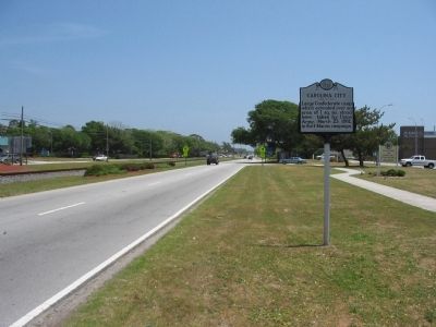
Large Confederate camp which extended over an area of 1 sq. mi. stood here; taken by Union Army, March 23, 1862, in Fort Macon campaign. — — Map (db m31250) HM
On Arendell Street (U.S. 70) east of North 35th Street, on the right when traveling east.
Prelude: On February 8, 1862, Union General Ambrose E. Burnside captured Roanoke Island, key to the important Sound Region of Norteastern North Carolina. On February 10, Elizabeth City fell followed by strategic New Bern on March 14. . . . — — Map (db m31254) HM
Near Arendell Street (U.S. 70) west of Taylor STreet, on the right when traveling east.
Carolina City was a small settlement established in 1855. It contained a post office, a turpentine distillery, and the large Carolina Hotel, a favorite resort stop for visitors from New Bern arriving by rail or steamship. During the Civil War, the . . . — — Map (db m31270) HM
Built by U.S. Corps of Engineers, 1826-34. Good example of brick fort. Seized by Confederates, April 14, 1861. Scene of battle, April 25, 1862. — — Map (db m31278) HM
On Fort Macon Road, on the right when traveling east.
This fort, guarding the entrance to Beaufort Harbor, was built between 1826 and 1834 as one of a series of seacoast fortifications for national defense. Local secessionist militia forces seized the fort on April 14, 1861, at the outbreak of the . . . — — Map (db m31451) HM
On Fort Macon Road, on the right when traveling east.
This cistern, built in 1897, collected and stored drinking water for Fort Macon's caretaker. Cisterns such as this one have been used by coastal residents for years. Moisture and rain shed from the roof through pipes into the cistern, where it could . . . — — Map (db m31457) HM
Near Fort Macon Road, on the right when traveling east.
Fort Macon was constructed between 1826 and 1834. This fort was used in the War Between the States (1861-1865), the Spanish American War (1898) and World War II (1941-1945). Fort Macon also served as a military prison from 1862-1877. Fort Macon was . . . — — Map (db m31479) HM
Near Fort Macon Road, on the right when traveling east.
These are the only known surviving cannons of Fort Macon's original armament. Used in the fort 1862 to 1902. Similar to mortars used by the Union Army against the fort in the 1862 bombardment. Weight of Barrel .......................... 1968 Pounds . . . — — Map (db m31490) HM
On Fort Macon Road, on the right when traveling east.
This replica Hot Shot Furnace stands on the foundation of Fort Macon's original Hot Shot Furnace, built in 1836. Hot Shot Furnaces were used in forts to heat non-explosive cannonballs red hot for use against the unarmored wooden enemy warships of . . . — — Map (db m31502) HM
On Fort Macon Road, on the right when traveling east.
Smallest caliber cannon used in the War Between the States. Several of these were used as secondary armament in Fort Macon during 1834-1861 to defend vulnerable areas against assaults.
Weight of Bronze Barrel ........887 Pounds
Weight of Gun . . . — — Map (db m31501) HM
On Fort Macon Road, on the right when traveling east.
This cannon is a replica of a smoothbore Model 1841 Navy 32-pounder which stood here during the War Between the States. Cannons of this caliber comprised almost half of Ft. Macon's armament. The 32-pounder is so named because it fired round iron . . . — — Map (db m31535) HM
On Fort Macon Road, on the right when traveling east.
This cannon is a replica of a rifled Model 1841 Navy 32-pounder which stood here in the War Between the States. The cannon was originally a smoothbore 32-pounder and fired a round 32-pound cannonball. In October, 1861, Confederate soldiers converted . . . — — Map (db m31536) HM
Near Fort Macon Road, on the right when traveling east.
The earthen mound in front of you was built to shield a battery of two 10-inch siege mortars mounted here in 1898 during the Spanish-American War. The underground gallery below was made into a magazine to store ammunition for the mortar battery. — — Map (db m31575) HM