3 entries match your criteria.
Related Historical Markers
To better understand the relationship, study each marker in the order shown.
By Dale K. Benington, July 27, 2011
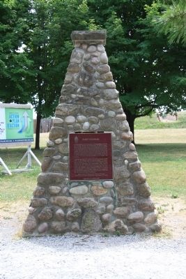
Fort George Marker
SHOWN IN SOURCE-SPECIFIED ORDER
| Near Queens Parade south of Wellington Street. |
| | Constructed by order of Lieutenant-Governor Simcoe 1796-99, Fort George served as the headquarters for Major-General Brock in 1812. In May, 1813, it was bombarded and captured by the Americans who constructed fortifications of their own on the site. . . . — — Map (db m48743) HM |
| On Main Street (New York State Route 18F) north of Lockport Road (New York State Route 93), on the left when traveling north. |
| | American warships silenced
the British guns after
2 hours of hard fighting.
The Americans had
captured Fort George and
the British retreated. — — Map (db m67349) HM |
| On Queen Street north of Newark Street, on the right when traveling north. |
| | On the 25th May, 1813, the American Fleet and the Batteries at Fort Niagara across the river began a devastating two-day bombardment of Fort George. On the 27th a large American force was landed and after a brief engagement in which his outnumbered . . . — — Map (db m48628) HM |
May. 18, 2024