On South Valley View Boulevard at Meadows Lane, on the right when traveling north on South Valley View Boulevard.
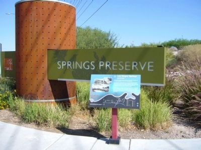
Bubbling artesian springs flowed here until they were exhausted in the middle of the 20th century, over-pumped to serve the city's growing population.
These springs and the creek they created gave life to the center of the valley. They erupted . . . — — Map (db m51043) HM
On Twin Lakes Drive, 0.1 miles south of West Washington Avenue, on the left when traveling south.
Lorenzi Lake, the dream of pioneer David G. Lorenzi, opened as a private resort in 1926, became the Twin Lakes Lodge in the 1940s, and a public park in 1966.
Arriving in southern Nevada in 1911, Lorenzi began building his park on 80 acres . . . — — Map (db m51044) HM
On West Bonanza Road at North Tonopah Drive, on the right when traveling west on West Bonanza Road.
Colorful Horseshoe Club owner Benny Binion and his family lived here from 1947 to 1989.
Originally built in 1942 by service station owner C.A. Morehouse, the home was one of the largest in Las Vegas with three bedrooms, several baths, a . . . — — Map (db m51045) HM
On West Bonanza Road (State Highway 579) at Clarkway Drive, on the right when traveling west on West Bonanza Road.
Here in the 1930s and 1940s, Korean immigrant Frank Kim raised melons, tomatoes, and onions. His devoted son, Frank Kim, Jr. became a pillar of the community.
From the early days of Las Vegas, Asian [...] considerable skill to make poor desert . . . — — Map (db m51046) HM
On West Bonanza Road (Nevada Route 579), on the right when traveling west.
The first integrated hotel and casino in Las Vegas, the Moulin Rouge opened in May 1955. It is celebrated as a landmark of racial integration in Las Vegas and the United States.
Entertainers from the Las Vegas Strip and Hollywood flocked to . . . — — Map (db m51047) HM
On H Street at West McWilliams Avenue, on the right when traveling north on H Street.
Created by J.T. McWilliams in 1905, the Original Las Vegas Townsite was Las Vegas' first business and residential development.
J.T. McWilliams (photo top right) was hired to do survey work in and around the Las Vegas Valley for the San Pedro, . . . — — Map (db m51048) HM
On H Street at Morgan Avenue, on the left when traveling south on H Street.
St James has been a vital force in meeting the needs of this underserved, segregated but expanding community.
The second Catholic Church in Las Vegas, St. James opened in 1940 in a small concrete building at H and Morgan streets (pictured . . . — — Map (db m51049) HM
On F Street at West Adams Avenue, on the right when traveling south on F Street.
Black entertainers were not allowed to stay at the Strip hotels where they performed in the 1940s and 1950s. Mrs. Harrison's boarding house offered fine accomodations for many of the era's most famous stars.
During one memorable week in . . . — — Map (db m51050) HM
On Jackson Avenue at F Street, on the right when traveling east on Jackson Avenue.
Commerce on the Westside was short lived, collapsing in 1905 when rival Las Vegas Townsite opened on the east side of the railroad tracks. In 1942, the Westside defined a new commercial district to serve the ethnic population of the area.
The . . . — — Map (db m51051) HM
On West Van Buren Avenue at North E Street, on the right when traveling east on West Van Buren Avenue.
This fairy-tale residence reflects the unique family that built it, whose roots stretch back to a pioneering Utah Mormon blacksmith, ranchers in Idaho and Nevada, and railroad workers in Las Vegas.
The life of Las Vegas pioneer Lucretia Tanner . . . — — Map (db m51052) HM
Herman Moody, Las Vegas' first black career police officer, was raised in this house at 321 Van Buren Avenue, built by his parents (father Henry Moody pictured lower left) who came here in 1939.
As first African-American in Las Vegas to make a . . . — — Map (db m51053) HM
The first school in West Las Vegas opened with two rooms and two teachers for four grades.
From 1904 until 1923, children from McWilliams' Townsite crossed the railroad tracks to get to school in Clark's Townsite. This dangerous situation . . . — — Map (db m51054) HM
On North Main Street at Paiute Drive, on the right when traveling south on North Main Street.
The Bureau of Indian Affairs (BIA) bought this ten-acre site in 1911 from Helen J. Stewart, former owner of the Las Vegas Ranch, to provide a home for the Southern Paiute Indians living in and near Las Vegas. With this purchase, the government . . . — — Map (db m51055) HM
On North Las Vegas Boulevard at Foremaster Lane on North Las Vegas Boulevard.
Until 1914, when the railroad donated land for a city cemetery, people buried the dead in small family plots or on public land just north of the railroad-owened Las Vegas Ranch, east of Las Vegas Boulevard.
In pre-railroad times, the Paiute . . . — — Map (db m51056) HM
On North Las Vegas Boulevard at Cashman Center, on the right when traveling south on North Las Vegas Boulevard. Reported missing.
This WWII neighborhood was named for the Nevada Biltmore Hotel which opened nearby in 1942. A WWII housing shortage called for the construction of several hundred homes for military personnel and their families. The federal government approved the . . . — — Map (db m51057) HM