6 entries match your criteria.
Related Historical Markers
To better understand the relationship, study each marker in the order shown.
By Tom Fuchs, March 18, 2006
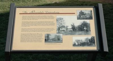
The Riversdale Dependency Marker
SHOWN IN SOURCE-SPECIFIED ORDER
| Near Riverdale Road west of Taylor Road. |
| On 15th Street Northwest at Chapin Street Northwest, on the right when traveling north on 15th Street Northwest. |
| On The Walk of History north of Main Street (Maryland Route 725). |
| Near U.S. 20, 0.5 miles north of U.S. 20. |
| Near Washington Place Northeast at Rhode Island Avenue Northeast (U.S. 1), on the right when traveling south. |
| On Ingraham Street south of Oliver Street. |
May. 17, 2024