3 entries match your criteria.
Related Historical Markers
By Jeffrey A. Schimpff, September 7, 2009
Lost Airmen of World War II Memorial at Knollcrest Cemetery
SHOWN IN SOURCE-SPECIFIED ORDER
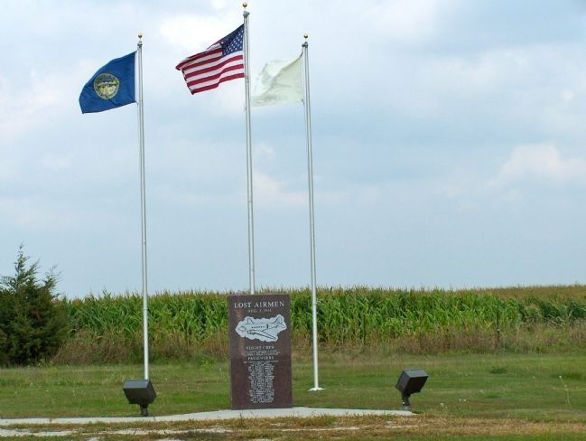
| | On August 3, 1944, a C-47 transport carrying twenty-eight men of the U.S. Army Air Forces crashed in a ravine six miles southwest of Naper during a severe storm. There were no survivors. It was the largest single military air disaster in Nebraska . . . — — Map (db m70623) HM |
| |
Acree, William • Albert, John • Armstrong, William • Arnett, Willard • Blakeslide, Herbert • Boekman, George • Bohle, Robert • Brown, Jack • Brown, Richard • Burke, James • Clarkson, Donald • Hemphill, Lloyd • Hutslar, Orson • Johnson, Arthur • . . . — — Map (db m206988) HM |
| | Bruning Army Air Field, located northeast of here, was one of eleven army airfields in Nebraska during World War II. Construction began in September 1942 on 1,480 acres of farmland, for which the government paid twelve landowners $73,400. The field . . . — — Map (db m206989) HM |
May. 2, 2024