3 entries match your criteria.
Related Historical Markers
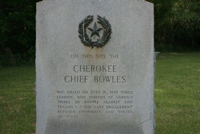
By Amanda Hartley, May 11, 2010
Cherokee Chief Bowles Marker
SHOWN IN SOURCE-SPECIFIED ORDER
| 1 ► Texas, Van Zandt County, Edom — 11383 — Cherokee Chief Bowles — |
| Near Jett Lane. | |||
| 2 ► Texas, Henderson County, Chandler — 12952 — John Crane — |
| On State Highway 31, 0.2 miles west of Parker Street (County Road 3302), on the left when traveling west. | |||
| 3 ► Texas, Smith County, Bullard — 7711 — Camp of the Army of the Republic of Texas — |
| On Farm to Market Road 346, 0.1 miles south of County Route 1353, on the right when traveling south. | |||