8 entries match your criteria.
South Carolina, McCormick County Historical Commission Historical Markers
By Brian Scott, September 20, 2008
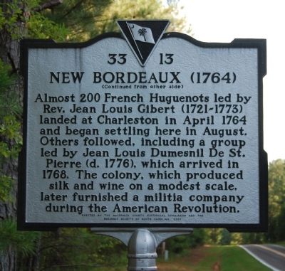
New Bordeaux (1764) Marker Reverse
GEOGRAPHIC SORT Title Sort Marker Number Sort Marker Number Sort N Marker Number Sort T Publication Order Sort Publication Order Sort A Erected Year Sort Most Viewed Sort Most Recent-Interest Sort Most Recently Changed Sort SEE FAQ #33 FOR DESCRIPTIONS
On SC Road 33-7, on the right when traveling north.
On Savannah River Scenic Byway (State Highway 28) at Barksdale Ferry Road (County Route S-33-61), on the left when traveling west on Savannah River Scenic Byway.
On State Highway 28 at Old Charleston Road (Local Road 38), on the left when traveling south on State Highway 28.
On North Mine Street, on the left when traveling south.
Near Mt. Carmel Road (State Highway 823) at State Highway 40. Reported missing.
On Mt. Carmel Road (State Highway 823) near Old Charleston Road. Reported missing.
On Charleston Road West when traveling south.
On State Highway 81 at Morrah Bridge Road (County Route 39), on the left when traveling north on State Highway 81.
May. 6, 2024