For whom Graceland Cemetery is named
Child of
Geo. W. (Hoo-Doo) and Sarah E. Brown
———————
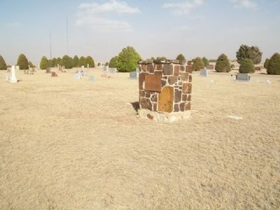
Grace Brown, her brother Parley and an aunt died of scarlet fever in early 1887 and were buried on the . . . — — Map (db m65635) HM
Formerly known as "Brown's Burying Ground" was purchased from George W. "Hoodoo" and Sarah E. Brown, March 23, 1887, for the sum of $,2000.00. The Browns asked that the name be changed to "Graceland" in memory of a small daughter who had . . . — — Map (db m65616) HM
In Sacred Memory
of
Our Heroes
This monument was erected by the American Legion Auxiliary of Meade, Kansas, assisted by ex-service men and patriotic citizens, and on May 30, 1927 dedicated to the memory of Meade County's Departed . . . — — Map (db m65636) WM
On Woodland Avenue west of Ohio Street, on the right when traveling west.
In memory of the men
killed in action on
Luzon Island, P. I.
in 1898-9
Capt. D. S. Elliott
Lieut. W. A. McTaggart
Privates
Albert Anibal • Orlin Birlew
Alva Dix • John Scherer — — Map (db m97022) WM
On October 5, 1892, the five-member Dalton Gang rode into Coffeyville planning to rob the two banks. George Cubine and Charles Brown, two of Coffeyville's citizens killed while defending their town against the notorious gang, are buried here in . . . — — Map (db m60835) HM
On Pennsylvania Avenue (U.S. 75) at Oak Street, on the right when traveling north on Pennsylvania Avenue.
to
Captain S. D. Elliott
Lieutenant W. McTaggart
and other brave soldiers
of the
20th Kansas
who fell in the
Spanish American War — — Map (db m61449) WM
On 900th Road, 1 mile west of Neosho Street (Kansas Highway 177), on the right when traveling south.
In 1542, Fr. Juan Padilla, a Franciscan Friar, (the First American Martyr), accompanied Coranado on his expedition from Mexico some 50 years after Christopher Columbus landed in the USA and 78 years before our pilgrim . . . — — Map (db m44939) HM
On Main Street (U.S. 56) near Jefferson Street, on the right when traveling west.
The wall was built primarily because of the controversy between Council Grove and Parkerville and their fight to secure the permanent location for the county seat.
Jobs were created by both towns and workers were imported to swell the number of . . . — — Map (db m45451) HM
On 20th Road, 5.5 miles east of Ottawa Road (U.S. 59), on the right when traveling east.
Oak Grove, District No. 20, was established in 1867 in Lincoln Township, Neosho County, the same year that the two neighboring counties of Neosho and Labette were formed from what was originally the single county of Dorn. Oak Grove was thus one of . . . — — Map (db m229749) HM
In Memory of Our
Patriot Dead
We here highly resolve
that these dead shall
not have died in vain.
Lincoln.
We loved our country
Gave our lives for her
Do ye, our children
for her honor live.
Sleep in peace with kindred ashes
Of . . . — — Map (db m79925) WM
Dedicated to the Soldiers who died while serving their country at Fort Larned, Kansas (1859-1878). In 1888, remains were relocated from the post cemetery to Fort Leavenworth National Cemetery, Section B, where they were not identified. Among the . . . — — Map (db m40162) HM
Original monument erected in 1867 by soldiers in the Third Infantry, to honor fellow soldiers who lost their lives at the fort. After Fort Larned was closed in 1878, this monument was moved to the Larned [city] Cemetery in 1887. In 2009 it was . . . — — Map (db m40180) HM
On State Highway 19, on the right when traveling south.
The desire for home ownership and self employment caused many people to move from east to west in the early history of our country. Pleasant Valley Townships No. 1 and No. 2, Pawnee County, Kansas, were no exception. People of numerous religious . . . — — Map (db m40251) HM
On 8th Street, 1 mile west of Morris Avenue, on the right when traveling west.
In memory of
those from Pawnee County
that sacrificed their lives to
protect their country, this
land of the free—home of the brave
Spanish-American War
Elmer R. Payne 1898 • Joseph R. McBride 1898
World War I
Tony A. . . . — — Map (db m95797) WM
On Camp Creek Road at U.S. 24, on the right when traveling east on Camp Creek Road.
A few miles to the northwest, the Oregon-California trail crossed the Vermillion Creek heading toward the Pacific from the "jumping off" towns on the Missouri River.
The crossing was named for Louis Vieux, a Potawatomi leader of French and . . . — — Map (db m119123) HM
On Oregon Trail Road, 0.8 miles west of Onaga Road, on the right when traveling west.
Of Pottawatomie Indian and French ancestry, Louis Vieux was an early resident of this area. Probably born near Lake Michigan, Vieux, with a portion of the Pottawatomies, moved to Iowa and later Indianola, Kan., near Topeka. In 1847 or 1848, Vieux . . . — — Map (db m32608) HM
On The Road to Oz Highway (State Highway 99), on the left when traveling south.
During excavation of the footing for this flag pole the remains of a Stone Age Native American, estimated 1,000 years old, were discovered. The find remains at this location.
This majestic flag pole
is in memory of
Sylvia Hartwich . . . — — Map (db m80950) HM
Erected by
Union Pacific Railroad Company
to mark the burial place of
Alexander McKeefer and John Lynch
who were killed
by a band of Cheyenne Indians,
May 28, 1869
while working as track laborers
two miles west of
Fossil Creek . . . — — Map (db m95544) HM
On Marymount Road, on the right when traveling south.
These seats
were erected to the memory of
Charles Edward Hyde,
Born at Lee, Mass. Feb'y 2, 1853.
Died of consumption July 17, 1881.
Aged 23 years.
His body is buried here.
——..........——
He was for . . . — — Map (db m92292) HM
Daughter of Wallace H. & Mary Louise Johnson. Pioneer family of 1858. Born, Abilene, Kan. Aug 28, 1872. Went to her rest, Salina, Kan. July 7, 1939. Charter member Business & Professional Women's Club. Only woman member of Kansas Anti-Horse Thief . . . — — Map (db m92225) HM
On Lightville Road, 0.5 miles south of Cloud Road, on the right when traveling south.
In June of 1872 Saline County obtained ownership of the North East Quarter of Section 25 for, and to be used as, "a country farm and asylum for the poor" except an one acre tract to be used as a cemetery. This site is the one acre tract known as . . . — — Map (db m80620) HM
On Marymount Road at Country Hills Road, on the right when traveling south on Marymount Road.
Dedicated to the memory of those who gave of their lives in defense of liberty for their country
Flag flying in memory
of all veterans — — Map (db m92270) WM
Came to Wichita in 1958 and developed Resthaven Gardens of memory and Resthaven Funeral Home from a wheat field into one of the Midwest's most beautiful Cemeteries; past president of the International Cemetery and Funeral Home Assn. and in 1998 . . . — — Map (db m56329) HM
Erected by G. G. Gage
to the memory of
his comrades who fell at
The Battle of the Blue.
Oct. 22, 1864.
By the blood of these heroes, and
their compatriots, this great
Republic was made to live
2nd Regiment K. S. M.
from . . . — — Map (db m47339) HM
Samuel Crawford, publisher, attorney, farmer, and financial agent, served as Third Governor of Kansas, 1856-1868, and as head of the 19th Kansas Volunteer Cavalry, 1868-1869. His wife, Isabel, the daughter of Enoch Chase, a founder of Topeka, at . . . — — Map (db m47393) HM
First Class Private, "Runner," Company B, 361st Infantry, 91st Division.
Born February 7th, 1893. Killed in battle in the Argonne September 27th, 1918,
and in honor of every "Runner" that lost his life in the service of the A.E.F. this . . . — — Map (db m47335) HM
Ninety-five theses
nailed to Castle Church
in Wittenberg
October 31, 1517
————————
[Luther Rose emblem]
"Here I stand;
I cannot do otherwise:
God help me! Amen"
1521 . . . — — Map (db m73734) HM
This memorial is given as a
tribute for those who worked
unselfishly in restoring our
city to normalcy, and as
a memorial to those who
lost their lives in the
tornado of June 8, 1966.
Lisle Grauer • Mary Beasley
Craig Beymer • . . . — — Map (db m47334) HM
Memorial Court of Honor
in memory of those who
have served their country
in the sacred cause of
liberty and justice
Veterans of All Wars
at rest in Mount Hope
[Honor Roll of Veterans]
Brave Men and Worthy Patriots
dear to . . . — — Map (db m73459) WM
On South Main Street (U.S. 81) near East 2nd Avenue, on the left when traveling south.
The Legend of Mount Lookout
Just south of town is the red sandstone bluff first known as Manning's Peak following the killing of a cowboy by that name in a gunfight in town in 1872. Manning's brothers refused to bury him in . . . — — Map (db m96550) HM
In Memory of
the Defenders
of the Union
1861 - 1865
Nor shall your glory be forgot
while fame her record keeps
or honor points the hallowed spot
where valor proudly sleeps — — Map (db m57808) WM
To the grateful memory of those who endured sacrifice and sorrow that we might serve
In memory of the Founders Neodesha Cemetery Association 1883 — — Map (db m57809) WM
The pioneer of the Wyandot Indians to the Kansas Valley in 1842. The leading man and constant friend of the Indian. A devout Christian and a good Mason. He leaves the craft on Earth and goes with joy to the great architect. — — Map (db m69393) HM
156 entries matched your criteria. Entries 101 through 156 are listed above. ⊲ Previous 100