Riverview in Kansas City in Wyandotte County, Kansas — The American Midwest (Upper Plains)
Silas Armstrong
Died Dec. 14, 1865
| — | Aged 55 Ys. 11 Mos. 11 Ds. | — |
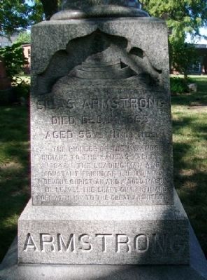
Photographed by William Fischer, Jr., September 2, 2013
1. Silas Armstrong Marker
Topics. This historical marker is listed in these topic lists: Cemeteries & Burial Sites • Fraternal or Sororal Organizations • Indigenous Peoples and Communities • Settlements & Settlers. A significant historical year for this entry is 1842.
Location. 39° 6.892′ N, 94° 37.565′ W. Marker is in Kansas City, Kansas, in Wyandotte County. It is in Riverview. It can be reached from 7th Street. Marker is in the Huron Indian Cemetery, with entrance off 7th Street north of Ann Avenue. Touch for map. Marker is at or near this postal address: 777 North 7th Street, Kansas City KS 66101, United States of America. Touch for directions.

Regionally, this marker is in Eastern Kansas. It is also in the American Midwest, in the Corn Belt, on the prairies, on the Southern Plains, and on the Santa Fe Trail Corridor. Globally, it is in North America, the Western Hemisphere, the Western World, and
this page online
Other nearby markers. At least 8 other markers are within walking distance of this marker: Eliza Burton Conley (within shouting distance of this marker); Helena Conley (within shouting distance of this marker); The History of the Wyandot Indian Nation (about 300 feet away, measured in a direct line); Judge Cordell D. Meeks, Sr. Plaza (about 700 feet away); Soldiers and Sailors Memorial (approx. 0.2 miles away); St. Mary's Church (approx. ¼ mile away); First Baptist Church and First African Methodist Episcopal Church (approx. ¼ mile away); Veterans Memorial (approx. 0.3 miles away). Touch for a list and map of all markers in Kansas City.
Also see . . .
1. Silas Armstrong. Kansas Public Public Library PDF (Submitted on February 11, 2022, by Larry Gertner of New York, New York.)
2. "Come to Their Promised Land," in History of Wyandotte County Kansas (1911). KSGenWeb website entry (Submitted on October 16, 2013, by William Fischer, Jr. of Reynoldsburg, Ohio.)
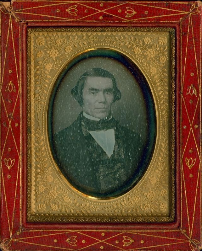
via Kansas Public Radio, unknown
2. Silas Armstrong
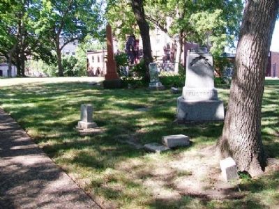
Photographed by William Fischer, Jr., September 2, 2013
3. Silas Armstrong Marker
Credits. This page was last revised on November 23, 2024. It was originally submitted on October 16, 2013, by William Fischer, Jr. of Reynoldsburg, Ohio. This page has been viewed 884 times since then and 42 times this year. Photos: 1. submitted on October 16, 2013, by William Fischer, Jr. of Reynoldsburg, Ohio. 2. submitted on November 23, 2024, by Larry Gertner of New York, New York. 3. submitted on October 16, 2013, by William Fischer, Jr. of Reynoldsburg, Ohio.
