With Jerome's rough and tumble early days came the red-light district and prostitutes. Much of the red-light district was located on Hull Avenue, the road below Main Street. In 1913, reformers helped pass an ordinance restricting houses of ill fame . . . — — Map (db m33154) HM
This is one of the two old furnaces found in place on The Hampton Lode, United Verde Copper Company Mines, at Jerome Arizona on March 5, 1888 when I first visited the property. I started operation on this furnace and also the other one on May 22, . . . — — Map (db m33147) HM
The original Jerome Town Hall was built in the late 1800s. The town quickly outgrew the small space and by 1929 a bond had passed to enlarge the old brick building. New construction was to be of concrete. In addition to enlarging town hall, a police . . . — — Map (db m33145) HM
The first mining claims were filed in 1876, within 20 years Jerome was a billion dollar copper mecca and one of the wildest, wickedest mining towns in the west. Drinking, gambling, brawls and frolicking with ladies of the night occurred . . . — — Map (db m33149) HM
In the late 1800's, Thomas Earnhart erected the Kirkland Store on the site of today's Kirkland Bar and Steakhouse.
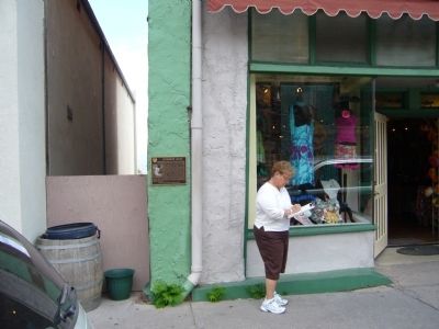
In the early 1900's, Louis Haselfeld assumed ownership and opened the Haselfeld Store. The original wood frame building burned in . . . — — Map (db m33046) HM
Territory of Arizona
MCMX ― MCMXI
Home for Aged and Infirm Arizona Pioneers
Established by act of the Twenty-Fifth Legislature under the administration of Governor Joseph H. Kibbey.
Erected under the direction of the Board . . . — — Map (db m33047) HM
Originally this was the site of A.G. Dunn's Butcher Shop, which provided fresh locally grown beef from Dunn's ranch. This was followed by Hubbard's drug store which was later owned by W.W.Ross. The drug store was purchased by Harry Brisley in 1899. . . . — — Map (db m20292) HM
American History in Arizona is quite recent, although the history of the Native American, Spanish and Mexican occupation periods are much older. Encampments of Native Americans were drawn to the creeks, which offered a fairly reliable source of . . . — — Map (db m33064) HM
The one hundred block of South Montezuma Street has long been known as "Whiskey Row" for the numerous saloons which once lined the street. As Prescott poet Gail Gardner once wrote of "Whiskey Row":
"Oh they starts her in at the Kaintucky bar, At . . . — — Map (db m20622) HM
Originally a part of the Capitol Block, which was set aside in 1864 for a Territorial Capitol Building, the south half of the block was sold at auction. John Lawler, a miner, capitalist and real estate developer, bought the entire block and built a . . . — — Map (db m20618) HM
Founded 1864 on Granite Creek, early source of placer gold. Former territorial capital of Arizona. Now a center for ranching, mining, health, especially asthma relief. Located here on site of old Ft. Whipple is Whipple Veterans Hospital. Seat of . . . — — Map (db m20298) HM
Three very prominent buildings once stood on East Gurley Street between Alarcon and Marina Streets – The Territorial Capital Building, Prescott High School and the Yavapai Club.
Originally, the property between Alarcon and Marina streets . . . — — Map (db m33095) HM
Prescott's modern public library was dedicated on May 18, 1975. However, the history of a public library in Prescott goes back to August 1895, when seven local ladies founded the Women's Club of Prescott (now the Monday Club). They gathered a . . . — — Map (db m52912) HM
This is the site of ‘the crossing' on the Mojave-Prescott "Hardyville" toll road. The road was authorized by the first territorial legislature and was built by W. H. Hardy, connecting Prescott with Hardyville on the Colorado River.
William John . . . — — Map (db m72625) HM
Joseph and Margaret Ehle arrived in Prescott, Arizona Territory, on July 13, 1864 with their children, John Henry, Mary Jane, Amy E., Olive Joan, Sarah F. and Margaret Viola. Mr. Ehle helped to build the log Governor's Mansion (now part of Sharlot . . . — — Map (db m33133) HM
Founded in 1864, Prescott is Arizona's Mile High City and seat of Yavapai County government. Named for historian William Hickling Prescott, it was established on the banks of Granite Creek in 1864.
Today it is the home to the Bob Stump VA . . . — — Map (db m33042) HM
By the early 1870s a full block of saloons, gambling halls and hotels made this the wildest part of town. Some of the saloons brewed their own beer and most drinks sold for 12½ (cents) each. On July 14, 1900 a disastrous fire swept the Row and . . . — — Map (db m21164) HM
Cleator was established in 1884 as a placer gold mining site in the Turkey Creek Mining District. A post office opened in July of 1869, but closed a few months later. James Cleator came to Arizona in 1900 to prospect in the Bradshaw mountains. In . . . — — Map (db m74224) HM
A cool canyon sanctuary at the confluence of two creeks
Mayhew Lodge, constructed of hand-smoothed logs and adorned with a towering rock chimney, was a rustic retreat attracting politicians, and movie stars. But this grand lodge had . . . — — Map (db m99273) HM
During World War II, the Yuma proving ground of the United States Army Corps of Engineers was known as the Yuma Test Branch, which was used as a floating-bridge test facility. By 1944, more allied troop support was needed to conduct the bridge tests . . . — — Map (db m29059) HM
In January 1943 the Yuma Test Branch of the Engineer Board of the Corps of Engineers commenced test operations on fixed and floating bridges at Imperial Dam. Tests were conducted in both sluiceways as well as above and below the dam. Transportation . . . — — Map (db m29058) HM
From 1850 to 1877 all travelers crossing the Colorado River used the ferry. Several operated between the mouth of the Gila River and Pilot Knob. Steamboats arrived on the river in 1850 and the first railroad bridge was built in 1877. — — Map (db m29015) HM
Yuma Crossing, used since prehistoric times, played a significant part in the development of the West and continues to influence the affairs of the state and the nation. The Yuma City-County Bicentennial Commission in the spring of 1974 conceived . . . — — Map (db m28984) HM
126 entries matched your criteria. Entries 101 through 126 are listed above. ⊲ Previous 100