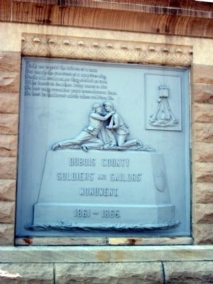
On Courthouse Square (East Side) at East 6th Street, on the left when traveling north on Courthouse Square (East Side).
( Battle Names - Around Top of Memorial )
Antietam • Chickamauga • Gettysburg • Vicksburg
( Front Panel )
Yield not to grief the tribute of a tear,
But ‘neath the fore-front of a specious sky,
Smile all exultant, as they . . . — — Map (db m47458) WM
On Courthouse Square (West Side) at West 6th Street, on the left when traveling south on Courthouse Square (West Side).
(( Left ‘Small Book’ ))
( Left ‘Page’ )
* * * Mexican War * * *
James Green • Pleasant Horton • James McElvaine • Hiram Main • David L. Matthews • Joseph Orinder
* * * Spanish American War * * *
Jesse K. Stork . . . — — Map (db m47497) WM
On Courthouse Square (East Side) at East 6th Street, on the left when traveling north on Courthouse Square (East Side).
From 1830 until it burned in 1839, a log building on this site served as the first Court house in Jasper and as the first school, which was taught by Simon Morgan, the County Clerk. — — Map (db m47410) HM
On Courthouse Square (Main Street) at East 6th Street, on the left when traveling north on Courthouse Square (Main Street).
Settling at Vincennes about 1780, Toussaint Dubois, a friend of William Henry Harrison, became a merchant, trader with Native Americans, soldier, and politician. His holdings included a land tract purchased from the United States Government on May . . . — — Map (db m195491) HM
On U.S. 231 near County Road W600N, on the right when traveling south.
This base line was part of survey system designed to divide and organize land on a grid. Described by Land Ordinance of 1785, this method enabled U.S. government to sell land to settlers after removal of Native Americans.
U.S. . . . — — Map (db m307070) HM
Near North Blackford Street north of Indianapolis Cultural Trail, on the right when traveling north.
In 1997, Dubois County produced 1,687,356 turkeys and ranked first among Indiana counties in raising poultry. Dubois County is also home to large manufacturers of pianos and organs, as well as office and home furniture. — — Map (db m238760) HM
On Main Street (State Road 162) at East 12th Street, on the right when traveling north on Main Street.
One of the most unique homes in Ferdinand, the Wollenmann House was built in 1903 by Ben Seufert Construction for Dr. Alois Wollenmann and his family to the good doctor's specifications. Born in Switzerland, in 1864, he wanted his home to . . . — — Map (db m289751) HM
On Trail #7 east of State Park Drive, on the right when traveling east.
Trace the history of Rose Island through time. As time marches on, so does the history of this former resort. As you explore the park, find the reclamation logo and look around to see how nature is slowly reclaiming the land.
1700
Indian . . . — — Map (db m303869) HM