2 entries match your criteria.
Entries Containing All of the Phrases «richland county» AND «montana»
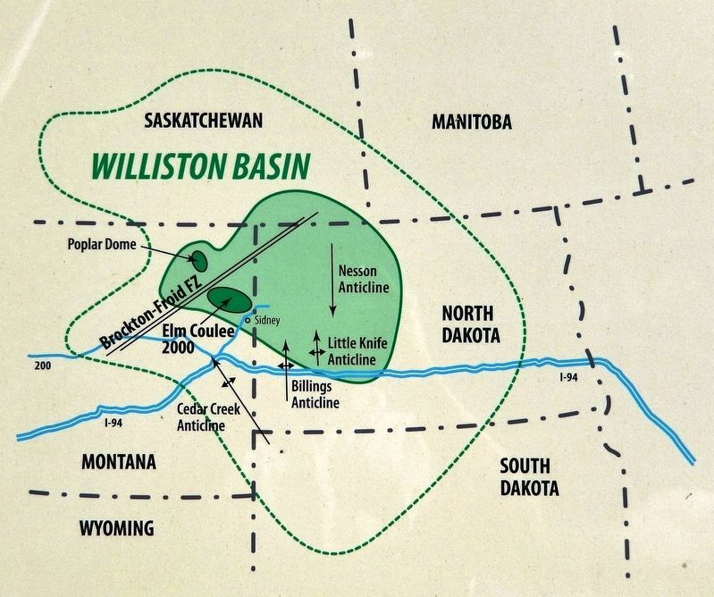
Marker detail: Williston Basin Map
RANKED BY RELEVANCE
1 ► Montana, Richland County, Sidney — The Elm Coulee Oil Field — Birthplace of the Bakken Oil Boom —  |
| On South Central Avenue (State Highway 16/200) at Lincoln Avenue South, on the right when traveling south on South Central Avenue. | |||
| Northeastern Montana is part of the Williston Basin geologic structure, a slightly irregular, bowl-shaped depression centered in North Dakota that slowly subsided over hundreds of millions of years. It served as a locus for sediment accumulation, . . . — — Map (db m203000) HM | |||
| 2 ► Montana, Valley County, Fort Peck — Northeast Montana Veterans Memorial Park — All Gave Some — Some Gave All — |
| On Missouri Avenue at South Missouri Street on Missouri Avenue. | |||
| This memorial is dedicated to the men and women of northeast Montana who proudly serve in the Armed Forces of the United States of America "Great love has no man than this: that he lay down his life for his friends." John 15:13 Valley . . . — — Map (db m312365) WM | |||
Thin black lines indicate changes in relevance. Between each pair of lines entries are ordered geographically but all have the same relevance.
* Inflectional forms of words are their plurals, singulars, and possessives as well as gramatical tenses and similar variations.
Nov. 12, 2026