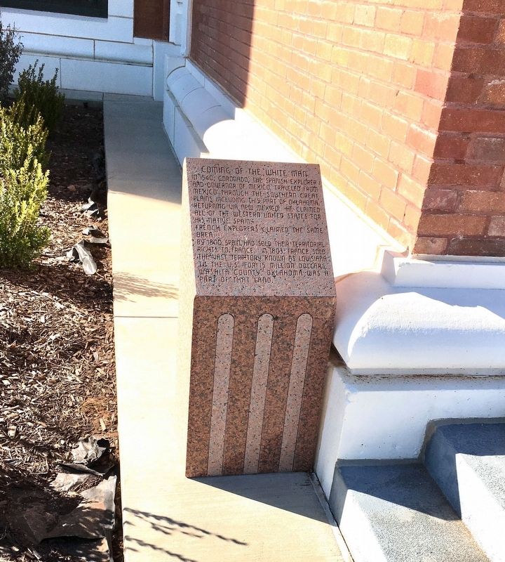
In 1540, Coronado, the Spanish explorer and governor of Mexico, traveled from Mexico through the southern Great Plains, including this part of Oklahoma, returning via New Mexico. He claimed all of the western United States for his native Spain. . . . — — Map (db m143747) HM
Beginning about 1820, the U.S. relocated the Five Civilized Tribes to Oklahoma. The Choctaws and the Chickasaws were located between the South Canadian and Red Rivers. In 1855, the U.S. leased lands from the Choctaws to settle the Plains Indians. . . . — — Map (db m166920) HM
The deep Anadarko Basin of Western Oklahoma is one of the most prolific gas provinces of North America. Wells drilled here have been among the world's deepest. The Bertha-Rogers No. 1 in Washita County, drilled in 1971 to 31,441 feet, was then . . . — — Map (db m162463) HM
Cloud Chief, originally Tacola, served as the first county seat. Area settled by land run April 19, 1892. August 7, 1900, citizens voted to move county seat to Cordell. U.S. Supreme Court voided the election since U.S. Congress had designated . . . — — Map (db m266383) HM
Construction Started 1910 - Completed 1911
Listed National Register of Historical Buildings in United States
State of Oklahoma Historical Society
1985
Floyd Craig - Mayor of Cordell
Washita County Commissioners
Gene Etris · Alfred . . . — — Map (db m166788) HM
Cloud Creek #1
Washita River Basin
Dedicated July 8, 1948
Rededicated July 3, 1998
Cloud Creek Dam No. 1 located 11 miles southeast of Cordell was the first of 1140 dams in the Washita river basin and the first of over 10.000 . . . — — Map (db m120178) HM
Thin black lines indicate changes in relevance. Between each pair of lines entries are ordered geographically but all have the same relevance.
* Inflectional forms of words are their plurals, singulars, and possessives as well as gramatical tenses and similar variations.