Following the April 4, 1968, assassination of the Reverend Dr. Martin Luther King, Jr., rioting broke out when angry crowds gathered at 14th and U Streets. The disturbances, here and around the city, lasted four days. At least ten people were . . . — — Map (db m184987) HM
Columbia Heights by the mid 1920s was a center of white elite activity and commerce. The elegant, Neoclassical style Riggs Bank branch and the Italian Renaissance style Tivoli Theater opened to great acclaim. Soon after, radio station WRC . . . — — Map (db m130743) HM
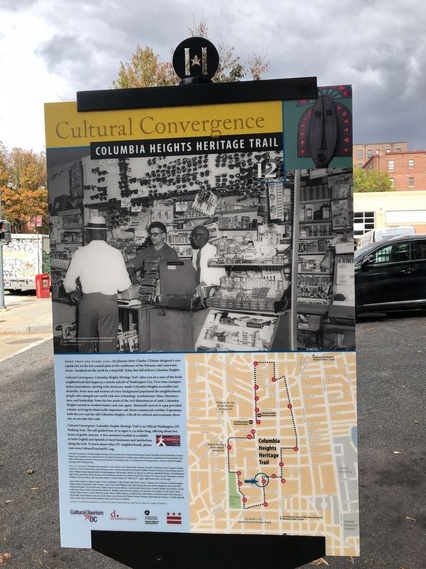
When the smoke cleared after the civil disturbances of April 1968, Columbia Heights lay devastated. Many residents and businesses simply left. Others remained to pick up the pieces. But who would help rebuild?
Citizen groups, church . . . — — Map (db m152929) HM
The intersection of 14th Street and Park Road has been the center of community life since at least 1871, when the neighborhood was called Mount Pleasant and storekeeper George Emery made his living on the northwest corner to your left. . . . — — Map (db m130744) HM
Wayland Seminary opened in Foggy Bottom just after the Civil War to train formerly enslaved people and others as “preachers and teachers for the South” and as missionaries to evangelize Africa. In 1875 it moved here, later merging . . . — — Map (db m130745) HM
Harry Wardman, Washington's prolific developer, built nearly all of the 300 houses to your right between Monroe Street and Spring Road. Wardman, an English immigrant and self-made millionaire, became known for his rowhouses, whose front . . . — — Map (db m130746) HM
The 1100 and 1200 blocks of Girard Street once were home to a “Who’s Who” of African American leaders. This and nearby “double-blocks” are the heart of John Sherman’s Columbia Heights subdivision. By placing all houses 30 feet from the . . . — — Map (db m130747) HM
This spot once was the center of the Holmead family estate, "Pleasant Plains." The property stretched from today's Spring Road to Columbia Road, and from Georgia Avenue to Rock Creek. In 1740 the Holmeads built a house near here.
In 1802, . . . — — Map (db m150253) HM
These elegant 13th Street houses were constructed when racial separation was legal and widely accepted. In 1910 the deeds for many houses across 13th Street had covenants banning “any negro or colored persons.” Those on this side generally . . . — — Map (db m130748) HM
"A Black world in which a wonderful democracy of conditions prevailed — waitresses, doctors, preachers, winos, teachers, numbers runners and funeral directors, prostitutes and housewives, cabdrivers and laborers all lived as neighbors."
. . . — — Map (db m130749) HM
Fourteenth Street has always been the business backbone of Columbia Heights. Beginning in the 1890s, electric streetcars dropped passengers at nearly every corner, attracting commerce. By 1925 storefronts occupied the blocks between Euclid . . . — — Map (db m130750) HM
On your right is Josephine Butler Parks Center, home of Washington Parks & People, a network of groups devoted to DC and its parks. The network's 1927 mansion, which once housed the Hungarian delegation, was part of an embassy row envisioned . . . — — Map (db m130751) HM
For nearly 50 years, this corner was home to Nob Hill Restaurant, one of the nation's first openly gay bars for-and run by-African Americans.
Started in the 1950s as a private social club, Nob Hill went public in 1957. Patrons enjoyed . . . — — Map (db m86014) HM
In the days of legally segregated public education (1862-1954), this school building was Central High, the gem of the School Board’s white division. But by 1949, it had few students, as the post-World War II suburban housing boom had drawn . . . — — Map (db m130752) HM
The Pitts Motor Hotel, formerly located at 1451 Belmont Street, lingers in memory for two reasons. In the 1960s it was a gathering place of Civil Rights movement leaders. Later it became a "welfare hotel."
In March 1968 the Reverend Dr. . . . — — Map (db m63706) HM
Straight ahead is All Souls Church, Unitarian, long known for its social activism, starting with abolitionism in the 1820s and ranging through nuclear disarmament and interracial cooperation. During the segregation era, All Souls was one of . . . — — Map (db m130753) HM
This block is home to some of the largest Latino organizations in the city, all founded as migration from Central America and the Caribbean increased in the 1970s. Several began with a boost from Cavalry United Methodist Church at 1459 Columbia . . . — — Map (db m130754) HM
On your left once stood Belmont, an impressive stone mansion built in 1883 by entrepreneur Amzi L. Barber, "America's Asphalt King." Barber headed the Education Department at Howard University at the time of its founding in 1867. He soon . . . — — Map (db m152933) HM