Villa Zempoala in Úrsulo Galván, Veracruz, Mexico — The Gulf Coast (North America)
Cempoala
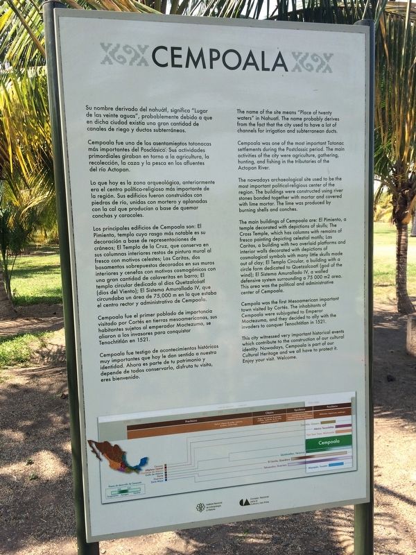
Su nombre derivado del nahuátl, significa "Lugar de las veinte aguas", probablemente debido a que en dicha ciudad existía una gran cantidad de canales de riego y ductos subterráneos.
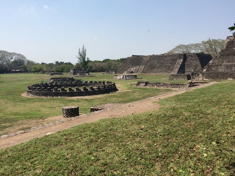
Cempoala fue uno de los asentamientos totonacas más importantes del Posclásico. Sus actividades primordiales giraban en torno a la agricultura, la recolección, la caza y la pesca en los afluentes del río Actopan.
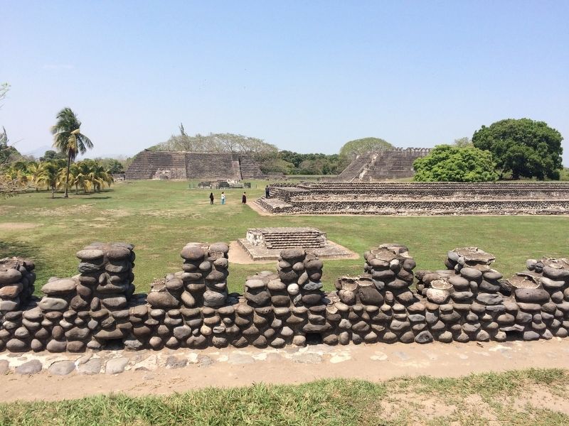
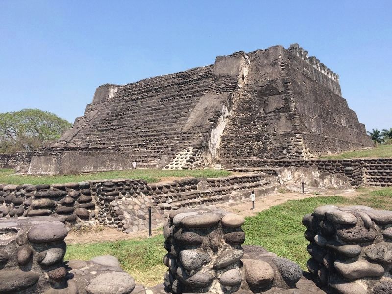
Lo que hoy es la zona arqueológica, anteriormente era el centro politico-religioso más importante de la región. Sus edificios fueron construidos con piedras de río, unidas con mortero y aplanadas con la cal que producian a base de quemar conchas y caracoles.
Los principales edificios de Cempoala son: El Pimiento, templo cuyo rasgo más notable es su decoración a base de representaciones de cráneos; El Templo de la Cruz, que conserva en sus columnas interiores restos de pintura mural al fresco con motivos celestes; Las Caritas, dos basamentos sobrepuestos decorados en sus muros interiores y cenefas con motivos cosmogónicos con una gran cantidad de calaveritas en barro; El templo circular dedicado al dios Quetzalcóatl (dios del Viento); El Sistema Amurallado IV, que circundaba un área de 75,000 m en la que estaba el centro rector y administrativo de Cempoala.
Cempoala fue el primer poblado de importancia visitado por Cortés en tierras mesoamericanas, sus habitantes sujetos al emperador Moctezuma, se aliaron a los invasores para conquistar Tenochtitlán en 1521.
Cempoala fue testigo de acontecimientos históricos muy importantes que hoy le dan sentido a nuestra identidad. Ahora es de tu patrimonio y depende de todos conservarlo, disfruta tu visita, eres bienvenido.
English:
The name of the site means "Place of twenty waters" in Nahuatl. The name probably derives from the fact that the city used to have a lot of channels for irrigation and subterranean ducts.
Cempoala was one of the most important Totonac settlements during the Postclassic period. The main activities of the city were agriculture, gathering, hunting, and fishing in the tributaries of the Actopan River.
The nowadays archaeological site used to be the most important political religious center of the region. The buildings were constructed using river stones bonded together with mortar and covered with lime mortar. The lime was produced by burning shells and conches.
The main buildings of Cempoala are: El Pimiento, a temple decorated with depictions of skulls; The Cross Temple, which has columns with remains of fresco painting depicting celestial motifs; Las Caritas, a building with two overlaid platforms and interior walls decorated with depictions of cosmological symbols with
many little skulls made out of clay; El Templo Circular, a building with a circle form dedicated to Quetzalcoatl (god of the wind); El Sistema Amurallado IV, a walled defensive system surrounding a 75 000 m2 area. This area was the political and administrative center of Cempoala.
Cempoala was the first Mesoamerican important town visited by Cortés. The inhabitants of Cempoala were subjugated to Emperor Moctezuma, and they decided to ally with the invaders to conquer Tenochtitlan in 1521.
This city witnessed very important historical events which contribute to the construction of our cultural identity. Nowadays, Cempoala is part of our Cultural Heritage and we all have to protect it. Enjoy your visit. Welcome.
Erected by Consejo Nacional para la Cultura y las Artes de México (CONACULTA)-INAH.
Topics. This historical marker is listed in these topic lists: Anthropology & Archaeology • Architecture • Colonial Era • Native Americans. A significant historical year for this entry is 1521.
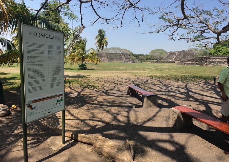
Location. 19° 26.785′ N, 96° 24.256′ W. Marker is in Villa Zempoala, Veracruz, in Úrsulo Galván. Marker can be reached from Francisco del Paso y Troncoso just north of José María Morelos Oriente. The marker is near the entrance to the Cempoala Archaeological Site. Touch for map.
Marker is in this post office area: Villa Zempoala VER 91660, Mexico. Touch for directions.
Other nearby markers. At least 1 other marker is within 18 kilometers of this marker, measured as the crow flies. Second Municipal Council in the Americas (approx. 16.4 kilometers away).
Regarding Cempoala. As the marker mentions, Cempoala was the first major settlement that Cortés visited in Mesoamerica. In a stroke of luck for his expedition, the area belonged to the Totonacas who had long suffered under the Aztecs. Cortés realized that he could use the Totonacas and other groups as allies to eventually attack the Aztecs.
Credits. This page was last revised on January 4, 2023. It was originally submitted on June 15, 2017, by J. Makali Bruton of Accra, Ghana. This page has been viewed 217 times since then and 13 times this year. Photos: 1, 2, 3, 4, 5, 6. submitted on June 15, 2017, by J. Makali Bruton of Accra, Ghana.
