San Joaquín, Querétaro, Mexico — The Central Highlands (North America)
Archaeological Work
Inscription.
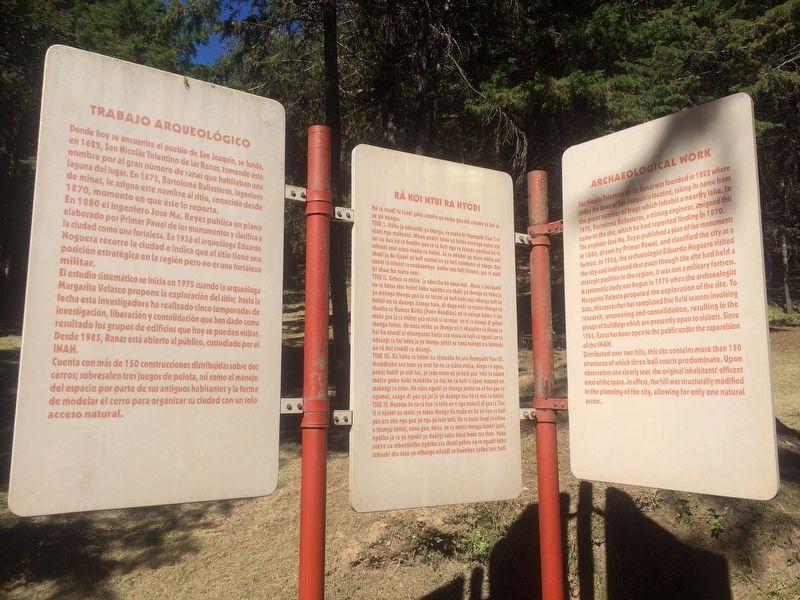
Trabajo Arqueológico
Donde hoy se encuentra el pueblo de San Joaquín, se funda, en 1622, San Nicolás Tolentino de las Ranas, tomando este nombre por el gran número de ranas que habitaban una laguna del lugar. En 1872, Bartolomé Ballesteros, ingeniero de minas, le asigna este nombre al sitio, conocido desde 1870, momento en que éste lo reporta.
En 1880 el ingeniero José Ma. Reyes publica un plano elaborado por Primer Pawel de los monumentos y clasifica a la ciudad como una fortaleza. En 1936 el arqueólogo Eduardo Noguera recorre la ciudad e indica que el sitio tiene una posición estratégica en la región pero no es una fortaleza militar.
El estudio sistemático se inicia en 1975 cuando la arqueóloga Margarita Velasco propone la exploración del sitio; hasta la fecha esta investigadora ha realizado cinco temporadas de investigación, liberación y consolidación que han dado como resultado los grupos de edificios que hoy se pueden visitar. Desde 1985, Ranas está abierto al público, custodiado por el INAH.
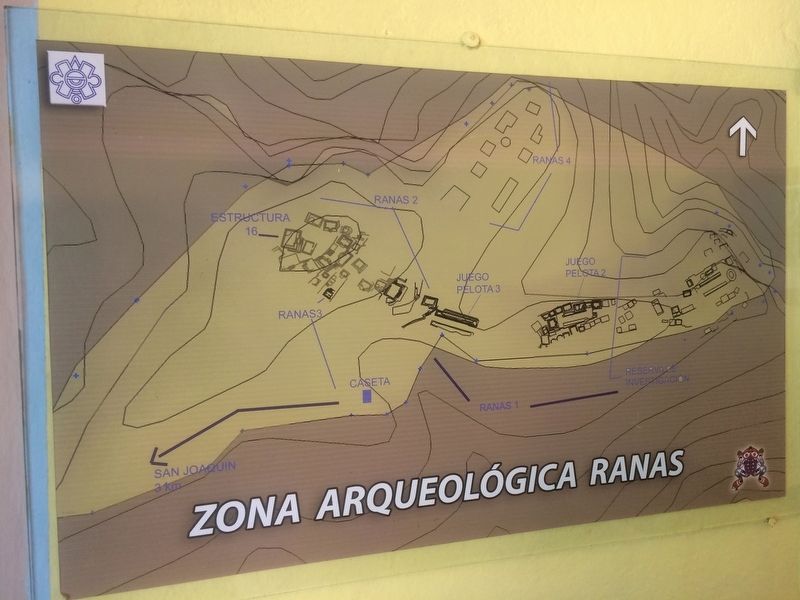
Cuenta con más de 150 construcciones distribuidas sobre dos cerros; sobresalen tres juegos de pelota, así como el manejo del espacio por parte de sus antiguos habitantes y la forma de modelar el cerro para organizar su ciudad con un solo acceso natural.
Ra koi ntui ra hyod
Há rá nxadi bi faádi goho ranaño ya nteke geu údi ranaño yá bai rá te yá nángu.
Tiue 1. Hábu ja nduúnthi ya thongu, ra ntéke bi thumpabi Tiue 1 rí njani nge mahyatsi. Mboó peétsi hñuú ya bátha nteénga nuúni xra tui na ñuú há ra ñantho gea ja rá befi ngu ra thanda yomñuú há rá mfeéni ntui núna nteke ra hniíni. Ja ra mfeéni ge núna ntéke xki thutsi ja da njaáni yá befi ntemei en yá befi tuimfeéni yá nángu. Una noóni rá mfeéni ra nxubaámhya yaábu tota befi Velasco, gea rá múdi bi thoe há núna mui.
Tiue II. Gehna ra ntéke ja ndeétho há núna mui. Mana rí bénduabi na ra hétsa ntei hniíni hábu naádbu xra thóki ya thongu en hábu ja ya doónga thongu geu ja mí tóteni yá befi kohi ntui mhanga befi ra hniíni en ra daánga nxinga haia, di daga néki ra mútsa thongu rá thuúhu ra Ñuúnta Bátha (Patio Hundido) en ra nxinga bátha rí nja maña gea ja rá thúhni gea ntsédi xi rá múui en xi ra daángi di gehna thongu hniíni. Há núna ntéke ya thongu xií rí nkatuitho rá nhomi ra hai ha ntsedi xi ntsanganza hánja xra totua rá befi ra nguúti en rá ndaángi ra hai hábu ja ya thongu gehni ya tsana toóngu xra túmbabi na rá bai ntsédi ra daángi.
Tiue III. Rá kúhu
ra hniíni xa njaseéhe ha xra thumpabi Tiue III Nsokthoho xra tote ya nsei há na ra tsána ntéke, hingo rá ngea, peétsi huádi ya nídi hai, ya jado nótse en ya húdi geu hóki ya tsáana mútsa goho báki mabátha xa nui há ra kati rí njani mapuni en makangi ra toho. Há núna nguúti ya thongu peétsi na rá bai gea ra ngumui, zaáge di geu ya jai ja yá daánga nsu há rá mui ra hniíni.
Tiue IV. Maxotse há na rá hyo ra toho en rí nge mahuifi di gea ra Tiue II rí njaáni na mútsi ya tsána thongu há maña en há yá hyo ra kati geu xra nhu ngu geu ya ngu gá tota befi. Ha ra bede thogi rá nthoe a thongu hniíni, núna gea, héna, na ra mútsa thongu hímbri juáti, ngétho ja ra yá nguúti ya daángi hábu néna hinte xra thoe. Núna ntéke xa mbonthitho ngétho xra thutsi gehna na ra nguúti hábu tekuabi dra tote ya nthónga mfaádi ra baámhya yaábu tote befi.
Archaeological Work
San Nicolás Tolentino de las Ranas was founded in 1622 where today the town of San Joaquin is located, taking its name from the great number of frogs which inhabit a nearby lake. In 1872, Bartolomé Ballesteros, a mining engineer, assigned this name to the site, which he had reported finding in 1870.
The engineer José Ma. Reyes published a plan of the monuments in 1880, drawn by Primer Pawel, and classified the city as a fortress. In 1936, the archaeologist Eduardo Noguera visited
the city and indicated that even though the site had held a strategic position in the region, it was not a military fortress. A systematic study was begun in 1975 when the archaeologist Margarita Velasco proposed the exploration of the site. To date, this researcher has completed five field seasons involving research, uncovering and consolidation, resulting in the groups of buildings which are presently open to visitors. Since 1985, Ranas has been open to the public under the supervision of the INAH.
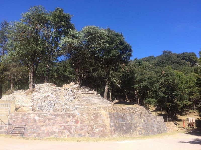
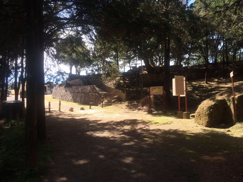
Distributed over two hills, this site contains more than 150 structures of which three ball courts predominate. Upon observation one clearly sees the original inhabitants' efficient used of the space. In effect, the hill was structurally modified in the planning of the city, allowing for only one natural access.
Erected by Instituto Nacional de Antropología e Historia (INAH).
Topics. This historical marker is listed in these topic lists: Anthropology & Archaeology • Man-Made Features • Native Americans. A significant historical year for this entry is 1622.
Location. 20° 55.575′ N, 99° 33.893′ W. Marker is in San Joaquín, Querétaro. Marker can be reached from Unnamed road. The marker is at Ranas Archaeological Site to the north of the town of San Joaquín, on an unnamed but well-known road, near the "Finca de Doña Lore". Touch for map. Marker is in this post office area: San Joaquín QUE 76550, Mexico. Touch for directions.
Other nearby markers. At least 8 other markers are within walking distance of this marker. Building Three (within shouting distance of this marker); The Doors of the City (within shouting distance of this marker); Ball Court Three (within shouting distance of this marker); The Sunken Patio Complex (within shouting distance of this marker); The Buildings 16 and 16-b (within shouting distance of this marker); The City and its Territory/The Inhabitants (within shouting distance of this marker); Las Ranas and the Access Complex (about 120 meters away, measured in a direct line); Ball Court Two (about 150 meters away). Touch for a list and map of all markers in San Joaquín.
Credits. This page was last revised on May 28, 2023. It was originally submitted on January 21, 2018, by J. Makali Bruton of Accra, Ghana. This page has been viewed 165 times since then and 8 times this year. Photos: 1, 2, 3, 4, 5. submitted on January 21, 2018, by J. Makali Bruton of Accra, Ghana.
