San Joaquín, Querétaro, Mexico — The Central Highlands (North America)
The Buildings 16 and 16-b
Edificios 16 y 16-b
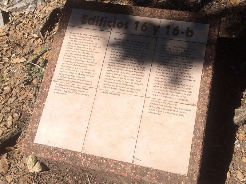
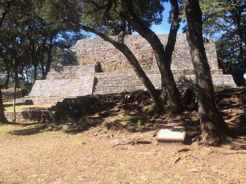
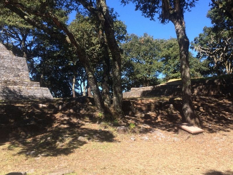
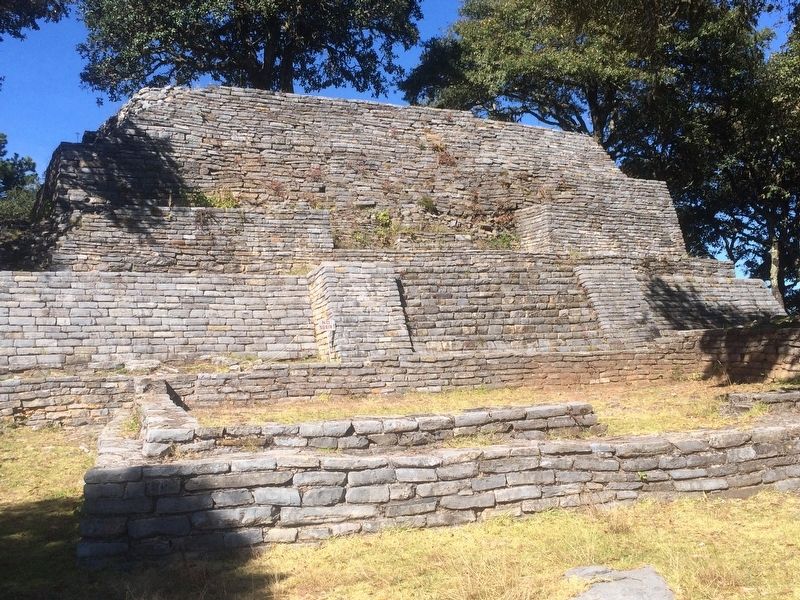
El templo 16 es la construcción más grandé e importante del sitio. Su exploración se efectuó en 1984-1985, y se observó en el interior que existieron al menos seis niveles de ocupación y que el edificio sufrió varias remodelaciones importantes. En su fachada se muestran datos de tres de ellas. La habitación 16-b, localizada al frente de la pirámide, es uno de los elementos que permiten proponer que la ciudad de Ranas fue reocupada, ya que se construyó con otra orientación y si se proyectan los muros en altura, se observa que esta construcción tapa al templo principal. Desconocemos quiénes lo hicieron, pero posiblemente fueron los grupos de Chichimecas-Jonaces que poblaron la región cuando se perdió la hegemonía de la ciudad y se abandonó.
Edificios 16 y 16-b
Ra níja 16 gehna na ra daánga nthoe xi ja rá múui há núna hyodi. Rá nsei gá thóni bi tote ya jeya 1984-1985, ha bi nhuú ge mboó bi nja bu xi tsutho ngu ráto hétsa nidi bi totua rá befi ha nuna daánga nguú bi totue juadi ya yonthoki xi yá múui. Há rá doóngi údi hñuú di geu ya nthóki. Ra ngumui 16b, gea bi tsudi há rá hmií ra ntsa tonga nthoe gehna na ra thongu údi ha tsa da mha ge ra hniíni tiue nduúnthi ya miki tóo bi muúhni, ngétho juádi rá múdi rá ntei bi túmbi naño rá thandi ha unbu styá yá jado núnä nthoe xä júti ra ndänija. Hindi paádihe tóo geu bi hyoe, di humuihe tóo geu ya mutsi Chichimecas-Jonaces geu bi muúhni há núu ya hai unbu bi beédi ra tsedi ra hniíni ha neépu bri tsoóhni.
Buildings 16 and 16-b
Temple 16 is the largest and most important structure of the site. Explored in 1984-1985 it was observed in the interior that there existed at least six levels of occupation and that the building suffered various important stages of rebuilding. Evidence of three of them are shown on the façade. The dwelling 16-b, found to the front of the pyramid, is one of the elements which leads one to suppose that the city of Ranas was reoccupied, since it was built with a different orientation, and has walls which would cover the main temple if extended to their original height. Even though the identity of the builders is unknown, it is possible that they were groups of Chichimecas-Jonaces, who populated the region after control of the city was lost and it was subsequently abandoned.
Erected by Instituto Nacional de Antropología e Historia (INAH).
Topics. This historical marker is listed in these topic lists: Anthropology & Archaeology • Architecture • Man-Made Features • Native Americans.
Location. 20° 55.596′ N, 99° 33.925′ W. Marker is in San Joaquín, Querétaro. Marker is on Unnamed Road. The marker is at Ranas Archaeological Site to the north of the town of San Joaquín, on an unnamed but well-known road, near the "Finca de Doña Lore". Touch for map. Marker is in this post office area: San Joaquín QUE 76550, Mexico. Touch for directions.
Other nearby markers. At least 8 other markers are within walking distance of this marker. The Sunken Patio Complex (a few steps from this marker); The City and its Territory/The Inhabitants (within shouting distance of this marker); The Doors of the City (within shouting distance of this marker); Archaeological Work (within shouting distance of this marker); Building Three (about 90 meters away, measured in a direct line); Ball Court Three (about 120 meters away); Las Ranas and the Access Complex (about 150 meters away); Ball Court Two (about 210 meters away). Touch for a list and map of all markers in San Joaquín.
Credits. This page was last revised on January 23, 2018. It was originally submitted on January 21, 2018, by J. Makali Bruton of Accra, Ghana. This page has been viewed 106 times since then and 5 times this year. Photos: 1, 2, 3, 4. submitted on January 21, 2018, by J. Makali Bruton of Accra, Ghana.


