Annapolis in Anne Arundel County, Maryland — The American Northeast (Mid-Atlantic)
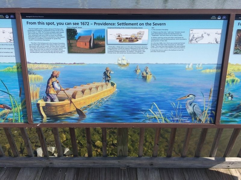
From this spot, you can see 1672 - Providence: Settlement on the Severn
Annapolis Maritime Museum

Photographed By Devry Becker Jones (CC0), March 10, 2018
1. From this spot, you can see 1672 - Providence: Settlement on the Severn Marker
The ship in the background is the Constant Friendship, one of the largest vessels in the tobacco fleet that carried Maryland's cash crop to London. On their return voyages, the vessels carried settlers, servants, household goods, and news. About this time, as many as 70 wooden sailing vessels made the round trip each year between England and Maryland's rivers around the Bay like the Severn.
Eventually, a village grew up on this side of the Severn. Governor Francis Nicholson moved the capital of Maryland to this little village in 1695 because of its central location, protected harbor, and Protestant-friendly population. He named it "Annapolis" after Princess Anne, who would soon become Queen of England.
Key
1. The Constant Friendship
2. Tobacco was the main "cash crop." Growers would pack dried tobacco leaves into barrels known as "hogsheads" and ferry them out to ships in boats.
3. Settlers used log canoes and other small boats for transportation and harvesting seafood, which provided a good portion of their diet.
4. In the late 1600s, Horn Point was owned and farmed by Richard Hill. Back Creek was known as "Hill's Back Creek." The trees have been girdled, their bark stripped to kill them in order to open fields for growing tobacco.
5. Great blue herons wade in the shallows to hunt fish and other small animals.
Erected by Chesapeake Bay Trust.
Topics. This historical marker is listed in these topic lists: Agriculture • Colonial Era • Settlements & Settlers • Waterways & Vessels. A significant historical year for this entry is 1649.
Location. 38° 58.131′ N, 76° 28.563′ W. Marker is in Annapolis, Maryland, in Anne Arundel County. Marker can be reached from 2nd Street south of Bay Shore Avenue, on the right when traveling north. Touch for map. Marker is at or near this postal address: 799 2nd Street, Annapolis MD 21403, United States of America. Touch for directions.
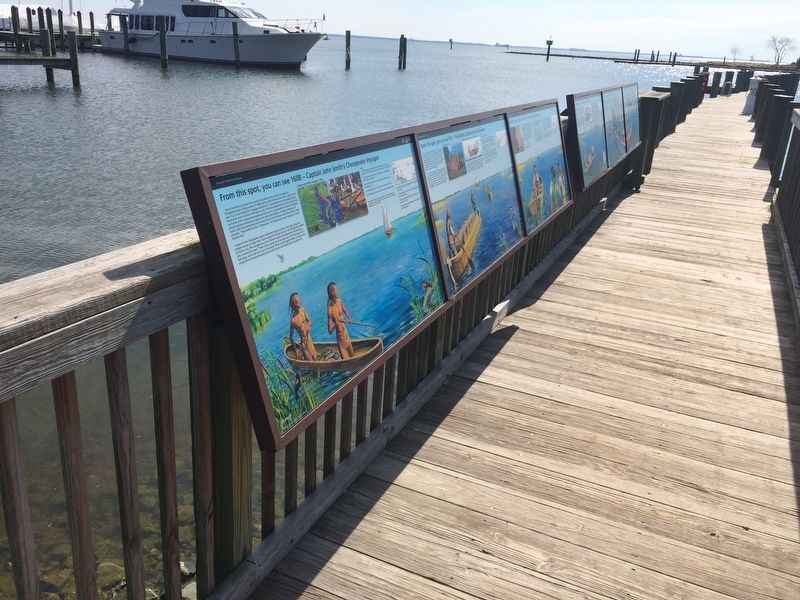
Other nearby markers. At least 8 other markers are within walking distance of this marker. From this spot, you can see 1608 - Captain John Smith's Chesapeake Voyages (here, next to this marker); From this spot, you can see 1887 - The Age of Steam (here, next to this marker); From this spot, you can see 1774 - The "Annapolis Tea Party"

Photographed By Devry Becker Jones (CC0), March 10, 2018
2. From this spot, you can see 1672 - Providence: Settlement on the Severn Marker
Credits. This page was last revised on September 18, 2023. It was originally submitted on March 11, 2018, by Devry Becker Jones of Washington, District of Columbia. This page has been viewed 382 times since then and 54 times this year. Photos: 1, 2. submitted on March 11, 2018, by Devry Becker Jones of Washington, District of Columbia. • Bill Pfingsten was the editor who published this page.