Santiago de Querétaro in Querétaro, Mexico — The Central Highlands (North America)
Querétaro, Cultural Heritage of Humanity

Photographed By J. Makali Bruton, August 13, 2018
1. Querétaro, Cultural Heritage of Humanity Marker
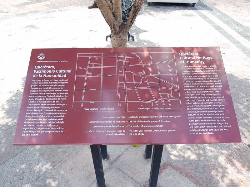
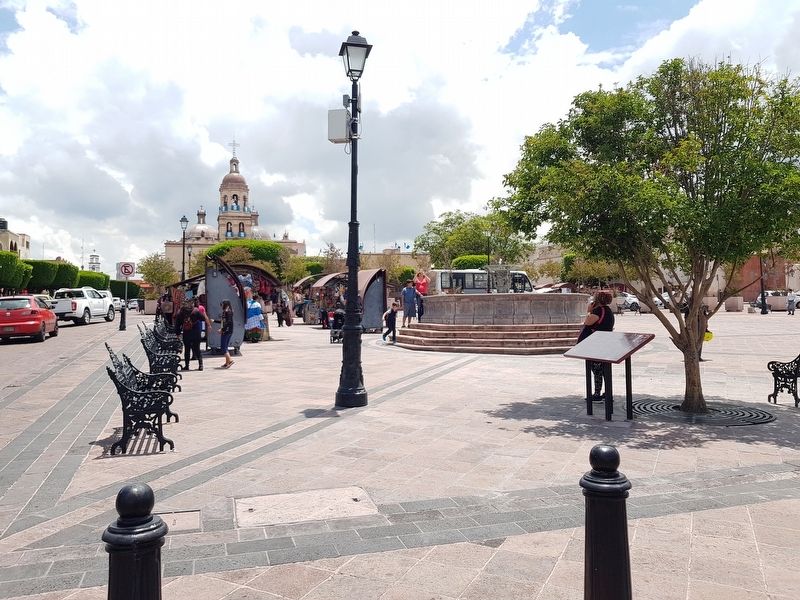
Unfortunately the marker's map is not correctly oriented for this location. The map should ideally be rotated 180 degrees, as the map's north actually is directed to the south. The Plaza de los Fundadores (the map's location) and the iconic Temple of the Santa Cruz are to the viewer's left (east) but on the map (although not indicated) would be on the right. Potentially the map was originally planned for a location in the central part of historic Querétaro.
Querétaro, Patrimonio Cultural de la Humanidad
Querétaro se fundó en 1531 en medio del valle de La Cañada, habitado por algunos gurpos chichimecas. Décadas después, Querétaro se convirtió en una de las ciudades más importantes para la Corona española, principalmente por ser punto de encuentro entra la Ciudad de México y las minas al norte de Camino Real de Tierra Adentro. El 7 de diciembre de 1996, la Organización de la Naciones Unidas para la Educación, la Ciencia y la Cultura (Unesco) ortogó a la Zona de Monumentos Históricos de Querétaro el nombramiento de Patrimonio Cultural de la Humanidad. La Unesco reconoció su decisión a partir de dos criterios: la traza original del siglo XVI, donde convivieron indígenas y españoles, y la arquitectura barroca de los siglos XVII y XVIII, que aún permanece de pie en el tiempo.
203 manzanas inscritas
4 kilómetros cuadrados mide la zona
1,400 monumentos lo conforman
1712, año en el que se le ortogó el rango de ciudad a Querétaro
Querétaro, Cultural Heritage of Humanity
Querétaro was founded in 1531 as a town of Indians in the middle of the valley of La Cañada. Decades after the arrival of the Spaniards, Querétaro became one of the most important cities of the Spanish Crown; mainly for its position as a crossroads between Mexico City and the mines of the Camino Real de Tierra Adentro in the north. On December 7, 1996, UNESCO granted the Historical Monuments Zone of Querétaro the designation of Cultural Heritage of Humanity. This designation was awarded by virtue of the exchange of indigenous, Spanish, and mestizo cultural values before and during the viceregal period, which impacted the development of architecture, monumental arts, urban planning, and landscape design in the area, the results of which can be well appreciated in the mixed layout of streets in the zone, which combines Spanish geometry with pre-Hispanic irregularity, and in the great richness that the civil and religious buildings of the XVII and XVIII centuries demonstrate.
203 blocks are registered within the World Heritage area
The size of the zone is 4 square kilometers
The number of monuments is 1,400
1712 is the year in which Querétaro was granted the rank of city
Erected 2018 by Municipalidad de Querétaro.
Topics and series. This historical marker is listed in these topic lists: Architecture • Colonial Era
• Man-Made Features • Native Americans. In addition, it is included in the UNESCO World Heritage Sites series list. A significant historical date for this entry is December 7, 1996.
Location. 20° 35.58′ N, 100° 23.093′ W. Marker is in Santiago de Querétaro, Querétaro. Marker is at the intersection of Calle Independencia and Calle Manuel Gutiérrez Nájera, on the right when traveling north on Calle Independencia. Touch for map. Marker is in this post office area: Santiago de Querétaro QUE 76000, Mexico. Touch for directions.
Other nearby markers. At least 8 other markers are within walking distance of this marker. The Founders of Santiago de Querétaro (within shouting distance of this marker); Friar Junipero Serra (within shouting distance of this marker); Friar Antonio Margil de Jésus (within shouting distance of this marker); Fountain of the Virgin del Pilar (within shouting distance of this marker); The Founding of Santiago de Querétaro (within shouting distance of this marker); Founding and History of the Church of the Holy Cross (about 120 meters away, measured in a direct line); Temple and Convent of Santa Cruz (about 120 meters away); Historical Events at the Church of the Holy Cross (about 120 meters away). Touch for a list and map of all markers in Santiago de Querétaro.
Credits. This page was last revised on August 14, 2018. It was originally submitted on August 14, 2018, by J. Makali Bruton of Accra, Ghana. This page has been viewed 161 times since then and 11 times this year. Photos: 1, 2. submitted on August 14, 2018, by J. Makali Bruton of Accra, Ghana.
