Berthier-sur-Mer in Chaudière-Appalaches, Québec — Central Canada (French-Canadian)
La salinite de l'eau / The Water Salinity
Inscription.
Les marées
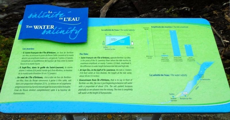
- À Saint-François-de-l'Île-d'Orléans, en face de Berthier-sur-Mer, on retrouve le point du fleuve Saint-Laurent où la marée atteint son amplitude maximum, soit près de 7 mètres (23 pieds). L'amplitude est la différence de hauteur de l'eau entre la marée basse et la marée haute.
- À Sept-Îles, dans le golfe du Saint-Laurent, la marée atteint 3 mètres (9,8 pieds) tandis qu'à Trois-Rivières, la hauteur de la marée varie d'environ 30 cm (12 pouces).
- En aval de l'Île d'Orléans, c'est-à-dire en face de Berthier-sur-Mer, l'eau du fleuve commece à peine à être salée, soit dans une proportion d'environ 25 %. La teneur en sel augmente progressivement au fur et à mesure que l'on avance dans l'estuair. L'eau du fleuve devient complètement salée à la hauteur de Kamouraska.
[Légendes des illustrations, dans le sens des aiguilles d'une montre à partir du centre, lisez]
• La salinité de l'eau
• Amplitude des marées
• La salinité de l'eau
The Tides
- Saint-François-de-l'Île-d'Orléans, opposite Berthier-sur-Mer, is the point of the St. Lawrence River where the tide reaches its maximum amplitude, or nearly 7 meters (23 feet). Amplitude is the difference in water height between low tide and high tide.
- At Sept-Îles, in the Gulf of St. Lawrence, the tide is 3 meters (9.8 feet) while at Trois-Rivières, the height of the tide varies about 30 cm (12 inches).
- Downstream from Île d'Orléans, that is to say in front of Berthier-sur-Mer, the river is just beginning to become salt water with a proportion of about 25%. The salt content increases gradually as we advance into the estuary. The river is completely salt water at the height of Kamouraska.
[Illustration captions, clockwise from top center, read]
• The water salinity
• The tide amplitude
• The water salinity
Topics. This historical marker is listed in these topic lists: Environment • Science & Medicine • Waterways & Vessels.
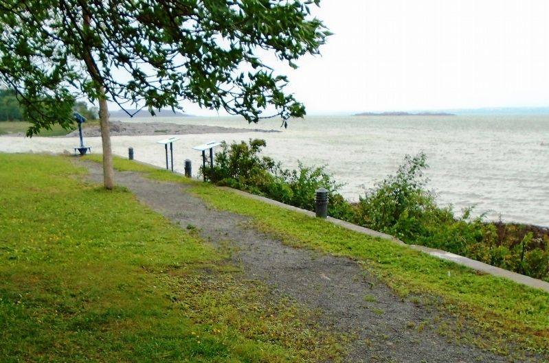
Location. 46° 56.073′ N, 70° 44.163′ W. Marker is in Berthier-sur-Mer, Québec, in Chaudière-Appalaches. Marker is on rue de la Marina just north of chemin d'Étiopie, on the left when traveling north. Marker is along the riverfront walking path at Marina Berthier-sur-Mer. Touch for map. Marker is in this post office area: Berthier-sur-Mer QC G0R 1E0, Canada. Touch for directions.
Other nearby markers. At least 8 other markers are within walking distance of this marker. Grosse-Île-et-le-Mémorial-des-Irlandais (within shouting distance of this marker); Les naufrages dans le secteur / Shipwrecks in the Sector (within
shouting distance of this marker); Le phare de l'îlet Bellechasse / The l'Îlet Bellechasee Lighthouse (within shouting distance of this marker); Le quai et la Villégiature / The Quay and Village Life (within shouting distance of this marker); Hameau Dunière-Dénéchaud (about 90 meters away, measured in a direct line); La seigneurie de Berthier / The Seigniory of Berthier (approx. 0.9 kilometers away); Des pionniers et navigateurs de Berthier-sur-Mer (approx. 0.9 kilometers away); Des armoiries Berthier-sur-Mer Coat of Arms (approx. 0.9 kilometers away). Touch for a list and map of all markers in Berthier-sur-Mer.
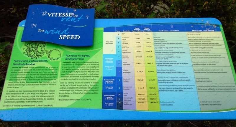
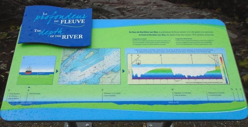
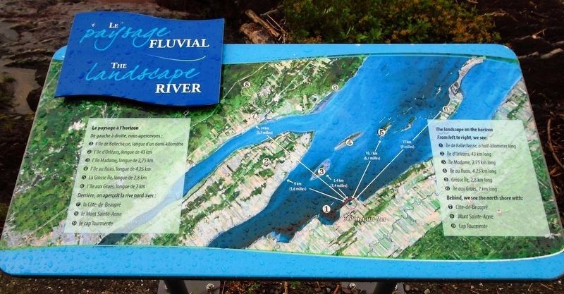
Regarding La salinite de l'eau / The Water Salinity. This marker has limited but useful historical information. Three other markers along the waterfront; La vitesse du vent/The Wind Speed, La profondeur du fleuve/The Depth of the River, and Le paysage fluvial/The River Landscape, contain scientific information but not historical information. Photos are included with this entry but are not transcribed.
Also see . . .
1. St. Lawrence River at The Canadian Encyclopedia. (Submitted on September 19, 2018, by William Fischer, Jr. of Scranton, Pennsylvania.)
2. St. Lawrence River: monitoring water quality. (Submitted on September 19, 2018, by William Fischer, Jr. of Scranton, Pennsylvania.)
Credits. This page was last revised on January 23, 2022. It was originally submitted on September 19, 2018, by William Fischer, Jr. of Scranton, Pennsylvania. This page has been viewed 367 times since then and 31 times this year. Photos: 1, 2, 3, 4, 5. submitted on September 19, 2018, by William Fischer, Jr. of Scranton, Pennsylvania.
