Brunswick in Glynn County, Georgia — The American South (South Atlantic)
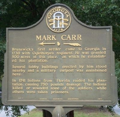
Mark Carr
←—«
Brunswick's first settler came to Georgia in 1738 with Oglethorpe's regiment. He was granted 500 acres at this place, on which he established his plantation.
Several tabby buildings erected by him stood nearby and a military outpost was maintained here.
In 1741 Indians from Florida raided his plantation, causing 750 pounds damage. The Indians killed or wounded some of the soldiers, while others were taken prisoners.
Erected 1953 by Georgia Historical Commission. (Marker Number 063-1.)
Topics and series. This historical marker is listed in these topic lists: Colonial Era • Native Americans • Settlements & Settlers • Wars, US Indian. In addition, it is included in the Georgia Historical Society series list. A significant historical year for this entry is 1738.
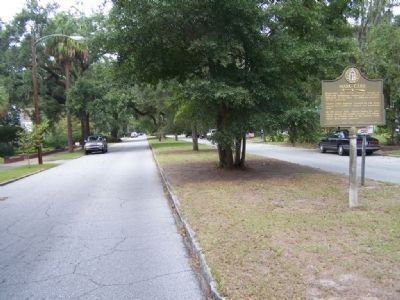
Location. 31° 8.252′ N, 81° 29.34′ W. Marker is in Brunswick, Georgia, in Glynn County. Marker is on Union Street near 1st Avenue, in the median. Touch for map. Marker is in this post office area: Brunswick GA 31520, United States of America. Touch for directions.
Other nearby markers. At least 8 other markers are within walking distance of this marker. Hanover Square (approx. half a mile away); Benjamin and Nancy Hart (approx. half a mile away); Wright Square (approx. half a mile away); Sidney Lanier (approx. half a mile away); a different marker also named Hanover Square (approx. half a mile away); a different marker also named Hanover Square (approx. half a mile away); a different marker also named Hanover Square (approx. half a mile away); Queen Square (approx. 0.7 miles away). Touch for a list and map of all markers in Brunswick.
Regarding Mark Carr. His settlement was near the river between what is now Dartmouth Street and 1st Avenue, comprised of about 1000 acres. Being situated on a peninsula and with the principle area crop being tobacco was grown in this area, it was called Plug Point.
Also see . . . Wikipedia entry for Brunswick, Georgia. The area's first European settler, Mark Carr, arrived in 1738. Carr, a Scotsman, was a captain in General James Oglethorpe’s Marine Boat Company; upon landing, he established his 1,000-acre (4.0 km2) tobacco plantation along the Turtle River. The Royal Province of Georgia purchased Carr’s fields in 1771 and laid out the town of Brunswick in the grid style following Oglethorpe’s Savannah Plan. (Submitted on October 13, 2008, by Mike Stroud of Bluffton, South Carolina.)
Credits. This page was last revised on October 13, 2020. It was originally submitted on October 13, 2008, by Mike Stroud of Bluffton, South Carolina. This page has been viewed 2,941 times since then and 63 times this year. Photos: 1, 2. submitted on October 13, 2008, by Mike Stroud of Bluffton, South Carolina. • Kevin W. was the editor who published this page.

