León, Guanajuato, Mexico — The Central Highlands (North America)
City Hall
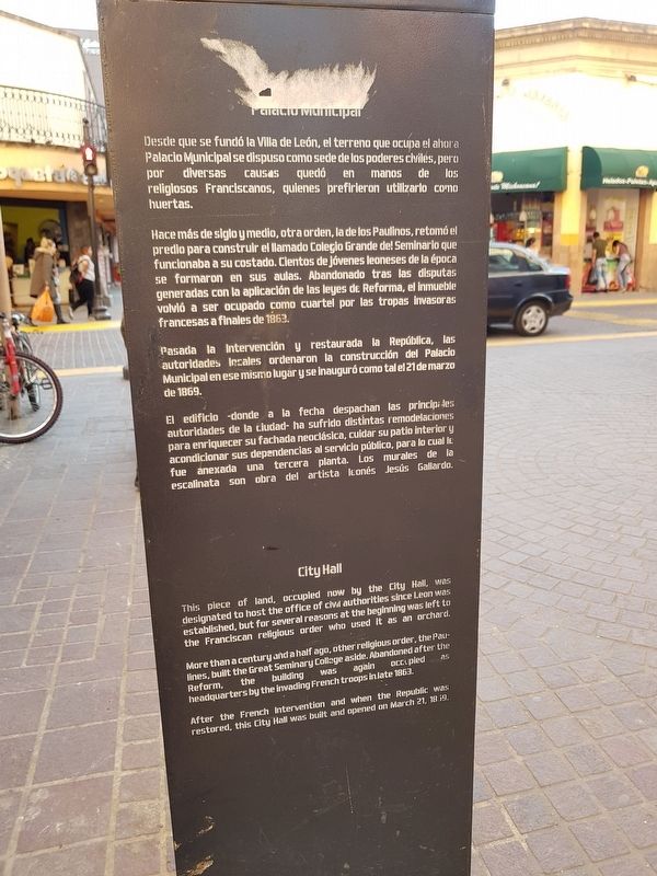
Palacio Municipal
Desde que se fundó la Villa de León, el terreno que ocupa el ahora Palacio Municipal se dispuso como sede de los poderes civiles, pero por diversas causas quedó en manos de los religiosos Franciscanos, quienes prefirieron utilizarlo como huertas.
Hace más de siglo y medio, otra orden, la de los Paulinos, retomó el predio para construir el llamado Colegio Grande del Seminario que funcionaba a su costado. Cientos de jóvenes leoneses de la época se formaron en sus aulas. Abandonado tras las disputas generadas con la aplicación de las leyes de Reforma, el inmueble volvió a ser ocupado como cuartel por las tropas invasoras francesas a finales de 1863.
Pasada la Intervención y restaurada la República, las autoridades locales ordenaron la construcción del Palacio Municipal en ese mismo lugar y se inauguró como tal el 21 de marzo de 1869.
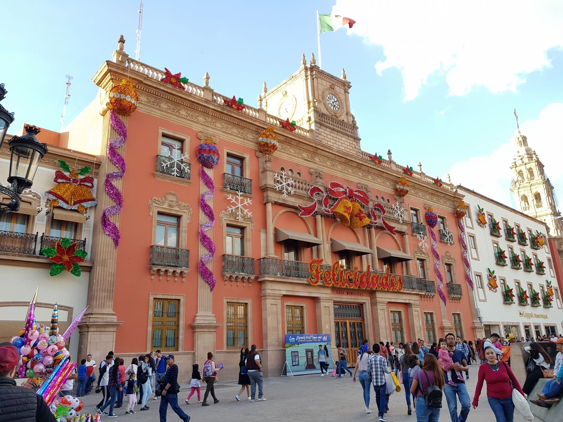
El edificio - donde a la fecha despachan las principales autoridades de la ciudad - ha sufrido distintas remodelaciones para enriquecer su fachada neoclásica, cuidar su patio interior y acondicionar sus dependencias al servicio público, para lo cual le fue anexada una tercera planta. Los murales de la escalinata son obra del artista leonés Jesus Gallardo.
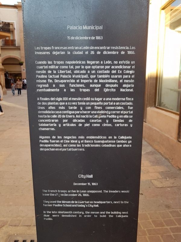
Palacio Municipal
15 de diciembre de 1863
Las tropas francesas entran a León sin encontrar resistencia. Los invasores dejarían la ciudad el 26 de diciembre de 1866.
Cuando las tropas napoleónicas llegaron a León, no existía un cuartel militar como tal, por lo que optaron por acondicionar el mesón de la Libertad, ubicado a un costado del Ex Colegio Paulino (actual Palacio Municipal), que también usaron para el mismo fin. Desaparecido el imperio de Maximiliano, el mesón regresó a sus funciones, aunque después alojaría eventualmente a las tropas del Ejército Nacional.
A finales del siglo XIX el mesón cedió su lugar a una moderna finca de dos plantas que a su vez tenía un pequeño portal a un costado. Unos años más tarde y con fines comerciales, fue demolida la casa contigua para hacer una vialidad y correr el portal hasta la calle 20 de Enero. Así nació la Callejuela Padilla y en ella se concentraron por décadas casetas y tiendas de talabartería y artículos de piel como cintos, carteras y chamarras.
Algunos de los negocios más emblemáticos en la Callejuela Padilla fueron el Cine Ideal y el Banco Guanajuatense (ambos ya desaparecidos), así como las tradicionales cebadinas que ahora despachan en el portal Guerrero.
City Hall
This piece of land, occupied now by the City Hall, was designated to host the office of civil authorities since Leon was established, but for several reasons at the beginning was left to the Franciscan religious order who used it as an orchard.
More than a century and a half ago, other religious ordler, the Paulines, built the Great Seminary College aside. Abandoned after the Reform, the building was again occupied as headquarters by the invading French troops in late 1863.
After the French Intervention and when the Republic was restored, this City Hall was built and opened on March 21, 1869.
City Hall
December 15, 1863
The French troops arrive in Leon unopposed. The invaders would leave the city on December 26, 1866.
They used the Meson de la Libertad as headquarters, next to the former Pauline School and today's City Hall.
In the late nineteenth century, the meson and the building next door were demolished in order to build the Callejuela Padilla.
Topics. This historical marker is listed in these topic lists: Colonial Era • Government & Politics • Man-Made Features • Wars, Non-US. A significant historical date for this entry is March 21, 1869.
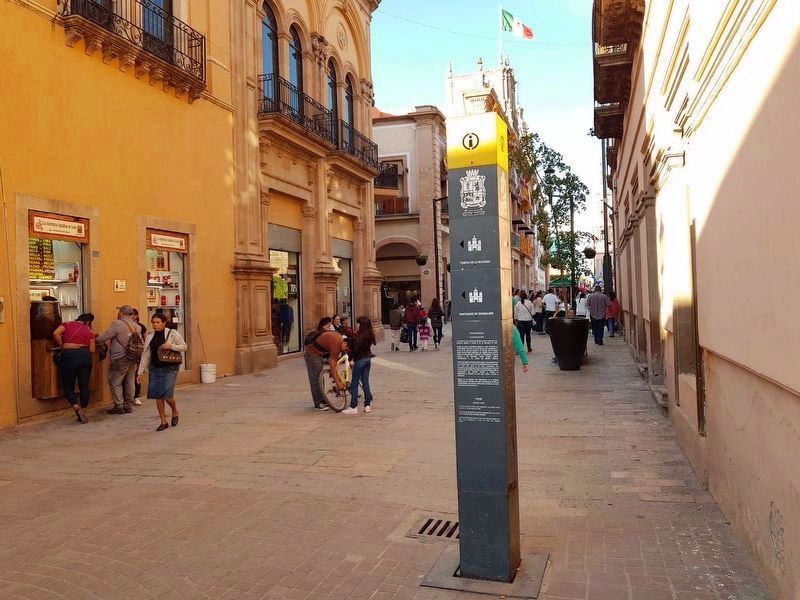
Location. 21° 7.289′ N, 101° 41′ W. Marker is in León, Guanajuato. Marker is on Benito Juárez just north of Avenida
B. Domínguez Poniente, on the right when traveling north. Benito Juárez is pedestrian-only on this portion close to the Plaza de los Mártires del 2 de Enero. Touch for map. Marker is in this post office area: León GTO 37000, Mexico. Touch for directions.
Other nearby markers. At least 8 other markers are within walking distance of this marker. Massacre of January 2, 1946 (within shouting distance of this marker); House of María Joaquina de la Portilla y Torres (within shouting distance of this marker); Royal Houses and Early Municipal Council (about 120 meters away, measured in a direct line); Plaza of Martyrs (approx. 0.2 kilometers away); Metropolitan Cathedral Basilica of Our Blessed Mother of Light (approx. 0.3 kilometers away); Manuel Doblado Theater (approx. 0.4 kilometers away); House of Cecilio Louis Long (approx. 0.4 kilometers away); Templo Expiatorio (approx. 0.8 kilometers away). Touch for a list and map of all markers in León.
Credits. This page was last revised on December 15, 2018. It was originally submitted on December 15, 2018, by J. Makali Bruton of Accra, Ghana. This page has been viewed 122 times since then and 10 times this year. Photos: 1, 2, 3, 4. submitted on December 15, 2018, by J. Makali Bruton of Accra, Ghana.


