Havre de Grace in Harford County, Maryland — The American Northeast (Mid-Atlantic)
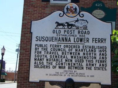
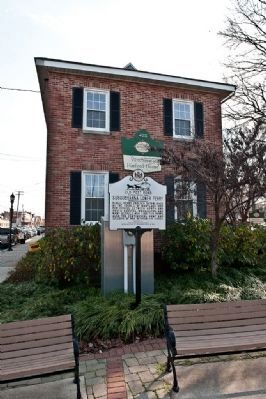
Susquehanna Lower Ferry
Old Post Road
— Established 1666 —
Erected 1985 by The City of Havre de Grace in celebration of its Bicentennial.
Topics and series. This historical marker is listed in these topic lists: Colonial Era • War, US Civil • War, US Revolutionary • Waterways & Vessels. In addition, it is included in the Former U.S. Presidents: #01 George Washington series list. A significant historical year for this entry is 1666.
Location. 39° 33.113′ N, 76° 5.508′ W. Marker is in Havre de Grace, Maryland, in Harford County. Marker is at the intersection of St. John’s Street and Union Avenue (Maryland Route 7), on the left when traveling north on St. John’s Street. Touch for map. Marker is in this post office area: Havre de Grace MD 21078, United States of America. Touch for directions.
Other nearby markers. At least 8 other markers are within walking distance of this marker. Major General Marquis De LaFayette (a few steps from this marker); Lafayette's Tour (a few steps from this marker); Susquehanna River Crossing (within shouting distance of this marker); American Legion Post No. 47 (within shouting distance of this marker); Matilda O'Neill Home (within shouting distance of this marker); a different marker also named Susquehanna Lower Ferry (about 300 feet away, measured in a direct line); Under Attack (about 300 feet away); Sergeant Alfred B. Hilton Memorial (about 400 feet away). Touch for a list and map of all markers in Havre de Grace.
Regarding Susquehanna Lower Ferry. This city became known as Havre de Grace in about 1782. Before it was known as Susquehanna Lower Ferry, a link in the great coach road between Philadelphia and the south known as the Post Road.
Credits. This page was last revised on August 18, 2019. It was originally submitted on June 24, 2007, by Bill Pfingsten of Bel Air, Maryland. This page has been viewed 2,150 times since then and 30 times this year. Photos: 1. submitted on June 24, 2007, by Bill Pfingsten of Bel Air, Maryland. 2. submitted on December 16, 2009, by Ronald Claiborne of College Station, Texas. 3. submitted on June 24, 2007, by Bill Pfingsten of Bel Air, Maryland. • J. J. Prats was the editor who published this page.


