Belle and Mayo Islands in Richmond, Virginia — The American South (Mid-Atlantic)
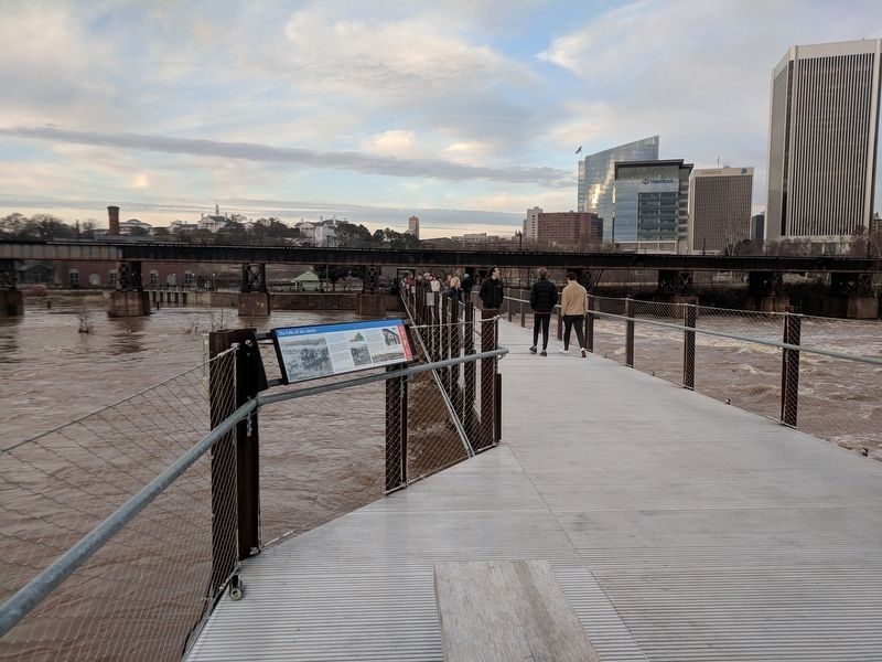
The Falls of the James
The “fall Line” is a geologic term for an imaginary line marking where the hard rock core of the Piedmont Plateau gives over to the soft sediment of the Coastal Plain. The transition causes dramatic erosion, creating waterfalls and rapids on rivers crossing the zone.
The opportunity for harnessing the motion of water for power made Richmond’s riverfront a natural location for early industry. Now it is beloved by whitewater paddlers who enter the Class III Pipeline rapids at a breach in the dam just below you.
Upriver, to your left, is Belle Isle, one of the city's first industrial centers. A dam, a mill and mill race, and several iron and nail factory buildings were all constructed on the island between 1814 and 1836. Granite was quarried there in the 19th and 20th centuries, and industrial production continued until the Old Dominion Iron & Nail Works closed in 1972.
After two centuries of industrial use, the City of Richmond acquired Belle Isle for a park in 1973. The island is a centerpiece of the James River Park system with walking trails, picnic facilities, and a mountain bike skills park. It can be reached from the north shore by the suspended pedestrian bridge below the Lee Bridge.
(captions)
Left: This image from ca. 1908 shows Belle Isle, with the Old Dominion Iron & Nail Company buildings and railroad bridge to the island. In the foreground is the dam you are standing on now. Photo courtesy of Library of Congress Prints and Photographs Division.
The “fall line” in Virginia.
The Historic Falls of the James are a state-designated scenic river, with multiple stretches of whitewater rapids. Photo courtesy of Rich Young.
The bridge before you is the Robert E. Lee Memorial Bridge completed in 1989. The stone piers below it are remnants of a railroad crossing that served industry on the island. In the 1986 photo above, the arches of the former Lee Bridge (completed in 1934) frame the construction of piers for the new Lee Bridge. Photo courtesy of Richmond-Times Dispatch Collection, The Valentine.
Early view showing Old Dominion Iron & Nail Works on Belle Isle. Photo courtesy of Prints & Photographs, Library of Virginia.
Topics. This historical marker is listed in these topic lists: Industry & Commerce • Parks & Recreational Areas • Waterways & Vessels.
Location. 37° 31.986′ N, 77° 26.686′ W. Marker is in Richmond, Virginia. It is in Belle and Mayo Islands. Marker can be reached from Tredegar Street east of South 5th Street, on the left when traveling west. Marker is located on the T. Tyler Potterfield Memorial Bridge accessible from Brown's Island. Touch for map. Marker is in this post office area: Richmond VA 23219, United States of America. Touch for directions.
Other nearby markers. At least 8 other markers are within walking distance of this marker. Three Days in April 1865 (about 400 feet away, measured in a direct line); Belle Isle (about 400 feet away); Potterfield Bridge (about 500 feet away); Haxall Headgates (about 500 feet away); Harnessing the River (about 500 feet away); Hurricane Agnes (about 600 feet away); What’s That? (about 600 feet away); John Jasper (about 700 feet away). Touch for a list and map of all markers in Richmond.
Credits. This page was last revised on February 1, 2023. It was originally submitted on December 31, 2018, by Bernard Fisher of Richmond, Virginia. This page has been viewed 195 times since then and 31 times this year. Photos: 1, 2. submitted on December 31, 2018, by Bernard Fisher of Richmond, Virginia.

