Gambles Hill in Richmond, Virginia — The American South (Mid-Atlantic)
Potterfield Bridge
Brown’s Island
—John Smith, describing Powhatan, later the site of Richmond
Potterfield Bridge
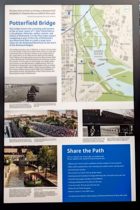
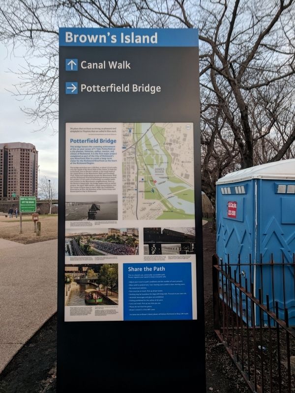
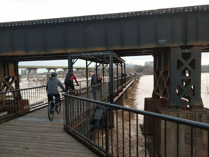
This bridge honors the crowning achievement of the 22-year career of T. Tyler Potterfield as a city planner, historian, author, mentor, and citizen of Richmond. It is the first major project completed as part of the City of Richmond’s 2012 Riverfront Plan to create a long-term vision for the Richmond Riverfront as the heart of the Richmond Region.
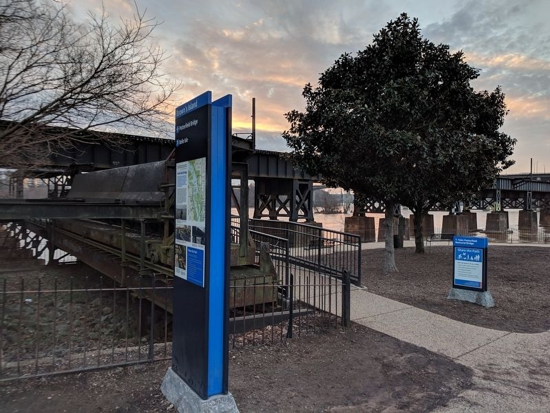
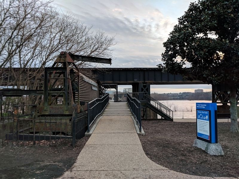
The bridge stretches over 1,700 feet, or about 1/ 3 of a mile, over the rapids of the Great Falls of the James. It links the north bank, here at Brown’s Island, to the south bank of the James River at the Manchester Wall and Floodwall Trail. Paths and landscaping around the Manchester Wall and the Richmond-Petersburg Railroad abutment stretch for another 1/3 of a mile of universally-accessible paths and connect to the Manchester neighborhood. Here on the Brown’s Island side, the bridge begins with an earlier project, the April 1865 exhibit, which memorializes, over the course of three days in April 1865: the Confederate Evacuation & Fire, the Entrance of the Union Army, and Emancipation Day in Richmond.
(captions)
The T. Tyler Potterfield Memorial Bridge was completed in 2016 by the City of Richmond. This image from 2013 shows what the ruins of the dam structure looked like at the start of construction.
A new bridge structure, with reinforcing steel, was built on top of the concrete piers of the dam, which date to 1901.
Brown’s Island is a City of Richmond park that is operated by Venture Richmond, hosting concerts, festivals, and other events. The island is named for its original owner, Elijah Brown. It was transferred to the City by the Ethyl Corporation in 1971 for use as a public riverfront.
Brown's Island is one terminus of the Canal Walk, a public pedestrian path that follows the Haxall and James River & Kanawha Canals for 1.25 miles. The City of Richmond completed this $52 million project in 1999. You can also reach a variety of restaurants in the Shockoe district and unique shopping by strolling the Canal Walk.
The Richmond Slave Trail intersects with the Canal Walk at 14th Street.
In addition to public art, historic artifacts and interpretive signage, the Canal Walk hosts the Riverfront Canal Cruises. You can take a 40-minute narrated historical boat tour of the Canal from early spring until late fall.
To your left is the C&O Railway Viaduct. You will walk underneath this viaduct out onto the T. Tyler Potterfleld Memorial Bridge; it stretches nearly 3 miles along the north bank of the James River, from Great Shiplock Park to the Oregon Hill Overlook. Viaduct construction began ln the 1890s and was completed in 1901. It still carries freight trains.
Topics. This historical marker is listed in these topic lists: Bridges & Viaducts • Parks & Recreational Areas • Railroads & Streetcars • War, US Civil.
Location. 37° 32.059′ N, 77° 26.651′ W. Marker is in Richmond, Virginia. It is in Gambles Hill. Marker can be reached from Tredegar Street west of South 5th Street, on the left when traveling west. Marker is located on Brown's Island. Touch for map. Marker is in this post office area: Richmond VA 23219, United States of America. Touch for directions.
Other nearby markers. At least 8 other markers are within walking distance of this marker. Three Days in April 1865 (a few steps from this marker); Belle Isle (within shouting distance of this marker); Haxall Headgates (within shouting distance of this marker); Tredegar Iron Works (within shouting distance of this marker); Canal Walk / Historic Canals (within shouting distance of this marker); a different marker also named Tredegar Iron Works (about 400 feet away, measured in a direct line); Joseph Reid Anderson (about 400 feet away); John Jasper (about 400 feet away). Touch for a list and map of all markers in Richmond.
Credits. This page was last revised on February 1, 2023. It was originally submitted on December 31, 2018, by Bernard Fisher of Richmond, Virginia. This page has been viewed 631 times since then and 66 times this year. Photos: 1, 2, 3, 4, 5. submitted on December 31, 2018, by Bernard Fisher of Richmond, Virginia.
