Hebron in Licking County, Ohio — The American Midwest (Great Lakes)
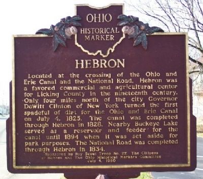
Hebron
Erected 1960 by Boy Scout Troop No. 27, The Citizens of Hebron, and The Ohio Historical Markers Committee. (Marker Number 1-45.)
Topics and series. This historical marker is listed in these topic lists: Agriculture • Industry & Commerce • Roads & Vehicles • Settlements & Settlers • Waterways & Vessels. In addition, it is included in the Ohio and Erie Canal, the Ohio Historical Society / The Ohio History Connection, and the The Historic National Road series lists. A significant historical month for this entry is July 1821.
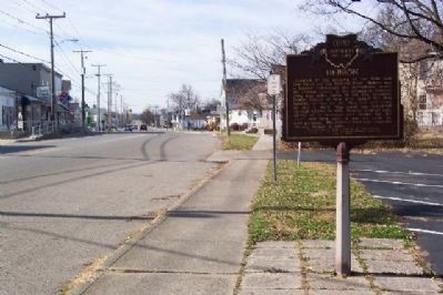
Location. 39° 57.716′ N, 82° 29.364′ W. Marker is in Hebron, Ohio, in Licking County. Marker is at the intersection of Main Street (U.S. 40) and Basin Street, on the right when traveling west on Main Street. Touch for map. Marker is in this post office area: Hebron OH 43025, United States of America. Touch for directions.
Other nearby markers. At least 8 other markers are within 3 miles of this marker, measured as the crow flies. Hebron Mill (within shouting distance of this marker); Hebron Milling Company (within shouting distance of this marker); Hebron Veterans Memorial (approx. 0.6 miles away); a different marker also named Hebron (approx. 0.8 miles away); Buckeye Lake Park (approx. 2.1 miles away); Buckeye Lake Dam (approx. 2.2 miles away); Eisenhower Interstate System (approx. 2.2 miles away); a different marker also named Eisenhower Interstate System (approx. 2.3 miles away). Touch for a list and map of all markers in Hebron.
Additional keywords. National Road
Credits. This page was last revised on December 2, 2019. It was originally submitted on November 26, 2008, by William Fischer, Jr. of Scranton, Pennsylvania. This page has been viewed 1,329 times since then and 50 times this year. Photos: 1, 2. submitted on November 26, 2008, by William Fischer, Jr. of Scranton, Pennsylvania. • Bill Pfingsten was the editor who published this page.

