Westminster in Carroll County, Maryland — The American Northeast (Mid-Atlantic)
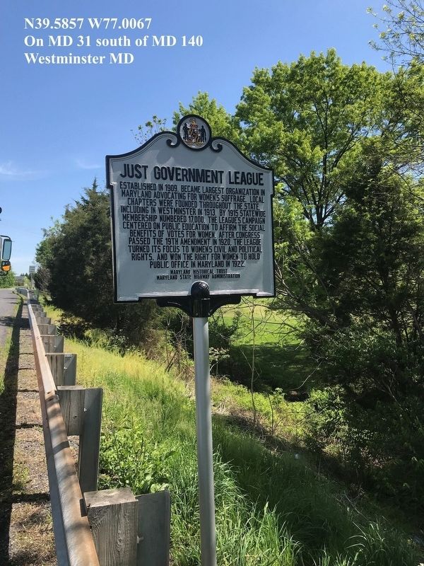
Just Government League
Erected 2019 by Maryland Historical Trust-Maryland State Highway Administration.
Topics and series. This historical marker is listed in these topic lists: Civil Rights • Women. In addition, it is included in the Maryland Historical Trust series list. A significant historical year for this entry is 1913.
Location. 39° 35.31′ N, 77° 0.39′ W. Marker is in Westminster, Maryland, in Carroll County. Marker is on Maryland Route 31 near Maryland Route 140. Touch for map. Marker is in this post office area: Westminster MD 21158, United States of America. Touch for directions.
Other nearby markers. At least 8 other markers are within 2 miles of this marker, measured as the crow flies. Carroll Hall / President's House / Levine Hall / Baker Chapel / Alumni Hall / Ward Memorial Arch (approx. half a mile away); First Lutheran Parsonage (approx. 0.7 miles away); Westminster MD War Memorial (approx. 0.8 miles away); The Rosser Raid (approx. 0.9 miles away); Westminster Depot (approx. 1.1 miles away); Mayor Joseph L. Mathias (approx. 1.1 miles away); History Is Also Now (approx. 1.2 miles away); Gen. Bradley T. Johnson's Raid (approx. 1.2 miles away). Touch for a list and map of all markers in Westminster.
Credits. This page was last revised on December 17, 2021. It was originally submitted on September 15, 2019, by Don Morfe of Baltimore, Maryland. This page has been viewed 264 times since then and 21 times this year. Photo 1. submitted on September 15, 2019, by Don Morfe of Baltimore, Maryland. • Bill Pfingsten was the editor who published this page.
