Charleston in Mississippi County, Missouri — The American Midwest (Upper Plains)
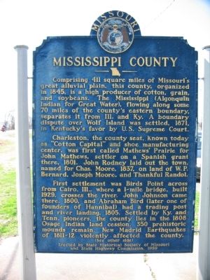
Mississippi County
Comprising 411 square miles of Missouri's great alluvial plain, this county, organized in 1845, is a high producer of cotton, grain, and soybeans. The Mississippi (Algonquin Indian for Great Water), flowing along some 70 miles of the county's eastern boundary, separates it from Ill. and Ky. A boundary dispute over Wolf Island was settled, 1871, in Kentucky's favor by U.S. Supreme Court.
Charleston, the county seat, known today as "Cotton Capital" and shoe manufacturing center, was first called Mathews' Prairie for John Mathews, settler on a Spanish grant there, 1801. John Rodney laid out the town, named for Chas. Moore, 1837, on land of W.P. Bernard, Joseph Moore, and Thankful Randol.
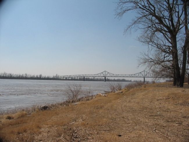
First settlement was Birds Point across from Cairo, Ill., where a 1-mile bridge, built 1929, crosses the river. John Johnson came there, 1800, and Abraham Bird (later one of founders of Hannibal) had a trading post and river landing, 1805. Settled by Ky. and Tenn. Pioneers, the country lies in the 1808 Osage Indian land cession. 350 prehistoric mounds remain. New Madrid Earthquakes of 1811-12 violently affected the country.
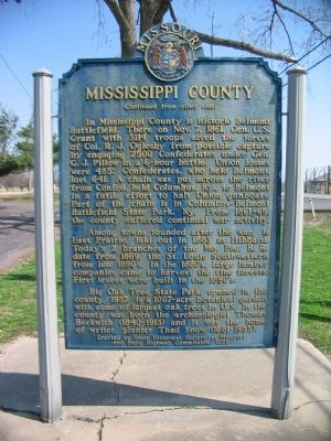
(Back):
Among towns founded after the war, is East Prairie, laid out in 1883 as Hibbard. Today's 2 branches of the Mo. Pac. R.R. date from 1869, the St. Louis Southwestern from the late 1890's. In the 1880's, large lumber companies came to harvest the fine forests. First levees were built in 1890's.
Big Oak Tree State Park, opened in the county, 1937, is a 1007-acre botanical garden with some of largest oak trees in U.S. In the county was born the archaeologist Thomas Beckwith (1840-1913) and it was the home of writer, planter Thad Snow (1881-1955).
Erected 1959 by State Historical Society of Missouri and State Highway Commission.
Topics and series. This historical marker is listed in these topic lists: Agriculture • Disasters • Native Americans • Railroads & Streetcars • Settlements & Settlers • War, US Civil. In addition, it is included in the Former U.S. Presidents: #18 Ulysses S. Grant, and the Missouri, The State Historical Society of series lists. A significant historical month for this entry is October 1908.
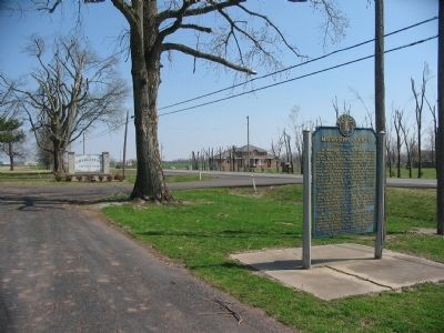
Location. 36° 55.324′ N, 89° 18.18′ W. Marker is in Charleston, Missouri, in Mississippi County. Marker is on East Marshall Street (U.S. 62), on the right when traveling west. Located in front of the Charleston Country Club. Touch for map. Marker is in this post office area: Charleston MO 63834, United States of America. Touch for directions.
Other nearby markers. At least 8 other markers are within 9 miles of this marker, measured as the crow flies. Missouri Sharecropper Strike of 1939 (approx. 1.8 miles away); Mississippi County War Memorial (approx. 2.6 miles away); Warren Eastman Hearnes (approx. 2.6 miles away); The Lewis and Clark Expedition Across Missouri (approx. 3 miles away); Riverlore (approx. 8.9 miles away in Illinois); Magnolia Manor (approx. 9 miles away in Illinois); African American Troops in the Civil War (approx. 9 miles away in Illinois); The Cairo Public Library (approx. 9.1 miles away in Illinois). Touch for a list and map of all markers in Charleston.
Also see . . . Big Oak Tree State Park. (Submitted on April 6, 2009, by Craig Swain of Leesburg, Virginia.)
Credits. This page was last revised on November 5, 2020. It was originally submitted on April 6, 2009, by Craig Swain of Leesburg, Virginia. This page has been viewed 2,572 times since then and 46 times this year. Photos: 1, 2, 3, 4. submitted on April 6, 2009, by Craig Swain of Leesburg, Virginia.


