Shockoe Slip in Richmond, Virginia — The American South (Mid-Atlantic)
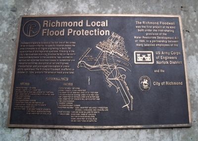
Richmond Local Flood Protection
Floodwall Facts
Northside
Protected area – 150 acres
Overall length – 4,277 linear feet
140 linear feet of sand bag levee up to 7 feet high
3,947 linear feet of concrete wall, 4 to 30 feet high
2 railroad closures
5 roadway closures
1 railroad/roadway closure
1 pedestrian overlook and parking lot
1 pump station – 75,000 gallons per minute
4 pedestrian closure sites
Materials used – 22,000 cubic yards of concrete
1,050 tons of reinforcing steel
55,000 linear feet of steel piles
Southside
Protected area – 600 acres
Overall length – 13,2046 linear feet
175 linear feet of sand bag levee up to 7 feet high
7,170 linear feet of earthen levee 4 to 30 feet high
1,887 linear feet of bin wall/levee 16 to 26 feet high
3,566 linear feet of concrete wall up to 50 feet high
4 railroad closures
1 roadway closures
1 railroad/roadway closure
Pedestrian walkway – 5,655 linear feet including: 3 pedestrian bridges, 2 overlooks, and 2 parking lots
2 pump station – 4,400 and 28,000 gallons per minute
Materials used – 26,000 cubic yards of concrete
950 tons of reinforcing steel
50,000 linear feet of steel piles
630,000 cubic yards of earth fill
The Richmond Floodwall was the first project of its kind built under the cost-sharing provision of the Water Resources Development Act of 1986, in partnership between many talented employees of the US Army Corps of Engineers Norfolk District and the City of Richmond
Erected by US Army Corps of Engineers, City of Richmond.
Topics. This historical marker is listed in these topic lists: Industry & Commerce • Man-Made Features • Waterways & Vessels. A significant historical month for this entry is October 1853.
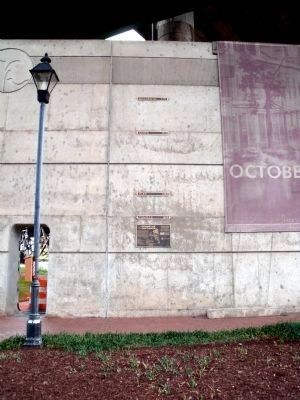
Location. 37° 31.931′ N, 77° 25.786′ W. Marker is in Richmond, Virginia. It is in Shockoe Slip. Marker is at the intersection of Dock
Street and South 17th Street, on the right when traveling east on Dock Street. This marker is on the Richmond Riverfront Canal Walk. Touch for map. Marker is in this post office area: Richmond VA 23219, United States of America. Touch for directions.
Other nearby markers. At least 8 other markers are within walking distance of this marker. Canal Walk / Historic Canals (a few steps from this marker); Capital Trees (within shouting distance of this marker); Virginia Capital Trail (within shouting distance of this marker); Lincoln's Visit to Richmond (within shouting distance of this marker); Chesapeake & Ohio Railway (about 300 feet away, measured in a direct line); African Americans and the Waterfront (about 400 feet away); In a wooden crate similar to this one… (about 500 feet away); Triple Crossing (about 500 feet away). Touch for a list and map of all markers in Richmond.
More about this marker. In the center of the marker is a map of the James River and the Richmond Floodwall.
Also see . . . Richmond’s Historic Canal Walk. Venture Richmond (Submitted on November 1, 2009.)
Credits. This page was last revised on February 1, 2023. It was originally submitted on November 1, 2009, by Bernard Fisher of Richmond, Virginia. This page has been viewed 2,142 times since then and 33 times this year. Photos: 1, 2. submitted on November 1, 2009, by Bernard Fisher of Richmond, Virginia.

