Bristol in Bucks County, Pennsylvania — The American Northeast (Mid-Atlantic)
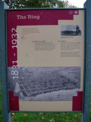
The Ring
1831 - 1932
“This day [June 11] the first clearance on the Delaware Division of the Pennsylvania Canal was issued from his office to the Mauch Chunk Canal Boat No. 30, Capt. William C. Zanes, bound to Bristol with 30 tons of coal.”
The Whig, Easton, Pennsylvania
June 12, 1832
A Century of Cargo
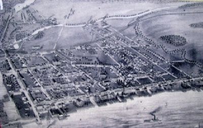
When Canal Boat No. 30 left Easton, it began nearly a century of traffic along the 60 mile Delaware Division of the Pennsylvania Canal. From the 1830s to 1931, boats loaded with thousands of tons of coal, lumber, grain, limestone, and other cargo floated through the Canal and the Locks, bypassing the Delaware River's shallow waters and dangerous rapids.
The Derrick
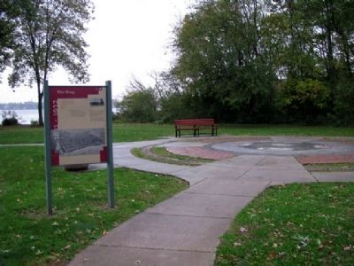
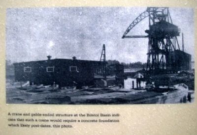
The Canal ended in Bristol where the river deepened. Cargoes continued on to the markets and factories of Philadelphia and New York City, sometimes in flotillas of Canal boats, or in barges loaded by derricks like the one that stood on this spot. All that remains of the derrick is the foundation which can be seen circling the outside of the tile map.
The date of the derrick's construction is unknown; however, photos indicate that it was late in the commercial life of the Canal. The approximate location of the Canal where it entered the Delaware River is edged and filled with spring flowers
Erected by Bristol Borough, Pennsylvania Department of Conservation and Natural Resources, and the Delaware & Lehigh National Heritage Corridor.
Topics and series. This historical marker is listed in these topic lists: Agriculture • Industry & Commerce • Man-Made Features • Natural Resources • Settlements & Settlers • Waterways & Vessels. In addition, it is included in the Delaware Canal (AKA Delaware Division of the Pennsylvania Canal), and the Pennsylvania Canal series lists. A significant historical date for this entry is June 12, 1832.
Location. This marker has been replaced by another marker nearby. It was located near 40° 5.602′ N, 74° 51.447′ W. Marker was in Bristol, Pennsylvania, in Bucks County. Marker is located in Basin Park, near the confluence of Otter Creek and the Delaware River, about 500 feet SW of the intersection of Mill and Radcliffe Streets. Touch for map. Marker was in this post office area: Bristol PA 19007, United States of America. Touch for directions.
Other nearby markers. At least 8 other markers are within walking distance of this location. Harriet Ross Tubman (a few steps from this marker); Tidal Delaware Water Trail (within shouting distance of this marker); Where the Canal Met the River (within shouting distance of this marker); The Puerto Rican Monument of Bristol (within shouting distance of this
marker); Working with the Tide (within shouting distance of this marker); Fueling the Economy (within shouting distance of this marker); In the Basin (within shouting distance of this marker); Marsh Ecology in an Urban Setting (about 400 feet away, measured in a direct line). Touch for a list and map of all markers in Bristol.
Related marker. Click here for another marker that is related to this marker. This marker has been replaced by the linked marker.
Also see . . .
1. History of Bristol Borough. (Submitted on May 27, 2010, by William Fischer, Jr. of Scranton, Pennsylvania.)
2. Delaware Canal State Park Field Guide. (Submitted on May 27, 2010, by William Fischer, Jr. of Scranton, Pennsylvania.)
Credits. This page was last revised on November 15, 2020. It was originally submitted on May 27, 2010, by William Fischer, Jr. of Scranton, Pennsylvania. This page has been viewed 1,169 times since then and 35 times this year. Photos: 1, 2, 3, 4, 5. submitted on May 27, 2010, by William Fischer, Jr. of Scranton, Pennsylvania.
