Near Coshocton in Coshocton County, Ohio — The American Midwest (Great Lakes)
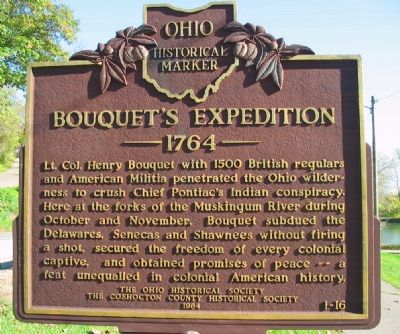
Bouquet’s Expedition
Erected 1964 by The Ohio Historical Society The Coshocton County Historical Society. (Marker Number 1-16.)
Topics and series. This historical marker is listed in these topic lists: Colonial Era • Native Americans • Wars, US Indian. In addition, it is included in the Ohio Historical Society / The Ohio History Connection series list. A significant historical year for this entry is 1764.
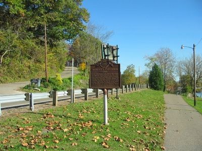
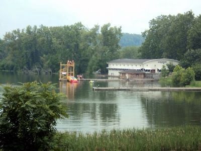
Location. 40° 17.429′ N, 81° 52.327′ W. Marker is near Coshocton, Ohio, in Coshocton County. Marker is on Ohio Route 83, on the left when traveling north. Located at the entrance to Lake Park Complex just north of Coshocton. Touch for map. Marker is in this post office area: Coshocton OH 43812, United States of America. Touch for directions.
Other nearby markers. At least 8 other markers are within walking distance of this marker. Ohio-Erie Canal and Walhonding Canal (approx. 0.6 miles away); Visitor Center - 1992 (approx. 0.6 miles away); Nicholas Schott (approx. 0.7 miles away); Underground Railroad Agents in Coshocton County / Muskingum River Underground Railroad Corridor (approx. 0.7 miles away); Capt. Bill Smart (approx. 0.7 miles away); This Building (approx. 0.7 miles away); Village Smithy - c.1890 (approx. ¾ mile away); Hay Craft and Learning Center - 1987 (approx. ¾ mile away). Touch for a list and map of all markers in Coshocton.
Credits. This page was last revised on June 16, 2016. It was originally submitted on November 4, 2007, by Carl Breth of Willoughby Hills, Ohio. This page has been viewed 2,186 times since then and 27 times this year. Photos: 1, 2. submitted on November 4, 2007, by Carl Breth of Willoughby Hills, Ohio. 3. submitted on July 28, 2013, by Jamie Abel of Westerville, Ohio. • J. J. Prats was the editor who published this page.


