Grand Canyon National Park in Coconino County, Arizona — The American Mountains (Southwest)
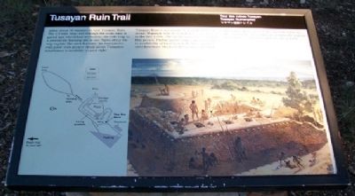
Tusayan Ruin Trail
Allow about 30 minutes to tour Tusayan Ruin. The 0.1 mile loop trail through the main ruin is paved and wheelchair-accessible; the side loop to a prehistoric farming site is not. Signs along the way explain the site's features. An interpretive trail guide with greater detail about Tusayan's inhabitants is available to your right.
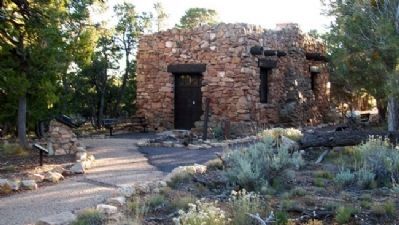
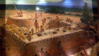
Tusayan Ruin is a remnant of a small village of about 30 people who lived here for 25 to 30 years in the late 1100s. The architecture was typical for that period. Pueblo architecture varied according to availability of local materials. Here, builders used limestone blocks held together with mud.
The name "Tusayan" was the Spanish name for this geographic area, and was given to the ruin by archeologists who excavated the site in 1930.
Trail Markers Follow
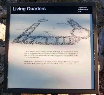
Living Quarters
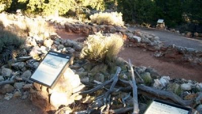
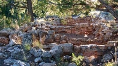
These rooms were living quarters. Although the initial excavation report suggested that the amount of rock debris was enough for a second story, the debris visible today suggests a single story, with 3 or 4 main rooms.
During the estimated 25 or 30 years that the pueblo was occupied, its population probably did not exceed 30 people at any one time.
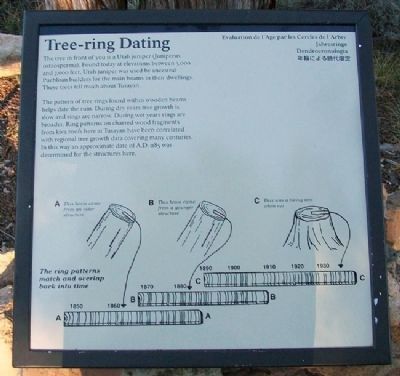
Tree-ring Dating
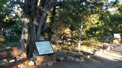
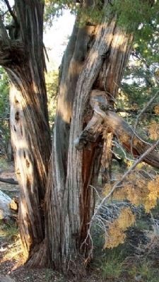
The tree in front of you is a Utah juniper (Juniperus osteosperma). Found today at elevations between 3,000 and 7,000 feet, Utah juniper was used by ancestral Puebloan builders for the main beams in their dwellings. These trees tell much about Tusayan.
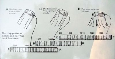
The pattern of tree rings found within wooden beams helps date the ruin. During dry years tree growth is slow and rings are narrow. During wet years rings are broader. Ring patterns on charred wood fragments from kiva roofs here at Tusayan have been correlated with regional tree growth data covering many centuries. In this way an approximate date of A.D. 1185 was determined for the structures here.
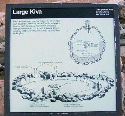
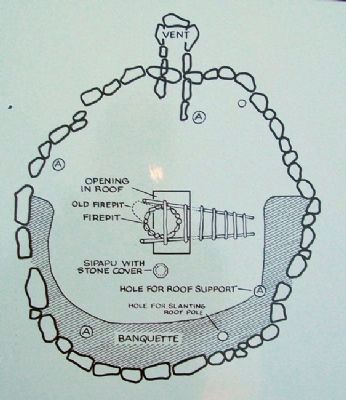
Large Kiva
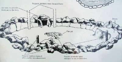
The kiva was a ceremonial room. Its basic structure developed from ancestral Pueblo pithouses. Various activities took place here, including storage, ceremonies, rites, and festivals. Public portions of these ceremonies were usually held in the plaza.
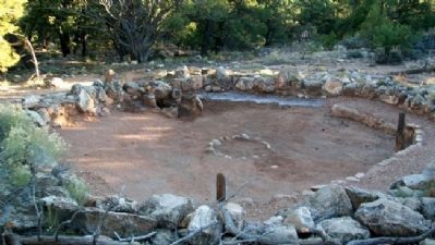
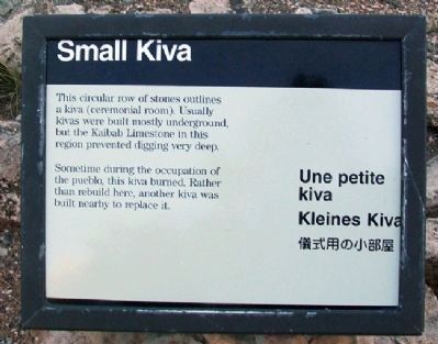
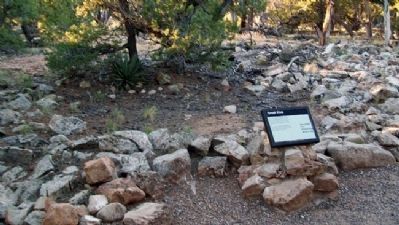
Small Kiva
This circular row of stones outlines a kiva (ceremonial room). Usually kivas were built mostly underground but the Kaibab Limestone in this region prevented digging very deep.
Sometime during the occupation of the pueblo, this kiva burned. Rather than rebuild here, another kiva was built nearby to replace it.
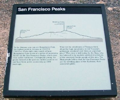
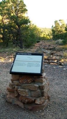
San Francisco Peaks
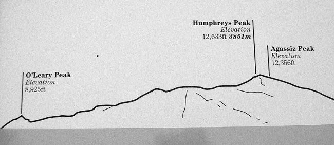
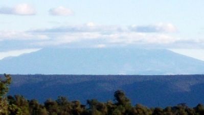
In the distance you can see Humphreys Peak, the highest point in Arizona at 12,633 ft (3851m). Forty-eight miles south of here, Humphreys Peak is
one of a series of mountains known as the San Francisco Peaks, which once were active volcanoes. Geologically young, the peaks formed in the past six million years or so and have been active as recently as 1000 years ago.
What did the inhabitants of Tusayan think about the huge mountains, or did Tusayan's prehistoric residents view them as a spiritual place? This view is held today by the Hopi, who are believed to be modern spiritual descendents of the ancestral Pueblo people of this area. The Hopi people believe that the San Francisco Peaks are the dwelling place of the Kachinas, their ancestral spirits.
Erected by National Park Service, U.S. Department of the Interior.
Topics. This historical marker is listed in these topic lists: Anthropology & Archaeology • Native Americans • Roads & Vehicles. A significant historical year for this entry is 1930.
Location. 36° 0.792′ N, 111° 51.961′ W. Marker is in Grand Canyon National Park, Arizona, in Coconino County. Marker is immediately northeast of the museum, southeast off Desert View (South Rim) Drive (Arizona Highway 64). Other markers are along the trail. Touch for map. Marker is in this post office area: Grand Canyon AZ 86023, United States of America. Touch for directions.
Other nearby markers. At least 8 other markers are within 7 miles of this marker, measured as the crow flies. Tusayan Museum and Ruin (within shouting distance of this marker); Ancient Illusion (approx. 3.1 miles away); 1956 Grand Canyon TWA-United Airlines Aviation Accident Site (approx. 3.1 miles away); The Watchtower (approx. 3.1 miles away); Tragedy Remembered (approx. 3.1 miles away); Spanish Discovery (approx. 3.3 miles away); Grandview, 1898 (approx. 6.9 miles away); Mining on Horseshoe Mesa (approx. 6.9 miles away). Touch for a list and map of all markers in Grand Canyon National Park.
Also see . . .
1. Tusayan Ruin Pamphlet. National Park Service website entry (Submitted on January 10, 2011, by William Fischer, Jr. of Scranton, Pennsylvania.)
2. Grand Canyon Archeological Resources. National Park Service website entry (Submitted on January 10, 2011, by William Fischer, Jr. of Scranton, Pennsylvania.)
3. Desert View Drive. National Park Service website entry (Submitted on January 10, 2011, by William Fischer, Jr. of Scranton, Pennsylvania.)
Credits. This page was last revised on April 22, 2024. It was originally submitted on January 10, 2011, by William Fischer, Jr. of Scranton, Pennsylvania. This page has been viewed 1,107 times since then and 46 times this year. Photos: 1, 2, 3, 4, 5, 6. submitted on January 10, 2011, by William Fischer, Jr. of Scranton, Pennsylvania. 7, 8, 9, 10, 11, 12, 13, 14, 15, 16, 17, 18, 19, 20. submitted on January 11, 2011, by William Fischer, Jr. of Scranton, Pennsylvania.
