Yorktown in York County, Virginia — The American South (Mid-Atlantic)
Kiskiak Indians
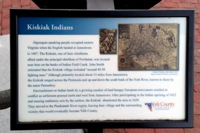
Encroachment on Indian lands by a growing number of land-hungry European newcomers resulted in conflict as settlement pressed north and west from Jamestown. After participating in the Indian uprising of 1622 and ensuing retaliatory acts by the settlers, the Kiskiak abandoned the area in 1629. They moved to the Piankatank River region, leaving their village and the surrounding vicinity that would eventually become York County.
A Map of Virginia, John Smith, 1624. Image courtesy of Library of Congress.
Erected 2010 by York County.
Topics. This historical marker is listed in these topic lists: Colonial Era • Native Americans. A significant historical year for this entry is 1607.
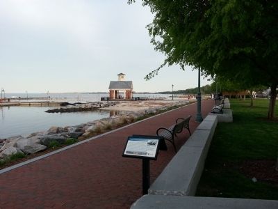
Location. 37° 14.311′ N, 76° 30.475′ W. Marker is in Yorktown, Virginia, in York County. Marker can be reached from the intersection of Water Street and Buckner Street, on the right when traveling west. Located along Yorktown's Riverwalk. Touch for map. Marker is in this post office area: Yorktown VA 23690, United States of America. Touch for directions.
Other nearby markers. At least 8 other markers are within walking distance of this marker. Virginia Institute of Marine Science (here, next to this marker); Heavy Artillery at Yorktown (within shouting distance of this marker); Wars & Yorktown (within shouting distance of this marker); The York River (within shouting distance of this marker); York River Ecosystem (within shouting distance of this marker); George Washington and Francois De Grasse (within shouting distance of this marker); The Olympic Flame (within shouting distance of this marker); Kiskiack (within shouting distance of this marker). Touch for a list and map of all markers in Yorktown.
Credits. This page was last revised on November 14, 2021. It was originally submitted on April 21, 2013, by Bernard Fisher of Richmond, Virginia. This page has been viewed 542 times since then and 52 times this year. Photos: 1, 2. submitted on April 21, 2013, by Bernard Fisher of Richmond, Virginia.

