Southwest Quadrant in Alexandria, Virginia — The American South (Mid-Atlantic)
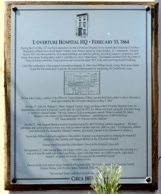
L'Overture Hospital HQ
February 15, 1864
Civil War confiscation of property occurred on January 11,1864 when William Fowle, a large land owner, failed to pay the real estate taxes in person. He feared imprisonment for supporting the Confederate cause.
Private John Cooley, a soldier of the 27th U.S. Colored Infantry (Ohio) was the first black soldier to die in Alexandria, "… died upon entering L'Overture Hospital on May 4, 1864."
On May 17, 1864, Dr, William C. Minor, Surgeon Captain, began working a L'Overture Hospital. Later he murdered an individual in England's seedy side. On April 6th 1872, Dr. Minor was found not guilty of murder being a “certified lunatic.” He was, however, held in permanent custody. While in custody Dr. Minor became a core creator of the Oxford English Dictionary — submitting over 10,000 definitions. (NY Times bestseller, The Professor and the Madman)
On Dec 27, 1864, Surgeon Bentley received a petition signed by 443 L'Overture patients requesting "…the same privileges and rights of burial in every way with our fellow soldiers who differ only in color…" Consequently soldiers where interred in the Alexandria National Cemetery (previously interred in the Freedman's Cemetery).
Nurse Julia Wilbur, who took supplies to Alexandria's Hospital, was instrumental in changing the hospital's conditions after meeting with Surgeon Bentley in L'Overture Hospital.
Former Slaves founded Shiloh Baptist Church in the Hospital's mess hall.
On September 27, 1894, Samuel Reed, builder of #217, was "…found dead at an early hour this morning in a coal yard near the north end of the Long Bridge…close to his fish wharf…two bullet wounds…right cheek…stomach…no pistol was found…it is supposed he committed suicide." (Alexandria Gazette)
Owners of the land include: King Charles II of England (1669), The Fairfax Family, The Alexander Family, Francis Peyton, John Dundas, James Hallowell, William Fowle and Samuel Reed.
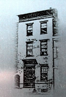
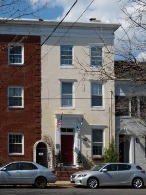
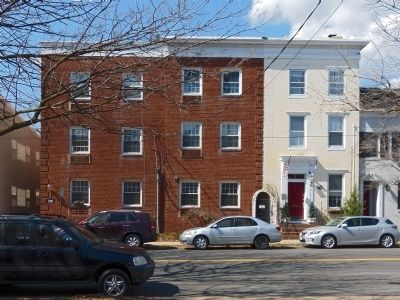
This unusual 2 bay Greek Revival style was a twin with #219.
Topics. This memorial is listed in these topic lists: African Americans • Cemeteries & Burial Sites • Science & Medicine • War, US Civil. A significant historical month for this entry is January 1821.
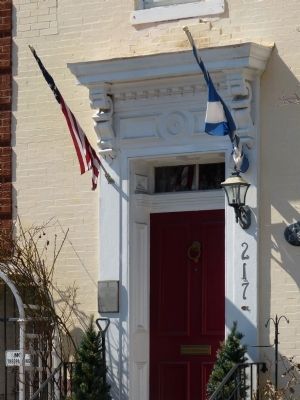
Location. 38° 48.256′ N, 77° 3.239′ W. Marker is in Alexandria, Virginia. It is in the Southwest Quadrant. Memorial is on South Payne Street south of Prince Street, on the right when traveling south. Touch for map. Marker is at or near this postal address: 217 South Payne Street, Alexandria VA 22314, United States of America. Touch for directions.
Other nearby markers. At least 8 other markers are within walking distance of this marker. L’Ouverture Hospital (within shouting distance of this marker); Franklin and Armfield Slave Office (within shouting distance of this marker); 1323 Duke Street – From Slavery to Freedom and Service (about 300 feet away, measured in a direct line); Shiloh Baptist Church (about 400 feet away); Capt. James McGuire House (about 500 feet away); James Harris House (about 500 feet away); The Growth of Upper King Street (about 600 feet away); Port City (about 700 feet away). Touch for a list and map of all markers in Alexandria.
Related markers. Click here for a list of markers that are related to this marker. To better understand the relationship,
study each marker in the order shown.
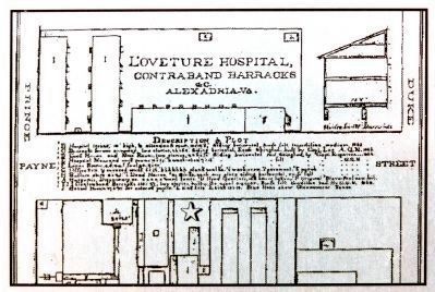
Also see . . . L'Ouverture Hospital and Barracks Marker, E-134. DHR Historical Marker approved in 2012 but not yet erected. "Named for Haitian revolutionary, L'Ouverture Hospital opened in February 1864 near the Freedman's barracks in Alexandria to serve sick and injured United States Colored Troops (USCT). Designed by the U.S. Army, the hospital complex could accommodate 600 patients and occupied the space of a city block. Besides USCT's, the hospital also served African American civilians, many of whom had escaped from slavery and sought refuge in Alexandria. In December 1864, more than 400 patients at the hospital led a successful protest demanding that USCTs be buried in Alexandria National Cemetery with full honors rather than being interned at the Freedman's Cemetery." -- at MarkerHistory.com (Submitted on March 16, 2014, by Allen C. Browne of Silver Spring, Maryland.)
Credits. This page was last revised on January 27, 2023. It was originally submitted on March 16, 2014, by Allen C. Browne of Silver Spring, Maryland. This page has been viewed 1,100 times since then and 24 times this year. Last updated on June 10, 2014, by Richard E. Miller of Oxon Hill, Maryland. Photos: 1, 2, 3, 4, 5, 6. submitted on March 16, 2014, by Allen C. Browne of Silver Spring, Maryland. • Bill Pfingsten was the editor who published this page.
