Thayer County
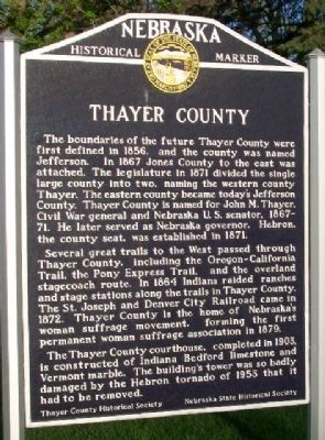
The boundaries of the future Thayer County were first defined in 1856, and the county was named Jefferson. In 1867 Jones County to the east was attached. The legislature in 1871 divided the single large county into two, naming the western county Thayer. The eastern county became today's Jefferson County. Thayer County is named for John M. Thayer, Civil War general and Nebraska U.S. senator, 1867-71. He later served as Nebraska governor. Hebron, the county seat, was established in 1871.
Several great trails to the West passed through Thayer County, including the Oregon-California Trail, the Pony Express Trail, and the overland stagecoach route. In 1864 Indians raided ranches and stage stations along the trails in Thayer County. The St. Joseph and Denver City Railroad came in 1872. Thayer County is the home of Nebraska's woman suffrage movement, forming the first permanent woman suffrage association in 1879.
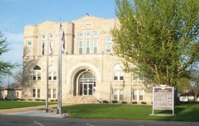
The Thayer County courthouse, completed in 1903, is constructed of Indiana Bedford limestone and Vermont marble. The building's tower was so badly damaged by the Hebron tornado of 1953 that it had to be removed.
Erected by Nebraska State Historical Society and Thayer County Historical Society. (Marker Number 433.)
Topics and series. This historical marker is listed in these
Location. 40° 10.114′ N, 97° 35.435′ W. Marker is in Hebron, Nebraska, in Thayer County. Marker is on 4th Street north of Olive Avenue, on the left when traveling north. Marker is on the county courthouse grounds. Touch for map. Marker is at or near this postal address: 225 North 4th Street, Hebron NE 68370, United States of America. Touch for directions.
Other nearby markers. At least 8 other markers are within 10 miles of this marker, measured as the crow flies. Veterans Memorial (within shouting distance of this marker); A Tribute To Hebron, Its People and Its Schools (approx. 0.2 miles away); World's Largest Porch Swing (approx. ¼ mile away); The Hebron CCC And POW Camps (approx. half a mile away); Oregon Trail (approx. 2.7 miles away); Friedensau (approx. 5.4 miles away); The Forty-Niner Trail (approx. 6.2 miles away); Bank Building (approx. 9.4 miles away). Touch for a list and map of all markers in Hebron.
Also see . . . Thayer County in Andreas' History of the State of Nebraska. (Submitted on December 25, 2014, by William Fischer, Jr. of Scranton, Pennsylvania.)
Credits. This page was last revised on November 30, 2020. It was originally submitted on December 25, 2014, by William Fischer, Jr. of Scranton, Pennsylvania. This page has been viewed 499 times since then and 17 times this year. Photos: 1, 2. submitted on December 25, 2014, by William Fischer, Jr. of Scranton, Pennsylvania.

