Ticonderoga in Essex County, New York — The American Northeast (Mid-Atlantic)
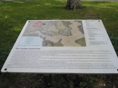
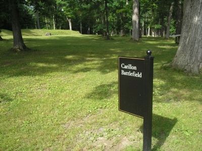
The Carillon Battlefield
In July of 1758, the British commanded by General James Abercromby, launched an attack on For Carillon (Ticonderoga), the newest French fort in New France. The British mustered an army of 16,000 British regulars and American provincials, the largest ever assembled to date in North America.
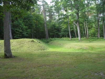
Louis-Joseph de Gozon, the Marquis de Montcalm, led the French defense of Carillon. In less than 48 hours, Montcalm’s 3400 French regulars and a handful of Canadians constructed defensive earthworks, the “French Lines,” across the Heights of Carillon.
In a bloody day of fighting on 8 July 1758, the British lost nearly 2000 troops. The Highland Regiment suffered nearly 2/3 casualties, the highest sustained by a unit in a single-day action in North American history. Proportionally, Montcalm lost as many.
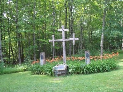
Here Montcalm had won the greatest French victory of the Seven Years’ war, although he was outnumbered 5 to 1. He gave thanks to God by creating a red-painted cross at the center of the Lines. The Cairn, positioned at the near edge of “the killing zone,” commemorates the valor of the Highland Regiment.
For two generations, in two wars, armies returned to the same battlefield. In 1759, the British returned on another attempt to drive the French from Carillon-and used the “French Lines” to protect themselves as they laid siege to the fort. During the Revolution, the American army dug in here in the summer and fall of 1776 as they succeeded in stopping Sir Guy Carelton’s British advance up Lake Champlain. In 1777, the old French earthworks served as the American outer defenses against Burgoyne’s advance. Later that autumn, the Americans, under Col. John Brown, succeeded in recapturing the French Lines, but lacked sufficient artillery to dislodge the British and German troops garrisoning the Fort. Many of these men (on both sides) had fought on this ground almost twenty years earlier.
Topics. This historical marker is listed in these topic lists: Forts and Castles • Military • Notable Events • Notable Places • War, French and Indian • War, US Revolutionary. A significant historical month for this entry is July 1758.
Location. 43° 50.921′ N, 73° 23.609′ W. Marker is in Ticonderoga, New York, in Essex County. Marker is on Sandy Redoubt, on the right when traveling east. Marker is located on the entrance road to Fort Ticonderoga. Touch for map. Marker is in this post office area: Ticonderoga NY 12883, United States of America. Touch for directions.
Other nearby markers. At least 8 other markers are within walking distance of this marker. “The Black Watch” (a few steps from this marker); The French Lines (a few steps from this marker); The French Lines & Carillon Battlefield (a few steps from this marker); Near this spot stood Montcalm (about 300 feet away, measured in a direct line); Carillon, July 8-1758 - 1958-13 Juillet (about 500 feet away); Hut Sites (about 500 feet away); George Augustus Viscount Howe (approx. ¼ mile away); a different marker also named “The Black Watch” (approx. 0.3 miles away). Touch for a list and map of all markers in Ticonderoga.
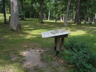
More about this marker. The upper portion of the marker contains a map of “A Plan of the town and Fort of Carillon and Ticonderoga with the attack made by the British Army. Superimposed on Thomas Jefferys’ 1768 map reproduced from the Fort Ticonderoga museum collection is the latest research about the disposition of the troops on 8 July 1758.” The French Troops under Montcalm and British Troops under Abercromby are listed on the marker.
Also see . . .
1. The Battle of Ticonderoga 1758. Account of the battle on the website BritishBattles.com.
(Submitted on July 26, 2008, by Bill Coughlin of Woodland Park, New Jersey.)
2. Fort Ticonderoga National Historic Landmark. (Submitted on July 26, 2008, by Bill Coughlin of Woodland Park, New Jersey.)
Credits. This page was last revised on June 16, 2016. It was originally submitted on July 26, 2008, by Bill Coughlin of Woodland Park, New Jersey. This page has been viewed 2,100 times since then and 33 times this year. Photos: 1, 2, 3, 4, 5. submitted on July 26, 2008, by Bill Coughlin of Woodland Park, New Jersey.
