Dolores Hidalgo, Guanajuato, Mexico — The Central Highlands (North America)
Cocomacán
Dolores Hidalgo
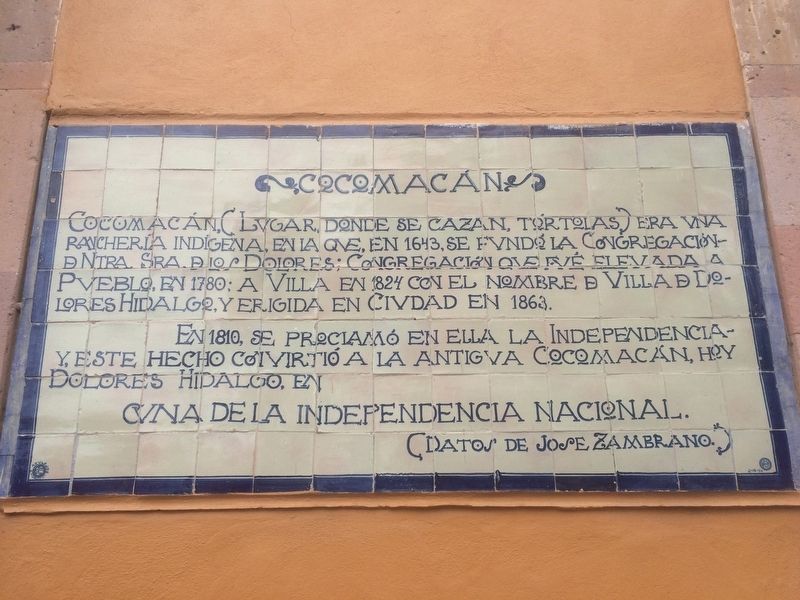
Cocomacán, (Lugar donde se cazan tórtolas) era una ranchería indígena, en la que, en 1643, su fundó la Congregación de Ntra. Sra. De los Dolores; Congregación que fue elevada a Pueblo, en 1780; a Villa en 1824 con el nombre de Villa de Dolores Hidalgo, y erigida en Ciudad en 1863.
En 1810, se proclamó en ella la independencia y, este hecho convirtió a la antigua Cocomacán, hoy Dolores Hidalgo, en
(Datos de Jose Zambrano.)
Cocomacán, (Place where turtle doves are hunted) was a small indigenous village, in which, in 1643 was founded the Congregation of Our Lady of Sorrows; that Congregation was elevated to the status of Town in 1780; To Villa in 1824 with the name of Villa of Dolores Hidalgo, and finally ascended to the category of City in 1863.
In 1810, Mexican independence was first proclaimed here. This act turned the old Cocomacán, today’s Dolores Hidalgo, into the
(Information courtesy José Zambrano.)
Topics. This memorial is listed in these topic lists: Colonial Era • Hispanic Americans • Settlements & Settlers • Wars, Non-US. A significant historical year for this entry is 1643.
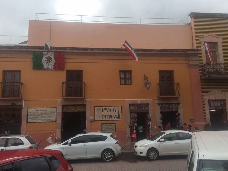
Location. 21° 9.455′ N, 100° 56.031′ W. Marker is in Dolores Hidalgo, Guanajuato. Memorial is on Calle Principal just south of Calle Guanajuato, on the right when traveling north. Touch for map. Marker is in this post office area: Dolores Hidalgo GTO 37800, Mexico. Touch for directions.
Other nearby markers. At least 8 other markers are within walking distance of this marker. Miguel Hidalgo and the First Insurgents (within shouting distance of this marker); Parish of Nuestro Señora de los Dolores (within shouting distance of this marker); The Decrees of Benito Juárez in Dolores Hidalgo (within shouting distance of this marker); Miguel Hidalgo (within shouting distance of this marker); The Route of Hidalgo (within shouting distance of this marker); Hidalgo Memorial and Independence Garden (within shouting distance of this marker); From Here Hidalgo Proclaimed Mexican Independence (about 90 meters away, measured in a direct line); House of Mariano Abasolo (about 90 meters away). Touch for a list and map of all markers in Dolores Hidalgo.

Photographed By J. Makali Bruton, October 1, 2016
3. An additional marker on Benito Juárez´s 1867 stay here
regreso del norte a Mexico,
se hospedo aqui el
C. Benito Juarez.
From July 3 to 4, 1867, on his return from the north to Mexico City,
Benito Juárez
stayed here.
Credits. This page was last revised on August 12, 2018. It was originally submitted on November 15, 2016, by J. Makali Bruton of Accra, Ghana. This page has been viewed 301 times since then and 13 times this year. Photos: 1, 2, 3. submitted on November 15, 2016, by J. Makali Bruton of Accra, Ghana.

