Weston in Platte County, Missouri — The American Midwest (Upper Plains)
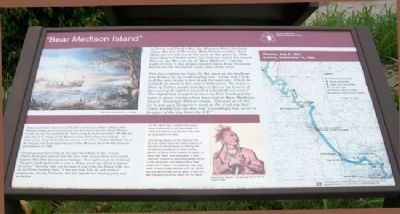
"Bear Medison Island"
Monday, July 2, 1804 [and] Sunday, September 14, 1806
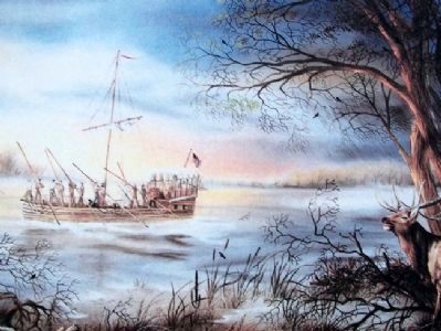
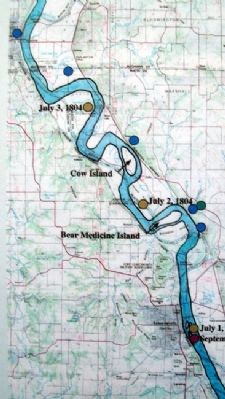
In Lewis and Clark's day, the Missouri River was here where the foot of Weston's Main Street is today. Bear Medicine Island was in the river at this place in 1804. According to Clark's notes, the Indians called the island Wau-car-ba War-con-da or "Bear Medison." On the night of July 2, the group camped above Bear Medicine Island on the starboard (east) side of the river.
Two days earlier on June 30, the mast of the keelboat was broken by an overhanging tree. Lewis and Clark had the men make a new mast the next day. Clark described the mast in his July 2 field notes, "We made a Mast of Cotton wood yesterday to day in the Course of the evening & night it turned of a butifull red colour". The expedition stopped at noon on July 2 and put the mast in place during a four hour rest at Bear Medicine Island. Sergeant Ordway wrote, "Delayed at 12 O.C. for to put up a Temperary mast as the wind was fair". Clark added that the day was "exceedingly hot, wind in, forepart of the day from the S.E."
Some years before Lewis and Clark's journey, an Indian village and a French trading post stood across the river from the site where Weston would one day be established. Clark noted he had heard that "Mr Mackey Says the first village of the Kanseis was a little above this Island...no trace of any thing of that Kind remains to be Seen" (James Mackay was a fur trapper who had explored part of the Missouri River for the Spanish government in 1795.)
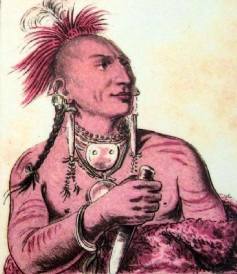
The group must have been on the alert for Indians in this vicinity. Clark's field notes indicate that the men were uneasy about what might happen when they did encounter Indians: "last night one of the Sentenals Changed (challenged) either a man or Beast, which ran off, all prepared for action". However, this was the time of year when the Kansa tribe was on the Plains hunting bison. It was not until July 28, just north of present-day Omaha, Nebraska, that the expedition's hunting party met an Indian.
On the return trip, Captain Clark gave more information in his September 14, 1806, journal entry about why they were so cautious in this area:
"this being the part of the Missouri the Kanzas nation resort to at this season of the year for the purpose of robbing the perogues passing up to other nations above, we have every reason to expect to meet with them, and agreeably to their common custom of examining every thing in the perogues and takeing what they want out of them, it is probable they may wish to take those liberties with us, which we are deturmined not to allow of and for the Smallest insult we shall fire on them."
Erected by St. Joseph Museum, Platte County Visitors Bureau, and The
Native Sons of Greater Kansas City.
Topics. This historical marker is listed in these topic lists: Environment • Exploration • Native Americans • Patriots & Patriotism. A significant historical month for this entry is June 1883.
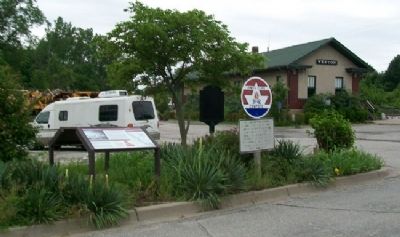
Location. 39° 24.555′ N, 94° 54.197′ W. Marker is in Weston, Missouri, in Platte County. Marker is on Main Street, on the left when traveling south. Marker is about 100 feet north of the former railroad passenger station. Touch for map. Marker is in this post office area: Weston MO 64098, United States of America. Touch for directions.
Other nearby markers. At least 8 other markers are within walking distance of this marker. The Lewis and Clark Expedition (here, next to this marker); Lewis & Clark Campsite (here, next to this marker); Weston, Missouri (here, next to this marker); "Hell's Half Acre" (about 600 feet away, measured in a direct line); Yocum-Benner Buildings (about 600 feet away); Doppler Building (about 800 feet away); Mitchell Building (approx. 0.2 miles away); St. George Hotel (approx. 0.2 miles away). Touch for a list and map of all markers in Weston.
Also see . . .
1. Lewis and Clark National Historic Trail. (Submitted on July 10, 2011, by William Fischer, Jr. of Scranton, Pennsylvania.)
2. Kansa Indian Tribe History. (Submitted on July 10, 2011, by William Fischer, Jr. of Scranton, Pennsylvania.)
3. The Kaw Nation. (Submitted on July 11, 2011, by William Fischer, Jr. of Scranton, Pennsylvania.)
Credits. This page was last revised on June 16, 2016. It was originally submitted on July 10, 2011, by William Fischer, Jr. of Scranton, Pennsylvania. This page has been viewed 975 times since then and 57 times this year. Photos: 1, 2, 3, 4, 5. submitted on July 11, 2011, by William Fischer, Jr. of Scranton, Pennsylvania.
