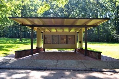
Near Stanton in Adams County, Mississippi — The American South (East South Central)
A National Road
(Marker #1)
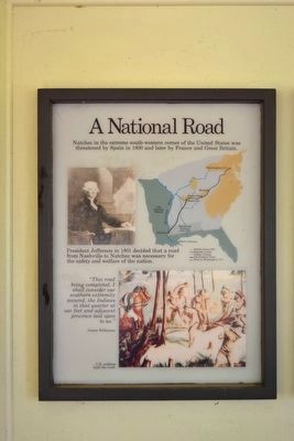
A National Road
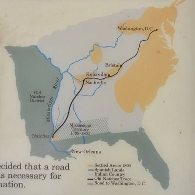
Natchez in the extreme south-western corner of the United States was threatened by Spain in 1800 and later by France and Great Britain.
President Jefferson in 1801 decided that a road from Nashville to Natchez was necessary for the safety and welfare of the nation.
“This road being completed, I shall consider our southern extremity secured, the Indians in that quarter at our feet and adjacent province laid open to us.”
James Wilkinson
(Marker #2)
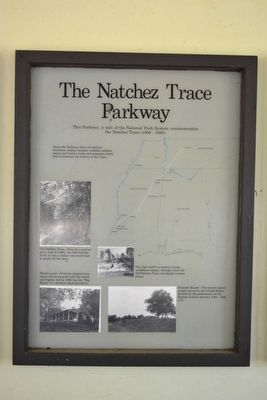
The Natchez Trace Parkway
This Parkway, a unit of the National Park System, commemorates the Natchez Trace (1800 - 1820).
Along the Parkway there are historic structures, Indian mounds, roadside exhibits, nature and history trails and museums which help to illustrate the history of the Trace.
(Photo Captions)
Old Natchez Trace - Worn by a century and half of traffic, the Old Natchez Trace is now a sunken tree-lined road in places 30 feet deep.
Mount Locust - From the original three rooms this house grew with the family and region, and by 1836 was the “Big House” of a medium sized-plantation.
Emerald Mound - The second largest temple mound in the United States. Erected by the predecessors of the Natchez Indians between 1300 - 1600 A.D.
The high bluff is a deposit of loess, windblown topsoil, through which the Old Natchez Trace cuts deeply in many places.
(Marker #3)
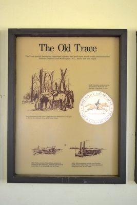
The Old Trace
The Trace quickly became an important highway and mail route which made communication between Natchez and Washington, D.C., fairly safe and rapid.
(Drawing Captions)
Troops marched over the Trace in 1803 when war seemed near, and again in 1812 at the outbreak of the war with Great Britain.
Swift Postriders could carry the mail between Nashville and Natchez in less than 10 days.
Ohio Valley pioneers floated their products to Natchez or New Orleans in flatboats and returned home afoot or on horseback over the Trace.
After 1820 steamboats carried most Natchez traffic. Parts of the Trace were then abandoned, other parts used as local roads.
(Marker #4)
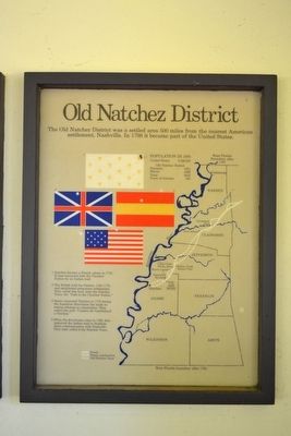
Old Natchez District
The Old Natchez District was a settled area 500 miles from the nearest American settlement, Nashville. In 1798 it became part of the United States.
POPULATION IN 1800
United States 5,308,483
Old Natchez District
Freeman 5361
Slaves 3489
Total 8850
Town of Natchez 500
Natchez became a French colony in 1716. It was connected with the Choctaw
Nation by an Indian trail.
The British held the District, 1763-1779, and established permanent settlements. They called this trail, later the Natchez Trace, the “Path to the Choctaw Nation.”
Spain conquered Natchez in 1779 during the American Revolution but made no serious attempt at colonization. They called this trail “Camino de Cumberland a Natches.”
When the Americans came in 1798, they improved the Indian trail to facilitate direct communication with Nashville. They later called it the Natchez Trace.
Erected by National Park Service.
Topics and series. This historical marker is listed in these topic lists: Colonial Era • Industry & Commerce • Native Americans • Roads & Vehicles. In addition, it is included in the Former U.S. Presidents: #03 Thomas Jefferson, and the Natchez Trace series lists. A significant historical year for this entry is 1800.
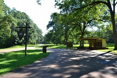
Location. Marker has been reported missing. It was located near 31° 36.899′ N, 91° 15.416′ W. Marker was near Stanton, Mississippi, in Adams County. Marker could be reached from Natchez Trace Parkway (at milepost 8.7), half a mile U.S. 61, on the right when traveling north. Touch for map. Marker was in this post office area: Natchez MS 39120, United States of America. Touch for directions.
Other nearby markers. At least 8 other markers are within 2 miles of this location, measured as the crow flies. Territorial Lifeline (here, next to this marker); The Hard Trip Home (here, next to this marker); Old Trace (a few steps from this marker); Natchez Trace (approx. 0.7 miles away); A Remarkable Feat (approx. 1½ miles away); A Well-Organized Society (approx. 1½ miles away); Still Sacred (approx. 1½ miles away); Emerald Mound (approx. 1½ miles away). Touch for a list and map of all markers in Stanton.
Also see . . . Natchez Trace Parkway. Official National Park Service website. (Submitted on August 16, 2015.)
Credits. This page was last revised on April 2, 2024. It was originally submitted on August 16, 2015, by Duane Hall of Abilene, Texas. This page has been viewed 420 times since then and 26 times this year. Photos: 1, 2, 3, 4, 5, 6, 7. submitted on August 16, 2015, by Duane Hall of Abilene, Texas.
