
Santiago de Querétaro in Querétaro, Mexico — The Central Highlands (North America)
The Royal Inland Road
El Camino Real de Tierra Adentro
Photographed by J. Makali Bruton, November 13, 2016
1. The Royal Inland Road Marker
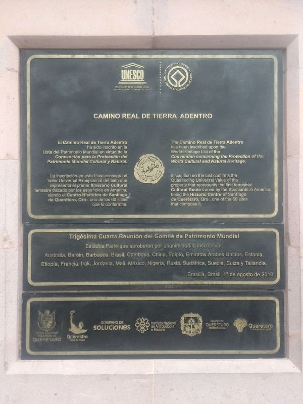
El Camino Real de Tierra Adentro ha sido inscrito en la Lista del Patrimonio Mundial en virtud de la Convención para la Protección del Patrimonio Mundial Cultural y Natural.
La inscripción en esta Lista consagra el Valor Universal Excepcional del bien que representa el primer itinerario Cultural terrestre trazado por los españoles en América, siendo el Centro Histórico de Santiago de Querétaro, Qro., uno de los 60 sitios que lo conforman.
English:
The Camino Real de Tierra Adentro has been inscribed upon the World Heritage List of the Convention concerning the Protection of the World Cultural and Natural Heritage.
Inscription on the List confirms the Outstanding Universal Value of the property that represents the first terrestrial Cultural Route traced by the Spaniards in America, being the Historic Centre of Santiago Querétaro, Qro., one of the 60 sites that compose it.
Trigésima Cuarta Reunión del Comité de Patrimonio Mundial
Estados Parte que aprobaron por unanimidad la inscripción: Australia, Baréin, Barbados, Brasil, Camboya, China, Egipto, Emiratos Árabes Unidos, Estonia, Etiopia, Francia, Irak, Jordania, Malí, México,
this page online
Brasilia, Brasil, 1º de agosto de 2010.
English translation:
The thirty-fourth meeting of the Comittee on Worldwide Patrimony
State members approved by unanimity the inscription: Australia, Bahrein, Barbados, Brazil, Cambodia, China, Egypt, United Arab Emirates, Estonia, Ethiopia, France, Iraq, Jordan, Mali, Mexico, Nigeria, Russia, South Africa, Sweden, Switzerland and Thailand.
Brasilia, Brazil, August 1, 2010.
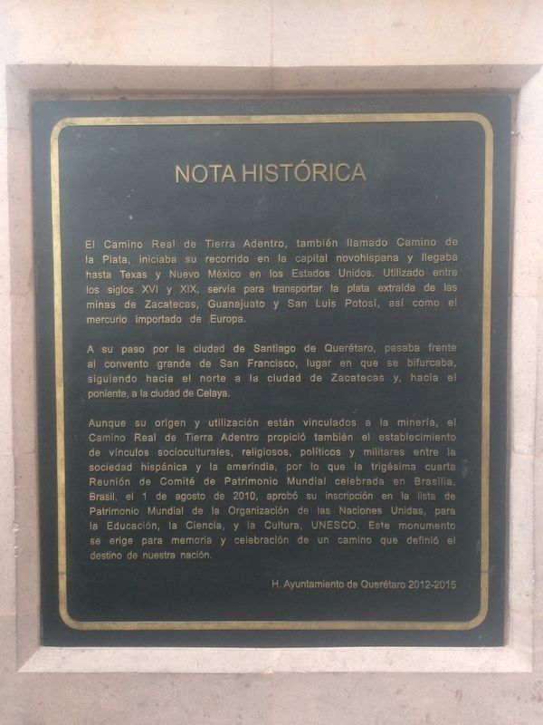
A su paso por la ciudad de Santiago de Querétaro, pasaba frente al convento grande de San Francisco, lugar en que se bifurcaba, siguiendo hacia el norte a la ciudad de Zacatecas y, hacia el poniente, a la ciudad de Celaya.
Aunque su origen y utilización están vinculados a la minería, el Camino Real de Tierra Adentro
Photographed by J. Makali Bruton, November 13, 2016
2. The Royal Inland Road Marker
H. Ayuntamiento de Querétaro 2012-2015
English translation:
As the road passed through the city of Santiago de Querétaro, it made its way in front of the largest convent, San Francisco,
Photographed by J. Makali Bruton, November 13, 2016
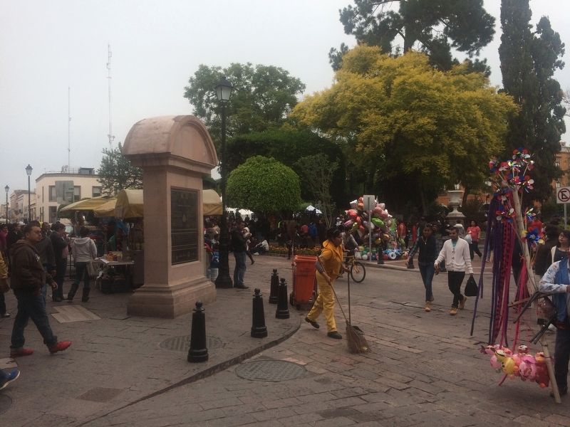
3. The Royal Inland Road Marker
Although its origin and use are linked to mining, the Camino Real de Tierra Adentro also led to the establishment of socio-cultural, religious, political and military links between Hispanic and Amerindian society, and the 34th Meeting of the Committee of Cultural Heritage, held in Brasilia, Brazil, on August 1, 2010, approved its inclusion on UNESCO's list of World Heritage Sites for Education, Science and Culture. This monument stands for the memory and celebration of a path that defined the destiny of our nation.
Honorable City Council of Querétaro 2012-2015
Erected by Honorable Ayuntamiento de Querétaro de 2012-2015.
Topics and series. This historical marker is listed in these topic lists: Colonial Era • Industry & Commerce • Man-Made Features • Settlements & Settlers. In addition, it is included in the El Camino Real de Tierra Adentro series list. A significant historical date for this entry is August 1, 2010.
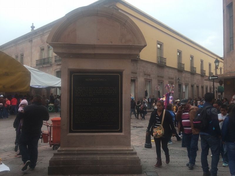
Location. 20° 35.552′ N, 100° 23.538′ W. Marker is in Santiago de Querétaro, Querétaro. It is at
Photographed by J. Makali Bruton, November 13, 2016
4. The Royal Inland Road Marker

Regionally, this marker is in Central Mexico and in the Bajío. Globally, it is in North America, specifically in Mesoamerica, on the Ring of Fire, and in the Western Hemisphere. Historically, it finds itself in what was once New Spain, a Spanish colony, and the Aztec Empire.
Other nearby markers. At least 8 other markers are within walking distance of this marker: Residence of Epigmenio and Emeterio González (about 90 meters away, measured in a direct line); Church and Former Convent of San Francisco / Templo y antiguo convento de San Francisco (about 90 meters away); Foundations of the Convent of San Francisco (about 90 meters away); The Great Convent of San Francisco (about 120 meters away); The House of the Marquesa (about 120 meters away); Former hospital of San José de Gracia (about 150 meters away); Monument to Josefa Ortiz de Domínguez (about 150 meters away); Fountain of Neptune (about 180 meters away). Touch for a list and map of all markers in Santiago de Querétaro.
Another marker is no longer nearby. Monument Dedicated to "La Corregidora" (was about 180 meters away but has been permanently removed).
More about this marker. A replica of this marker and monument is located near the Cemetery of the Illustrious of Querétaro.
Credits. This page was last revised on November 25, 2017. It was originally submitted on December 7, 2016, by J. Makali Bruton of Washington, District of Columbia. This page has been viewed 449 times since then and 14 times this year. Photos: 1, 2, 3, 4. submitted on December 7, 2016, by J. Makali Bruton of Washington, District of Columbia.
