Zapotlanejo, Jalisco, Mexico — The Pacific Coast (and Central Highlands)
The Battle of Calderón Bridge
Photographed by J. Makali Bruton, November 16, 2016
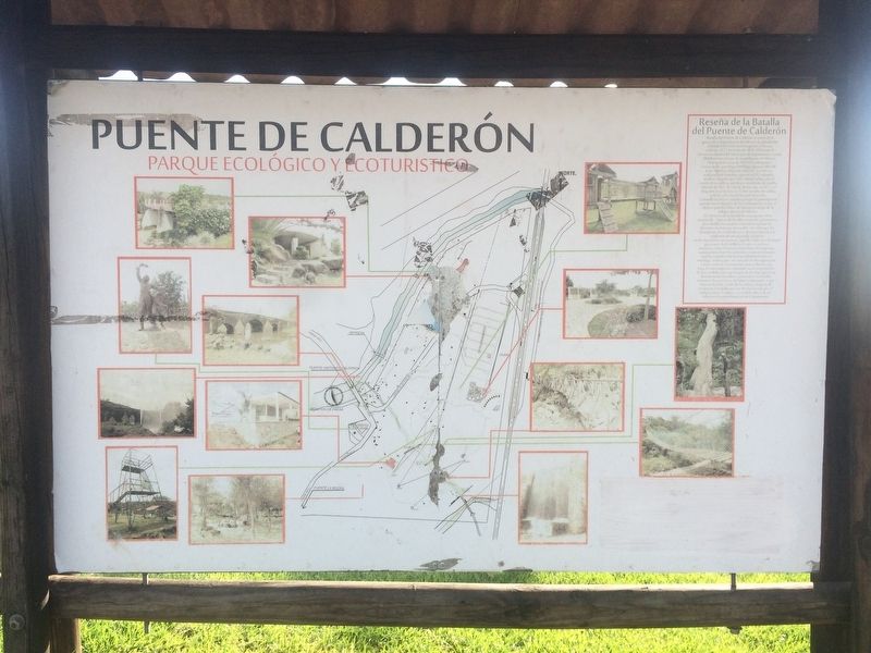
1. The Battle of Calderón Bridge Marker
Inscription.
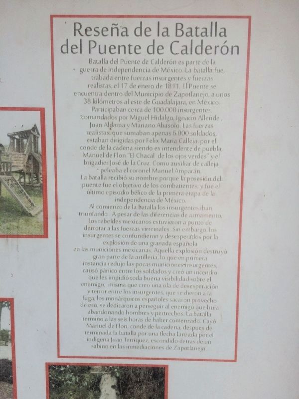
Reseña de la Batalla del Puente de Calderón
Batalla de Puente de Calderón es parte de la guerra de independencia de México. La batalla fue trabada entre fuerzas insurgentes y fuerzas realistas, el 17 de enero de 1811. El Puente se encuentra dentro del Municipio de Zapotlanejo, a unos 38 kilómetros al este de Guadalajara, en México. Participaban cerca de 100,000 insurgentes comandados por Miguel Hidalgo, Ignacio Allende, Juan Aldama y Mariano Abasolo. Las fuerzas realistas, que sumaban 6,000 soldados, estaban dirigidas por Felix Maria Calleja, por el conde de la cadena siendo ex intendente de puebla, Manuel de Flon “El Chacal de los ojos verdes" y el brigadier José de la Cruz Como auxiliar de Calleja. Peleaba el coronel Manuel Amparán. La batalla recibió su nombre porque la posesión del puente fue el objetivo de los combatientes, y fue el último episodio bélico de la primera etapa de la independencia de México. Al comienzo de la batalla los insurgentes iban triunfando. A pesar de las diferencias de armamento los rebeldes mexicanos estuvieron a punto de derrotar a las fuerzas virreinales. Sin embargo, los insurgentes
Click or scan to see this page online
se confundieron y desesperados por la explosión de una granada española en las municiones mexicanas. Aquella explosión destruyó gran parte de la artillería, lo que en primera instancia redujo las pocas municiones insurgentes, causó pánico entre los soldados y creó un incendio que les impidió toda buena visibilidad sobre el enemigo, misma que creó una ola de desesperación y terror entre los insurgentes, que se dieron a la fuga, los monárquicos españoles sacaron provecho de eso se dedicaron a perseguir al enemigo que huía abandonando hombres y pertrechos. La batalla terminó a las seis horas de haber comenzado. Cayó Manuel de Flon, conde de la cadena, después de terminada la batalla por una flecha lanzada por el indigena Juan Terriquez, escondido detrás de un sabino en las inmediaciones de Zapotlanejo.
English translation: The Battle of Calderón Bridge The Battle of Calderón Bridge was a battle the makes up an important part of the history of the Mexican War of Independence. The battle was fought between Insurgent forces and Spanish Royalist forces, on January 17, 1811. The Bridge is located within the Municipality of Zapotlanejo, about
Photographed by J. Makali Bruton, November 16, 2016
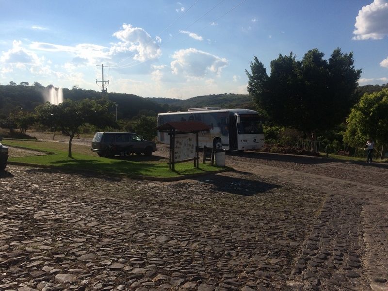
2. The Battle of Calderón Bridge Marker
The marker is here in the parking lot of the Calderón Bridge park. Another copy of the marker is a few steps away closer to the highway entrance.
38 kilometers east of Guadalajara, in Mexico. Some 100,000 Insurgents led by Miguel Hidalgo, Ignacio Allende, Juan Aldama and Mariano Abasolo participated. The royalist forces, which numbered 6,000 soldiers, were led by Felix Maria Calleja and his assistant, the Brigadier José de la Cruz and Manuel de Flon, the Count de la Cadena and Ex-Intendent of Puebla whose nickname was "The Green Eyed Jackal." Colonel Manuel Amparán also fought. The battle was so named because the possession of the bridge was the target of the combatants. This was the last battle of the first stage of Mexico's independence. At the beginning of the battle the Insurgents were winning because of the sheer mass of their forces. In spite of the differences in armament the Mexican rebels were on the verge of defeating the Royalist forces. However, the Insurgents became confused and desperate when a Spanish grenade exploded the rebels´ munitions. That explosion destroyed much of their artillery and munitions and also caused panic among the soldiers. It also created a fire that prevented good visibility of the enemy, which caused a wave of despair and terror among the
Photographed by J. Makali Bruton, November 16, 2016
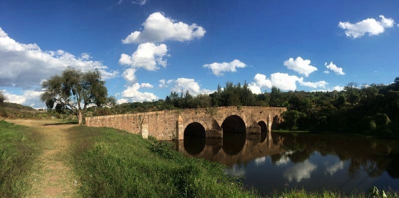
3. The Battle of Calderón Bridge Marker
In this view from the west of the bridge, the Insurgent forces would have been to the left, towards Guadalajara. The Royalist forces would have been attacking from the right.
Insurgents, many who fled. The Spanish Royalist forces took advantage of the situation and began to pursue the enemy who fled leaving men and supplies on the battlefield. The battle ended six hours after it started. Manuel de Flon fell at the end of the battle, killed by an arrow shot by the indigenous Insurgent Juan Terriquez, hidden behind a sabino tree in the outskirts of Zapotlanejo.
Location. 20° 40.515′ N, 103° 0.558′ W. Memorial is in Zapotlanejo, Jalisco. It can be reached from Carretera Tepatitlán de Morelos - Zapotlanejo (Route 80). The marker is in the parking area of the Calderón Bridge park. The park is about 11 km north of the town of Zapotlanejo on Carretera 80, on the left while traveling north. Touch for map. Memorial is in this post office area: Zapotlanejo JAL 45430, Mexico. Touch for directions.
Regionally, this memorial is in Western Mexico, in the Bajío, on the Pacific Coast, and in the Sierra Madre. Globally, it is in North America, on the Ring of Fire, in the Pacific
Photographed by J. Makali Bruton, November 16, 2016
4. The Battle of Calderón Bridge Marker text close-up
Rim, and in the Western Hemisphere. Historically, it finds itself in what was once New Spain, a Spanish colony, and the Aztec Empire.
Other nearby markers. At least one other marker is within walking distance of this marker: A different marker also named The Battle of Calderón Bridge (about 90 meters away, measured in a direct line).
Photographed by J. Makali Bruton, November 16, 2016
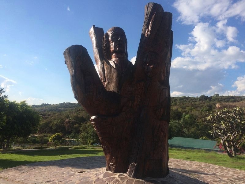
5. Mexican War for Independence sculpture
Near the marker is this interesting 2006 sculpture of Hidalgo and other Mexican War for Independence figures and symbols, carved from a tree. It was made by Alfonso Ocampo M. and collaborators.
Credits. This page was last revised on March 24, 2026. It was originally submitted on December 10, 2016, by J. Makali Bruton of Washington, District of Columbia. This page has been viewed 2,288 times since then and 264 times this year. Photos:1, 2, 3, 4, 5. submitted on December 10, 2016, by J. Makali Bruton of Washington, District of Columbia.