Tequisquiapan, Querétaro, Mexico — The Central Highlands (North America)
Miguel Hidalgo y Costilla
Photographed by J. Makali Bruton, November 18, 2016
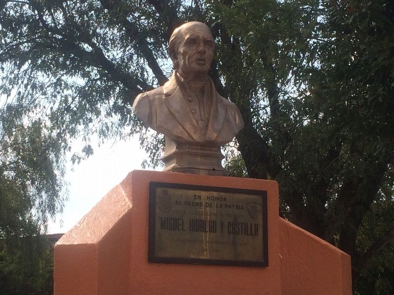
1. Miguel Hidalgo y Costilla Marker

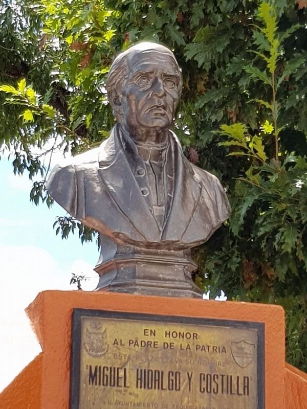
En honor
al Padre de la Patria
Esta Plaza lleva su nombre
“Miguel Hidalgo y Costilla”
H. Ayuntamiento de Tequisquiapan, Qro.
1980-1984
In honor of the Father of the Nation
This plaza is named for
“Miguel Hidalgo y Costilla”
Honorable City Council of Tequisquiapan, Querétaro
1980-1984
Erected by Honorable Ayuntamiento de Tequisquiapan 1980-1984.
Topics. This memorial is listed in these topic lists: Colonial Era • Patriots & Patriotism • Wars, Non-US.
Location. 20° 31.35′ N, 99° 53.496′ W. Memorial is in Tequisquiapan, Querétaro. It can be reached from the intersection of Calle Benito Juárez and Calle Morelos. The marker is near the center of the central plaza of Tequisquiapan, in front of the Catholic church. Touch for map. Memorial is in this post office area: Tequisquiapan QUE 76750, Mexico. Touch for directions.

Regionally, this memorial is in Central Mexico and in the Bajío. Globally, it is in North America, specifically in Mesoamerica, on the Ring of Fire, and in the Western Hemisphere. Historically,
this page online
Other nearby markers. At least 8 other markers are within 8 kilometers of this marker, measured as the crow flies: Plaza Reforma (within shouting distance of this marker); Parish of Santa María de la Asunción (within shouting distance of this marker); Municipal Auditorium (about 90 meters away, measured in a direct line); First Public Education in Tequisquiapan (about 90 meters away); Salvador Michaus Marroquín (about 120 meters away); The Legend of the Baroness (about 240 meters away); The Geographical Center of Mexico (approx. 0.3 kilometers away); La Trinidad Natural Protected Area (approx. 7.6 kilometers away). Touch for a list and map of all markers in Tequisquiapan.
Photographed by J. Makali Bruton, September 13, 2020
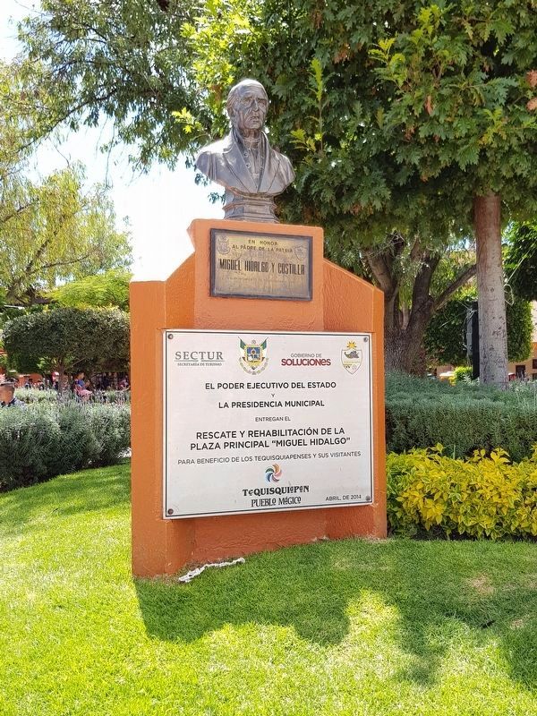
2. Miguel Hidalgo y Costilla Marker
The secondary, lower marker describes the restoration of the central park of Tequisquiapan in April, 2014.
Photographed by J. Makali Bruton, September 13, 2020
3. Miguel Hidalgo y Costilla Marker
Photographed by J. Makali Bruton, November 6, 2016
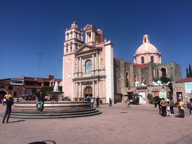
4. The Catholic Church of Santa María de la Asunción of Tequisquiapan
The Catholic church is some steps from the marker across the plaza.
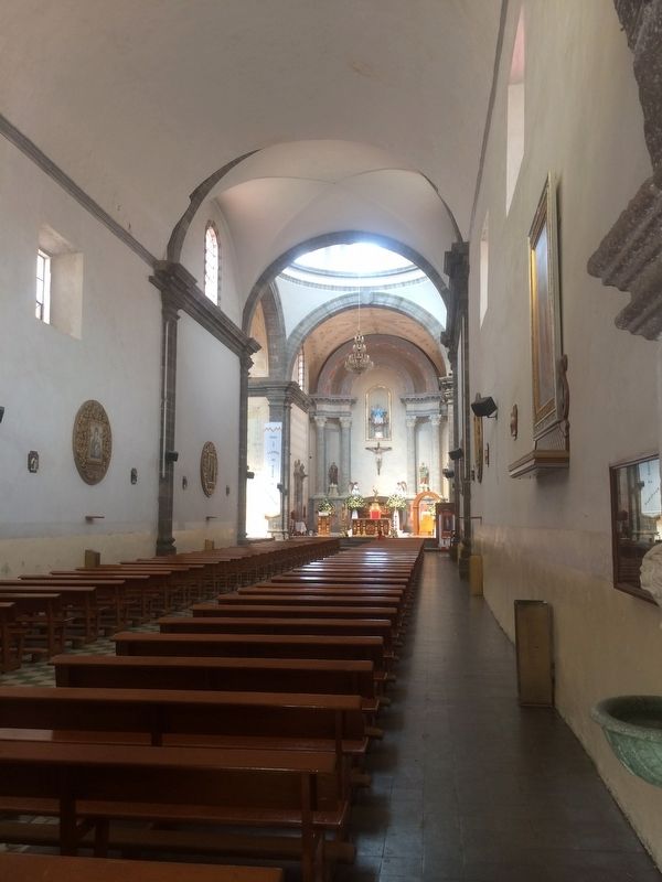
Photographed by J. Makali Bruton, November 18, 2016
5. The interior of the Catholic Church of Santa María de la Asunción de Tequisquiapan
Credits. This page was last revised on September 16, 2020. It was originally submitted on December 10, 2016, by J. Makali Bruton of Washington, District of Columbia. This page has been viewed 304 times since then and 8 times this year. Photos: 1. submitted on December 10, 2016, by J. Makali Bruton of Washington, District of Columbia. 2, 3. submitted on September 16, 2020, by J. Makali Bruton of Washington, District of Columbia. 4, 5. submitted on December 10, 2016, by J. Makali Bruton of Washington, District of Columbia.
