Near Helen in White County, Georgia — The American South (South Atlantic)
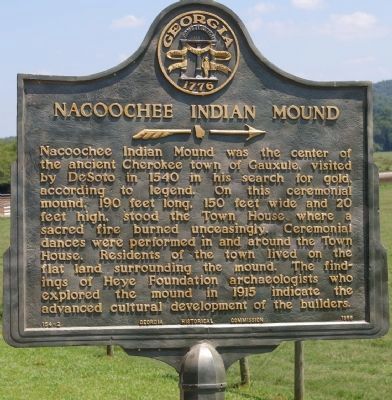
Nacoochee Indian Mound
Nacoochee Indian Mound was the center of the ancient Cherokee town of Gauxule, visited by DeSoto in 1540 in his search for gold, according to legend. On this ceremonial mound, 190 feet long, 150 feet wide and 20 feet high, stood the Town House where a sacred fire burned unceasingly. Ceremonial dances were performed in and around the Town House. Residents of the town lived on the flat land surrounding the mound. The findings of Heye Foundation archaeologists who explored the mound in 1915 indicate the advanced cultural development of the builders.
Erected 1955 by Georgia Historical Commission. (Marker Number 154-2.)
Topics and series. This historical marker is listed in this topic list: Native Americans. In addition, it is included in the Georgia Historical Society series list. A significant historical year for this entry is 1540.
Location. 34° 41.066′ N, 83° 42.521′ W. Marker is near Helen, Georgia, in White County. Marker is on Unicoi Turnpike (State Road 17) 0.1 miles east of Helen Highway (State Route 75), on the right when traveling east. Touch for map. Marker is in this post office area: Helen GA 30545, United States of America. Touch for directions.
Other nearby markers. At least 8 other markers are within walking distance of this marker. Nacoochee Mound (within shouting distance of this marker); The Residence at West End (within shouting distance of this marker); Fountain and Greenhouse (within shouting distance of this marker); The Game Room (about 300 feet away, measured in a direct line); Breezeway,Smokehouse/Servant's Quarters & Kitchen (about 400 feet away); Spring and Gas House (about 400 feet away); The Unicoi Road (about 600 feet away); The Carriage House (about 600 feet away).
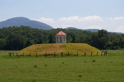
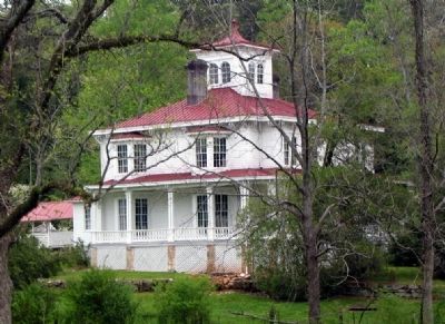
Regarding Nacoochee Indian Mound. The gazebo on the mound was built in 1890, by Capt. J. H. Nichols, who bought land in the Nachoochee Valley following the Civil War. Capt. Nichols built the Italianate house on the opposite site of Ga. 17 from the mound.
Also see . . . Nacoochee Mound. New Georgia Encyclopedia website entry (Submitted on August 7, 2008, by David Seibert of Sandy Springs, Georgia.)
Credits. This page was last revised on October 9, 2021. It was originally submitted on August 5, 2008, by David Seibert of Sandy Springs, Georgia. This page has been viewed 2,779 times since then and 58 times this year. Last updated on August 7, 2008, by David Seibert of Sandy Springs, Georgia. Photos: 1, 2, 3. submitted on August 5, 2008, by David Seibert of Sandy Springs, Georgia. • Craig Swain was the editor who published this page.


