Red River Transportation / A Busy Port
Red River Transportation
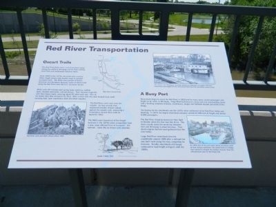
The Red River Trails were a set of overland routes linking the cities of Winnipeg and St. Paul and the small forts and settlements between them.
From 1820 to the 1870s, the trails were used by Metis freight drivers who hauled cargo in wooded ox-drawn carts. The Metis were people of native American and European descent, many of whom lived along the Red River near the U.S.-Canadian border.
Metis carts left Canada each spring laden with furs, buffalo skins, beaded moccasins and pemmican. They traveled single-file with their heavy loads, covered about 20 miles each day. Four to six weeks later they arrived in St. Paul. After a short rest, the carts headed back north carrying food, farm machinery, tools and other supplies.
The Red River carts were slow but reliable. As they moved, their ungreased wooden wheels rubbed against the wooden axle, producing a tremendous squeak that could be heard for miles.
The Metis were forced out of the freight business in the 1870s when competition from a new, more efficient form of transport - the railroad - made the ox-drawn carts obsolete.
A Busy Port
Steamboats began to travel the Red River in 1859 and for many years carried passengers and freight as far north as Winnipeg. Fargo-Moorhead became a busy port and ship-building center with a bustling
The heyday for the steamboats was the 1870s when settlement of the Red River Valley was booming. In 1875 the largest steamboat company carried 24,500 tons of freight and almost 8,000 passengers.
The Red River shipping season ran from April to October when the river was free of ice. The boats usually made the round trip between here and Winnipeg in about ten days. Their steam engines burned wood gathered from the river banks.
Large Red River steamboats became unprofitable around 1880 after a railroad line was built north along the river, competing for business. Smaller steamboats and barges continued to haul freight and grain until the 1890s.
Top Photo
The "pluck", the "Winnipeg" and other barges and flatboats are loaded with farm implements and supplies in this 1879 photo taken less than two blocks north of here.
Left Photo
Red River carts and Metis drivers about 1854.
Right Photo
An 1879 view of the port taken about one block north of here, facing northwest. The center boat is a dredge that worked to deepen the shallow channel. Note the railroad track spur on the Fargo side.
Erected 2004 by MnDOT.
Topics and series. This historical marker is listed in these topic lists: Industry & Commerce
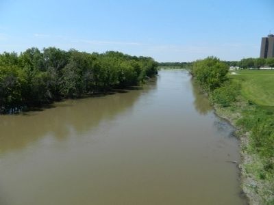
Location. 46° 52.421′ N, 96° 46.61′ W. Marker is in Moorhead, Minnesota, in Clay County. Marker is on U.S. 10, on the left when traveling west. Marker is on the bridge crossing the Red River of the North. Touch for map. Marker is in this post office area: Moorhead MN 56560, United States of America. Touch for directions.
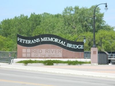
Other nearby markers. At least 8 other markers are within walking distance of this marker. 'The Next Great City' (within shouting distance of this marker in North Dakota); Gasoline Horsepower (within shouting distance of this marker in North Dakota); Veterans Memorial Bridge (about 400 feet away, measured in a direct line); Douglas House (about 600 feet away); The First Bridge over the Red River (approx. 0.2 miles away); Replica of the Statue of Liberty (approx. 0.2 miles away in North Dakota); St, John's Episcopal Church (approx. 0.4 miles away); Sodbuster Statue & Restoration (approx. 0.4 miles away in North Dakota). Touch for a list and map of all markers in Moorhead.
More about this marker. Marker was created by Gemini Research for MnDOT; erected when the bridge
Credits. This page was last revised on January 16, 2017. It was originally submitted on June 27, 2011, by Bill Pfingsten of Bel Air, Maryland. This page has been viewed 1,020 times since then and 22 times this year. Last updated on January 14, 2017. Photos: 1, 2, 3. submitted on June 27, 2011, by Bill Pfingsten of Bel Air, Maryland.


