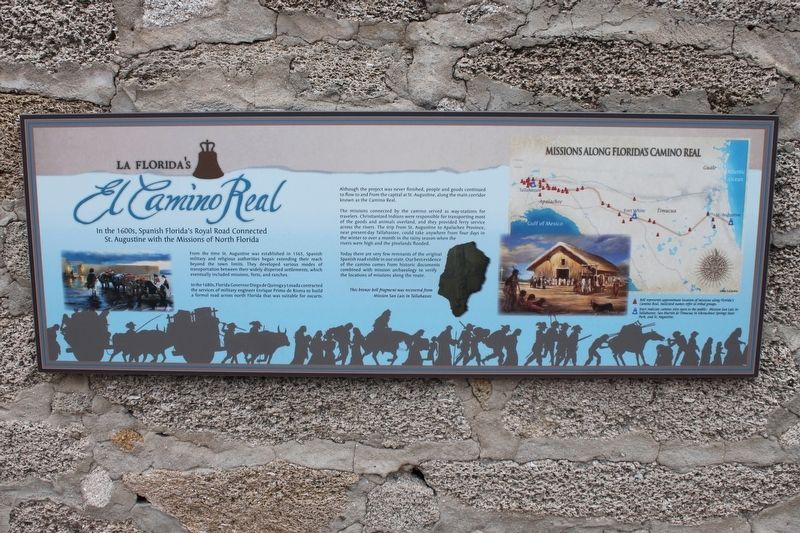
La Florida's El Camino Real
From the time St. Augustine was established in 1565, Spanish military and religious authorities began extending their reach beyond the town limits. They developed various modes of transportation between their widely dispersed settlements, which eventually included missions, forts, and ranches.
In the 1680s, Florida Governor Diego de Quiroga Losada contracted the services of military engineer Enrique Primo de Rivera to build a formal road across north Florida that was suitable for oxcarts.
Although the project was never finished, people and goods continued to flow to and from the capital at St. Augustine, along the main corridor known as the Camino Real.
The missions connected by the camino served as way-stations for travelers. Christianized Indians were responsible for transporting most of the goods and animals overland, and they provided ferry service across the rivers. The trip from St. Augustine to Aplalachee Province, near present-day Tallahassee, could take anywhere from four days in the winter to over a month in the rainy season when the rivers were high and the pinelands flooded.
Today there are very few remnants of the original Spanish road visible in our state. Our best evidence of the camino comes from historic
documents combined with mission archaeology to verify the locations of missions along the route.Topics. This historical marker is listed in these topic lists: Colonial Era • Roads & Vehicles.
Location. 29° 53.796′ N, 81° 18.8′ W. Marker is in St. Augustine, Florida, in St. Johns County. It is in the Historic District. Marker is on St. George Street, 0.1 miles north of Cuna Street, on the left when traveling north. Marker is on the wall in front of the public restrooms. Touch for map. Marker is at or near this postal address: 40 St George St, Saint Augustine FL 32084, United States of America. Touch for directions.
Other nearby markers. At least 8 other markers are within walking distance of this marker. Spanish Colonial Hygiene (here, next to this marker); British Colonial Hygiene (here, next to this marker); Every Drop Counts (here, next to this marker); Florencia House (a few steps from this marker); Salcedo House (a few steps from this marker); Triay House (a few steps from this marker); The Minorcan Heritage (a few steps from this marker); De Hita-González Houses (a few steps from this marker). Touch for a list and map of all markers in St. Augustine.
Credits. This page was last revised on January 2, 2019. It was originally submitted on January 27, 2017, by Tim Fillmon of Webster, Florida. This page has been viewed 660 times since then and 47 times this year. Photos: 1, 2. submitted on January 27, 2017, by Tim Fillmon of Webster, Florida. • Bill Pfingsten was the editor who published this page.

