Cobá in Tulum, Quintana Roo, Mexico — The Yucatan Peninsula (The Southeast)
The Coba Group
Grupo Cobá
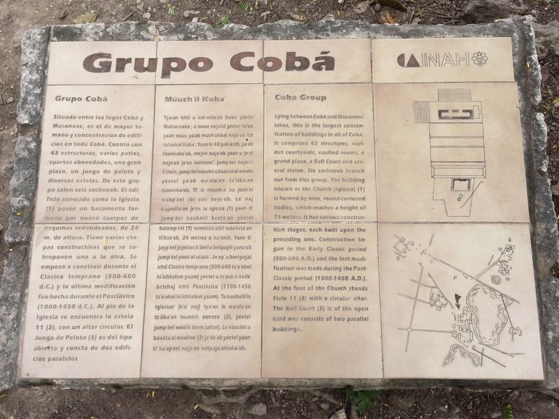
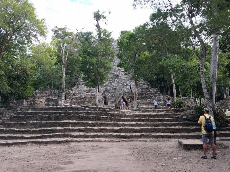
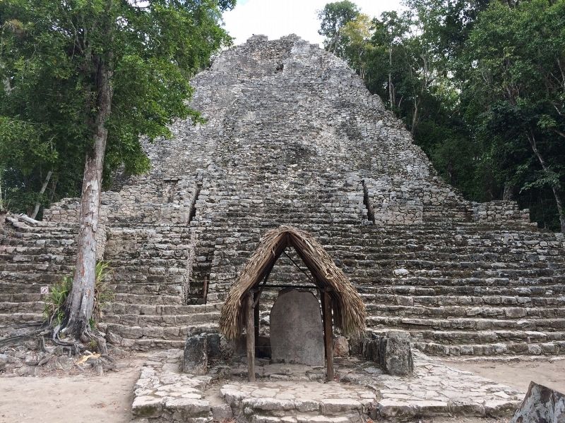
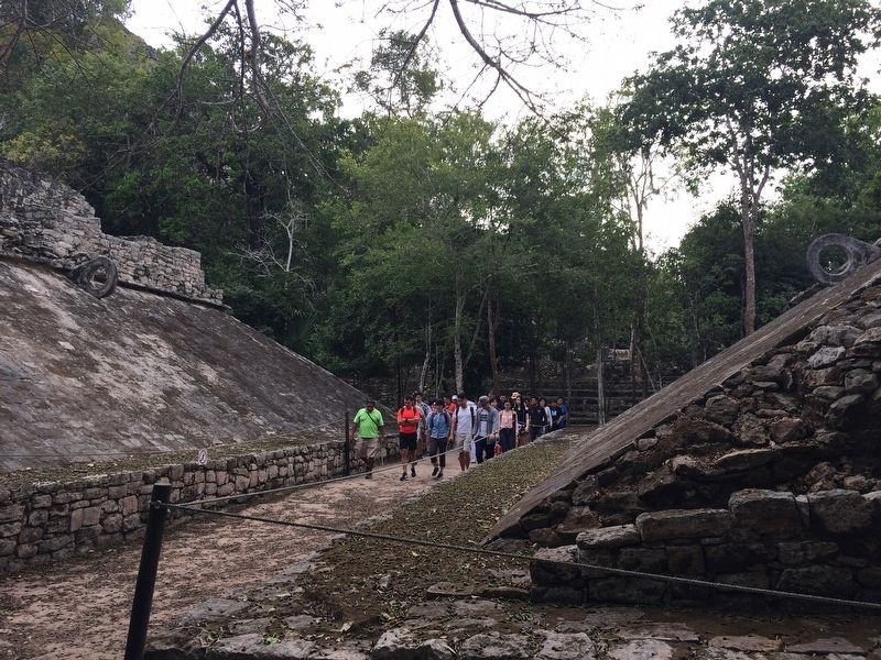
Situado entre los lagos Cobá y Macanxoc, es el de mayor tamaño y concentración de edificios en todo Cobá. Cuenta con 43 estructuras, varios patios, cuartos abovedados, una gran plaza, un juego de pelota y diversas estelas. De este grupo salen seis sacbeoob. El edificio como la Iglesia (1) posess un basamento formado por nueve cuerpos de esquinas redondeadas, de 24 m. de altura. Tiene varias etapas constructivas que se sobreponen una a la otra. Se empezó a construir durante el Clásico temprano (300-600 d.C.) y la última modificación fue hecha durante el Posclásico (1000-1450 d.C.). Al pie de la Iglesia se encuentra la estela 11 (2), con un altar circular. El Juego de Pelota (3) es del tipo abierto y consta de dos edificios paralelos.
Maya-Yucateco:
Múuch’il Koba’
Tya’an ichil u áak’ alilo’ob Koba’ yéetel Makanxoke’, u maas nojchil yéetel tu’ux yaan maas ya’ab much’ukbal najo’ob ich tuláakal Koba’. Yaan ti’ 43 pak’o’ob, ya’ab táankabo’ob, mejen najo’ob yaan u jo’ol najo’ob je’ex áaktune’, jump’éel nojoch k’iiwik, jump’eel kúuchil u báaxta’al wóolis yéetel ya’ab wa’al’an ts’iiba’an tuunicho’ob. Ti’ le múuch’a’ ku jóok’ol wakp’éel (6) sak bejo’ob. Le naj k’ajóolta’an je’ex la Iglesia (1) yaan ti’ jump’éel kaabalil beeta’an yéetel bolomp’éel (9) wiinklilo’obil wóolista’an ti’itso’ob, 24 metros u ka’anlil. Yaan ti’ jayp’éel jejeláas k’iinil u betpajlil yano’ob jump’éel yóok’ol uláak’. Jo’op’u beetpajal ichil Clasico temprano (300-600 ts’o’okol ki’ichkelem yuum) yéetel u ts’ook k’exile’ betchaj ichil Posclásico (1100-1450 ts’o’okol ki’ichkelem yuum). Tu kaabalil le Iglesiao’ (k’u’ naj) tya’an le wa’ala’an ts’iiba’an tuunich oonseo’ (2), yéetel jump’éel wóolis teem (altar). Le kúuchil u báaxta’al wóoliso’ (3) je’ek’ab yéetel yaan ti’ ka’ap’éel najo’ob ketpaja’antako’ob.
English:
Coba Group
Lying between Cobá and Macanxoc lakes, this is the largest concentration of buildings in all of Cobá. It comprises 43 structures, various courtyards, vaulted rooms, a grand plaza, a Ball Court and several stelae. Six sacbeook branch out from this group. The building known as the Church (Iglesia) (1) is formed by nine, round-cornered bodies, which reaches a height of 24 meters. It has various construction stages, each built upon the preceding one. Construction began in the Early Classic period (300-600 A.D.) and the last modification was made during the Post-Classic period (1000-1450 A.D.). At the foot of the Church stands Stele 11 (2) with a circular altar. The Ball Court (3) is of the open kind and consists of two parallel buildings.
Erected by Instituto Nacional de Antropología e Historia (INAH).
Topics. This
historical marker is listed in these topic lists: Anthropology & Archaeology • Architecture • Man-Made Features • Native Americans.
Location. 20° 29.415′ N, 87° 43.933′ W. Marker is in Cobá, Quintana Roo, in Tulum. The marker is in front of the Cobá Group at the Cobá Archaeological Site, about 200 meters after the park entrance, in front of the "Iglesia" temple. Touch for map. Marker is in this post office area: Cobá QR 77793, Mexico. Touch for directions.
Other nearby markers. At least 4 other markers are within 21 kilometers of this marker, measured as the crow flies. The City of Cobá (within shouting distance of this marker); Paintings Complex (approx. 0.7 kilometers away); Nohoch Mul Group (approx. 1.3 kilometers away); Otoch Ma’ax Yetel Kooh Ramsar Site (approx. 20.2 kilometers away).
Credits. This page was last revised on January 29, 2017. It was originally submitted on January 28, 2017, by J. Makali Bruton of Accra, Ghana. This page has been viewed 241 times since then and 20 times this year. Photos: 1, 2, 3, 4, 5. submitted on January 28, 2017, by J. Makali Bruton of Accra, Ghana.
