Mérida, Yucatán, Mexico — The Southeast (Yucatan Peninsula)
Pedz Balam House

Photographed by J. Makali Bruton, January 12, 2017
1. Pedz Balam House Marker
Calle 60 x 61 No. 500
Las entrañas de los muros de la casa Pedz Balam son un ejemplo de la reutilización de aquellos bloques mayas, colocados con el mismo sistema constructivo prehispánico, para levantar los edificios de lo que hoy es el Centro Histórico de Mérida.
English:
Street 60 by 61 Number 500
The insides of the walls in the Pedz Balam house are an example of the reuse of those Mayan blocks, placed with the same pre-Hispanic construction
this page online
Maya-Yucateco:
Calle 60 x 61 No. 500
U dzu’ u pak’il u najil Pedz balame’ jump’éel chíikul ti’ bix u ka’ beeta’al u meyaj le úuchben meyaj tu beetaj le maaya’o’obo’, beeta’ano’ob je bix le suukil u beeta’al le maaya najo’obo’.
Topics. This historical marker is listed in these topic lists: Anthropology & Archaeology • Architecture • Indigenous Peoples and Communities.
Location. 20° 58.056′ N, 89° 37.376′ W. Marker is in Mérida, Yucatán. It is at the intersection of Calle 60 and Calle 60, on the right when traveling north on Calle 60. Touch for map. Marker is at or near this postal address: 498 Calle 60, Mérida YU 97000, Mexico. Touch for directions.

Regionally, this marker is in the
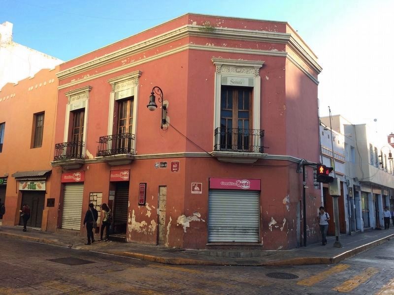
Photographed by J. Makali Bruton, January 12, 2017
2. Pedz Balam House Marker
Parts of the outer surface of the building's stucco have been left bare in order to see the stones taken from destroyed Mayan structures to make this Colonial-era building.
Other nearby markers. At least 8 other markers are within walking distance of this marker: The Gran Hotel (within shouting distance of this marker); Temple of San Juan de Dios (about 90 meters away, measured in a direct line); Chapel of Our Lady of the Rosary (about 90 meters away); The Peninsular Athenaeum (about 120 meters away); General Manuel Cepeda Peraza (about 120 meters away); The Main Square of Merida (about 120 meters away); La Nacional Building (about 120 meters away); The Sheriff's House (about 120 meters away). Touch for a list and map of all markers in Mérida.
Credits. This page was last revised on October 14, 2022. It was originally submitted on February 2, 2017, by J. Makali Bruton of Washington, District of Columbia. This page has been viewed 409 times since then and 20 times this year. Photos: 1, 2. submitted on February 2, 2017, by J. Makali Bruton of Washington, District of Columbia.
