Manassas in Prince William County, Virginia — The American South (Mid-Atlantic)
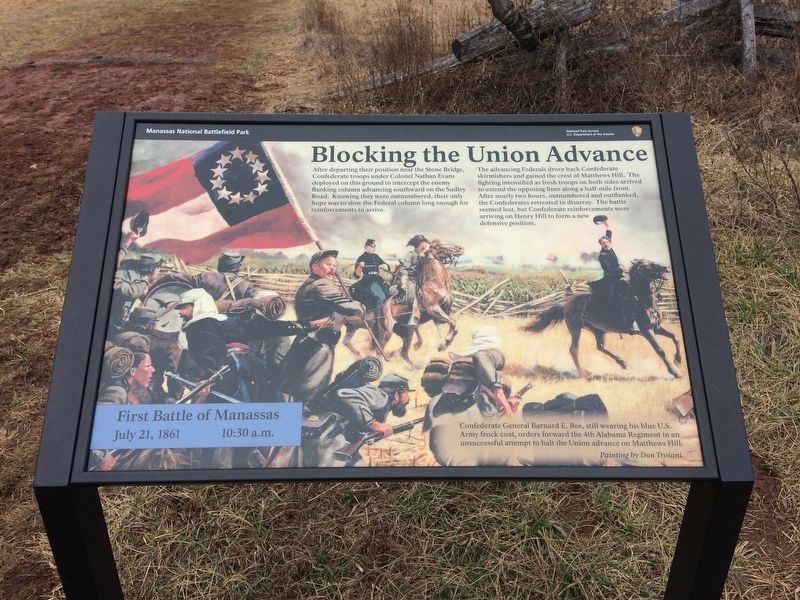
Blocking the Union Advance
First Battle of Manassas
— July 21, 1861 10:30 a.m. —
The advancing Federals drove back Confederate skirmishers and gained the crest of Matthews Hill. The fighting intensified as fresh troops on both sides arrived to extend the opposing lines along a half-mile front. After nearly two hours, outnumbered and outflanked, the Confederates retreated in disarray. The battle seemed lost, but Confederate reinforcements were arriving on Henry Hill to form a new defensive position.
(caption)
Confederate General Barnard E. Bee, still wearing his blue U.S. Army frock coat, orders forward the 4th Alabama Regiment in an unsuccessful attempt to halt the Union advance on Matthews Hill.
Painting by Don Troiani
Erected by Manassas Nationa Battlefield Park, National Park Service, U.S. Department of the Interior.
Topics. This historical marker is listed in these topic lists: Military • War, US Civil. A significant historical date for this entry is July 21, 1861.
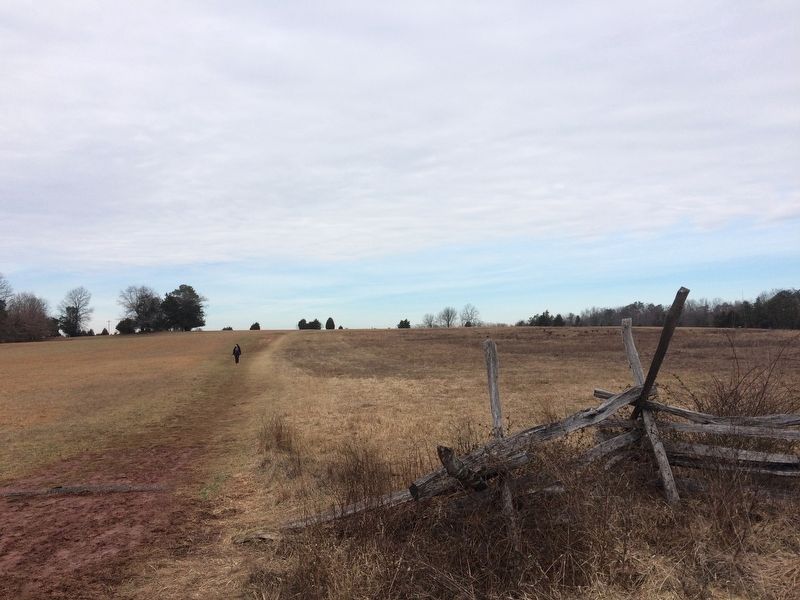
Location. 38° 49.344′ N, 77° 31.696′ W. Marker is in Manassas, Virginia, in Prince William County. Marker can be reached from Sudley Road (Virginia Route 234) 0.4 miles north of Lee Highway (Route 29), on the right when traveling north. Located along the Matthews Hill walking trail. Touch for map. Marker is at or near this postal address: 6511 Sudley Rd, Manassas VA 20109, United States of America. Touch for directions.
Other nearby markers. At least 8 other markers are within walking distance of this marker. A different marker also named Blocking the Union Advance (about 700 feet away, measured in a direct line); Pope's Headquarters (approx. 0.2 miles away); Visions of Victory (approx. 0.2 miles away); The Fight for Matthews Hill (approx. ¼ mile away); Rhode Island Battery (approx. ¼ mile away); The Matthew Farm (approx. ¼ mile away); Battlefield of Bull Run or First Manassas (approx. ¼ mile away); 4th Alabama Infantry (approx. ¼ mile away). Touch for a list and map of all markers in Manassas.
Also see . . .
1. Manassas National Battlefield Park. National Park Service (Submitted on February 20, 2017.)
2. Old Marker at this Location. This marker replaced an older one at this location also titled “Blocking the Union Advance” (Submitted on February 20, 2017.)
Credits. This page was last revised on February 20, 2017. It was originally submitted on February 19, 2017, by Shane Oliver of Richmond, Virginia. This page has been viewed 348 times since then and 13 times this year. Photos: 1, 2. submitted on February 19, 2017, by Shane Oliver of Richmond, Virginia. • Bernard Fisher was the editor who published this page.

