Jenkins in Newport News, Virginia — The American South (Mid-Atlantic)
First Peninsula Defense Line
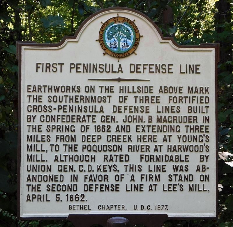
Photographed by Bradley Owen, October 17, 2021
1. First Peninsula Defense Line Marker (refurbished)
Erected 1977 by United Daughters of the Confederacy, Bethel Chapter.
Topics and series. This historical marker is listed in this topic list: War, US Civil. In addition, it is included in the United Daughters of the Confederacy, and the Virginia, Corporation of Newport News series lists. A significant historical month for this entry is April 1846.
Location. 37° 6.357′ N, 76° 30.828′ W. Marker is in Newport News, Virginia. It is in Jenkins. It is at the intersection of Old Grist Mill Lane and Warwick Blvd (U.S. 60), on the left when traveling west on Old Grist Mill Lane. Marker is located across the street from Young's Mill. Touch for map. Marker is in this post office area: Newport News VA 23602, United
this page online

Regionally, this marker is on Virginia’s Peninsula, in Hampton Roads, in Coastal Virginia, and in the Hampton Roads Metropolitan Area. It is also in the American South, specifically in the Upper South, in the Tidewater, and on the Eastern Seaboard. Globally, it is in the North Atlantic Region, North America, the Western Hemisphere, the Western World, and the Anglosphere. Historically, it finds itself in what was once the territory of the Mississippian Culture, one of the original Thirteen Colonies, one of the Confederate States of America, and the Antebellum South.
Other nearby markers. At least 8 other markers are within 2 miles of this marker, measured as the crow flies: Young’s Mill (a few steps from this marker); a different marker also named Young’s Mill (a few steps from this marker); a different marker also named Young’s Mill (a few steps from this marker); Mathews Mill (within shouting distance of this marker); Providence Mennonite Church (approx. 0.2 miles away); Denbigh Parish (approx. ¼ mile away); Church Bell (approx. 1.1 miles away); Two USCT Heroes (approx. 1.1

Photographed by Bill Coughlin, August 11, 2008
2. First Peninsula Defense Line Marker

Photographed by Bill Coughlin, August 11, 2008
3. Marker near Warwick Blvd
The earthworks here protected the Great Warwick Road, one of the few roads leading from Fort Monroe to Williamsburg.

Photographed by Bill Coughlin, August 11, 2008
4. First Peninsula Defense Line Marker
Gen. Magruder established a base here at Young's Mill in 1861, which would be the right flank of his first defensive line on the peninsula.
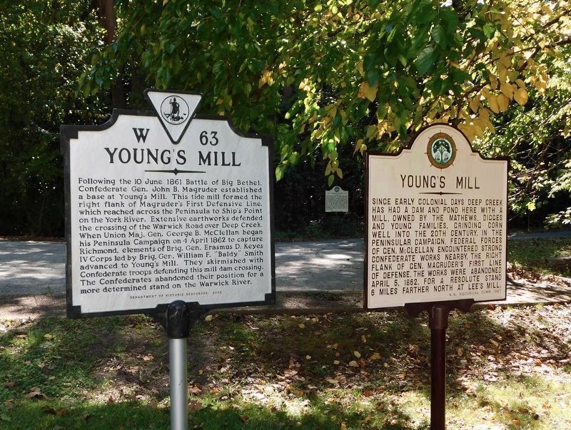
Photographed by Bradley Owen, October 17, 2021
5. First Peninsula Defense Line Marker
Marker can be seen in the distance, demonstrating its position with other markers at Young’s Mill.

Photographed by Bill Coughlin, August 11, 2008
6. Young’s Mill
The marker is across the street from this 1820 mill which was the site of a major Confederate camp in 1861-62.

Photographed by Bill Coughlin, August 11, 2008
7. First Peninsula Defense Line
These earthworks, located in the woods south of the marker, was part of Confederate Gen. John Magruder's first line of defense.
Credits. This page was last revised on July 23, 2024. It was originally submitted on August 12, 2008, by Bill Coughlin of Woodland Park, New Jersey. This page has been viewed 1,721 times since then and 29 times this year. Photos: 1. submitted on October 31, 2021, by Bradley Owen of Morgantown, West Virginia. 2, 3, 4. submitted on August 12, 2008, by Bill Coughlin of Woodland Park, New Jersey. 5. submitted on October 31, 2021, by Bradley Owen of Morgantown, West Virginia. 6, 7. submitted on August 12, 2008, by Bill Coughlin of Woodland Park, New Jersey.
