New Smyrna Beach in Volusia County, Florida — The American South (South Atlantic)
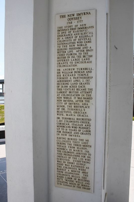
The New Smyrna Odyssey
1768 - 1777
The story of New Smyrna's first immigrants is one of hardship, endurance and survival by a group of religious colonists of several nationalities who came to the New World seeking freedom and a better life. After Spain ceded Florida to the British in 1763, the British offered large land grants to encourage colonization.
Dr. Andrew Turnbull, Sir William Duncan and Sir Richard Temple formed a partnership agreement April 2, 1767, securing land grants of 20,000 acres each. This venture became the largest British attempt at colonization in the New World. It was named New Smyrna, after the city of Smyrna, Asia Minor, the birthplace of Dr. Turnbull's beautiful Grecian wife, Maria Gracia.
Dr. Turnbull recruited 1,403 colonist-Greek, Corsican, Italian and Minorcans-who pledged up to 10 year of labor for passage and grants in New Smyrna.
Having buried the 148 colonists they lost during the three-month voyage from Mahon, Minorca in March, 1768, the colonists arrived to find preparations for 500, instead of the 1,255 who survived. Everything was in short supply. Food was rationed as the colonists were barely a month away from starvation. The colonists began the hard labor of building huts, digging wells and creating miles of irrigation canals in the swamp
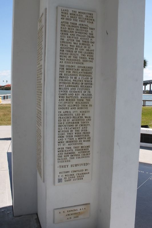
(side 2)
land. The mosquitoes were merciless. Death was a daily occurrence; 450 died the first year. After their arrival, the colonists sensed they had been deceived. A rebellion involving the Greek and Italian colonists erupted August 19, 1768. After the three-day uprising was subdued, a trial was held in St. Augustine by Gov. Grant for three of the leaders. Found guilty, two were hung by the third, who was pardoned, serving as executioner.
The colony, established for monetary benefit, not for philanthropic or religious purposes, proved to be a clash of colonial politics which involved people of different languages, religious beliefs and cultures. Under guidance of Fr. Camps and Rev. Frazier, who baptized, married and buried them, the colonists' religious faith allowed them to endure and survive.
In April 1777, ninety colonists, led by Francisco Pellicer, walked to St. Augustine and gave Governor Tonyn depositions of cruelty, ill-treatment and murder by the overseers. They were freed from their indentures, and within a month 600 more deserted en masse to St. Augustine.
Over time, they became merchants, fishermen and farmers. Although the New Smyrna Colony failed, the colonists endured.
-They Survived!-
History compiled by:
T.C. Wilder, Chairman
Jo Anne Sikes
Gary Luther
Erected 2000 by Order of AHEPA-Speedway Chapter 410.
Topics. This historical marker is listed in these topic lists: Colonial Era • Settlements & Settlers • Waterways & Vessels. A significant historical date for this entry is April 2, 1767.
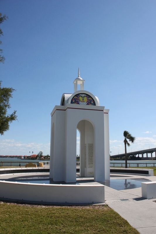
Location. 29° 1.5′ N, 80° 55.176′ W. Marker is in New Smyrna Beach, Florida, in Volusia County. Marker is at the intersection of South Riverside Drive and Downing Street, on the left when traveling south on South Riverside Drive. Marker is located in Riverside Park. Touch for map. Marker is at or near this postal address: 105 South Riverside Drive, New Smyrna Beach FL 32168, United States of America. Touch for directions.
Other nearby markers. At least 8 other markers are within walking distance of this marker. PFC Emory L. Bennett (within shouting distance of this marker); Supreme Sacrifice (within shouting distance of this marker); Turnbull Canal (about 500 feet away, measured in a direct line); Vietnam Memorial (about 600 feet away); Emory L. Bennett Park (approx. 0.2 miles away); New Smyrna Museum Of History (approx. 0.2 miles away); 1768 British Colony of New Smyrna (approx. 0.2 miles away); Anniversary of Shelling by Union Gunboats (approx. 0.2 miles away). Touch for a list and map of all markers in New Smyrna Beach.
Also see . . . Middle Passage Ceremonies and Port Markers Project (MPCPMP). Project homepage. (Submitted on January 22, 2020.)
Additional commentary.
1. Middle Passage Ceremonies and Port Markers Project - Mosquito Inlet
Between Florida’s first and second Spanish period, the British assumed control of the territory from 1763-1783. There was an influx of people to central Florida as indigo, sugar, and cotton plantations were established. The laborers shipped in to work were Africans and Europeans from the Mediterranean. Historical research indicates that at least 50 “salt water” Africans who arrived at Mosquito Inlet worked on the Turnbull Plantation.
On April 17, 1768, eight ships were loaded with the 1,403 Italian, Greek, Corsican, and Minorcan men, women and children who had left their homes and entered into contract with Dr. Andrew Turnbull under the British Indentured Servitude Act. On that voyage many died, their bodies tossed from the ship into the Atlantic, joining the other souls in creating the Middle Passage of human remains. On June 26, 1768, seven of the eight ships arrived in St. Augustine, registered, and continued on to Mosquito Inlet. These colonists were delivered to Turnbull’s 100,000-acre tract that had been cleared and prepared by Africans for indigo cultivation and production.
Since accommodations had been made for only 500 people, the colonists quickly realized that this was ill fated. Living in squalor, suffering from illness, disease,
hunger, and physical abuse associated with the destruction to the body that indigo processing causes, death rates were high. Over a period of nine years they discovered the only release or escape from their contract was by death. Tensions ran high; rebellions were quickly quashed and dissenters were severely punished and some were hanged. In 1777, many escaped to St. Augustine, the government seat approximately 75 miles north, where eventually they were granted sanctuary at the Avero House by Governor Patrick Tonyn.
— Submitted January 22, 2020.
Credits. This page was last revised on January 26, 2021. It was originally submitted on March 5, 2017, by Tim Fillmon of Webster, Florida. This page has been viewed 629 times since then and 56 times this year. Photos: 1, 2, 3. submitted on March 5, 2017, by Tim Fillmon of Webster, Florida. 4. submitted on January 18, 2020, by John Bloomfield of Palm Coast, Florida. • Bernard Fisher was the editor who published this page.


